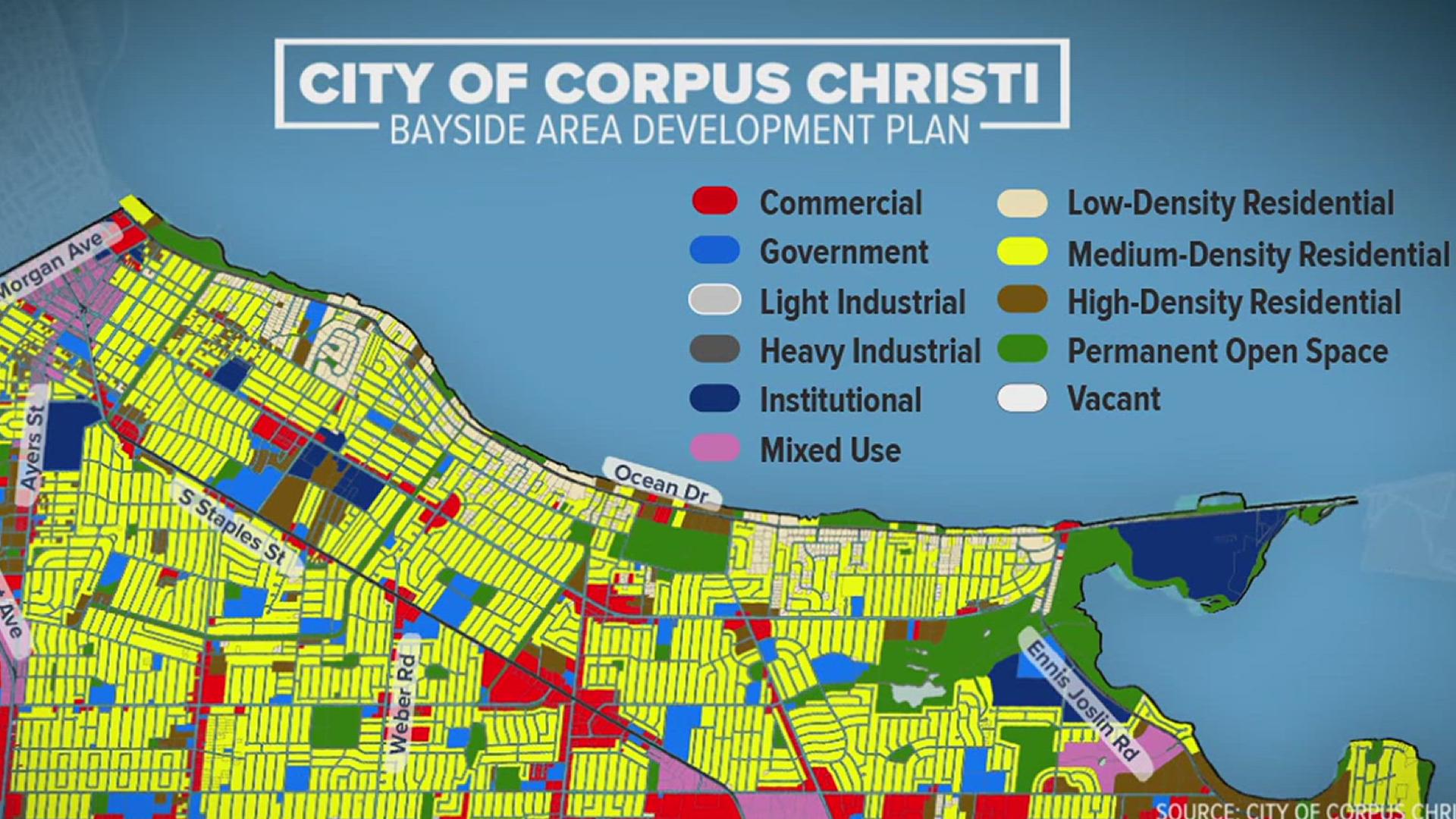
CORPUS CHRISTI, Texas — After two years of seeking input the City now has a finalized blueprint on how residents want to see the Bayside area, the part of the city between SPID and Ocean Drive.
There were a lot of ideas presented that will serve as guidelines for the next 20 years.
The bayside of SPID is outlined by Morgan Avenue and the Crosstown Expressway to the west, all the way to Oso Bay on the east -- a total of 16 square miles.
"We have had 903 people engage on this project," said Annika Yankee, planning manager for the city.
It took two years of input through surveys and community meetings of what residents feel is most important.
"Everyone can recognize the uniqueness of the area, you've got the Corpus Christi Bay, the Oso Bay, people come down here to enjoy the parks along these special areas," Yankee said.
One of nine different planning districts throughout the city, it's an area with historic neighborhoods, small businesses, but also higher education options with both Del Mar College's Heritage Campus and Texas A&M University- Corpus Christi.
One initiative is to introduce and support affordable student housing.
Yankee also described neighborhood style villages that are walkable developments.
"Another thing we hear support for, making sure we have places with character where people can walk and have a coffee, go out to eat," she said. "These are things people do experience in other cities."
Also included in this area, the old Sunrise Mall which is currently being torn down. The guide talks about the growth of that property to include housing, shops and restaurants.
"Our city planning is based on what the community is asking for, essential for us to get this input," she said.
Yankee said the City hasn't had a new development plan for this part of the city since 1995, almost 30 years ago, which is why a new plan was needed.
The public asked to improve green and open spaces, making sure they're ADA accessible.
"Taking care of what we have, taking care of existing neighborhoods making sure they are thriving making sure we have streets that are repaired," she said.
In fact, feedback from the community showed that poor street conditions was the top infrastructure issue facing Bayside followed by not being able to safely walk or ride a bike.
"There is a great need to repair streets," Yankee said "You have Staples Street recently reconstructed, Alameda, Everhart."
The final draft passed through the planning commission Wednesday night.
It will now go to city council for approval which is slated for Dec. 3.
To see the details of the plan yourself, you can check out creatingcc.com/bayside.

