
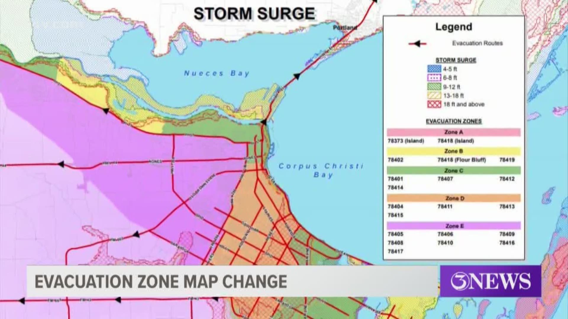
CORPUS CHRISTI, Texas — After an exhaustive study, the City of Corpus Christi has decided to make adjustments in its Hurricane Evacuation Zone Maps.
The last update to the map came in 2009. The update this year comes after a year-long study between FEMA, the city and coastal communities.
Emergency Management Coordinator for the city, Billy Delgado, said because of new information on the Oso Creek area, the zone has been moved from third to second.
"The new study actually studies the storms coming from all directions so if you go back to the old map and the new map, you can see where we're taking the Oso Creek area now a little earlier in the map in the zone," Delgado said.
The new map still calls for the evacuations first of Port Aransas, Padre Island and Flour Bluff based on storm surge.
For the latest updates on coronavirus in the Coastal Bend, click here.
More from 3News on KIIITV.com:
- IHOP dining room in Corpus Christi closed due to coronavirus concerns, Mayor Joe McComb confirms
- Woman shot in the head at the Woodlawn Apartments on Up River Road
- Strong winds, rip currents and rough waves make for a situation that is not safe for even for the strongest swimmers
- Keeping an eye on your child's social media; experts warn how their actions on social media today can come back years from now