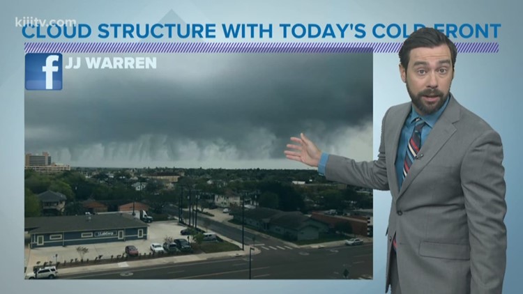
CORPUS CHRISTI, Texas — The cold front that worked through Corpus Christi around 2pm, Monday created some picturesque clouds (pictures below). We received many photos of these finger-like clouds to our social media pages and even some worried phone calls to the newsroom. The clouds were produced along the leading edge of the cold front, which often will produce a shelf cloud when cold fronts blow through. Today's was different....we observed scud clouds.


From what I can tell, most photos of Monday's cold front were over or near water---moisture rich areas. The cold front, bringing a cooler and more dense mass of air with it, collided with warm humid air as it blew through (we were in the low 80s prior to the front's arrival). Because colder air is more dense, it dislodged the warmer air at the surface upwards. As air rises, it expands, as it expands, it cools, and when it cools enough, it condenses (clouds). We got to see this process real-time within the photos that were sent in. Water vapor rising and condensing toward the main cloud deck.
In my opinion, this cloud type would be classified under the "scud cloud" family. Scud clouds are more commonly associated with thunderstorms and their appearance can lead some people to think there are tornadoes or violent weather even though scud clouds themselves are harmless. In thunderstorms, scud clouds can form along outflow boundaries, which is a pocket of rain-cooled air rushing away from a storm. They can also form in intense updrafts, somewhat similar to the process we saw happening here today.


