CORPUS CHRISTI, Texas — Before we begin talking about the outlook leading up to and on Christmas Day, I want to preface it by saying this outlook is eight-to-14 days away, which means we are mainly looking at longer-range trends for clues on what to expect in Corpus Christi and the Coastal Bend.
Similar to tropical-weather forecasting, I do not put a ton of credence on outlooks that are more than a week away; especially when looking for specific details. It's simply impossible to discern exactly what locations will get what type of precipitation, temperature, etc.
In tropical season, we can point out reasons the tropics may become active, but cannot get specific on where something develops, where it will go, and what type of impacts.
The same applies for winter outlooks.
I'm confident you'll come across a post somewhere that will include some type of forecast from a weather model that looks snowy for a location well-south of where snow typically falls on Christmas.
These are not to be trusted this far out, and are not reliable even though they generate tons of traction on the Interwebs.
All of that being said, it does look like the overall pattern will be a cooler one for much of the US during the week leading up to Christmas Eve and Christmas Day.

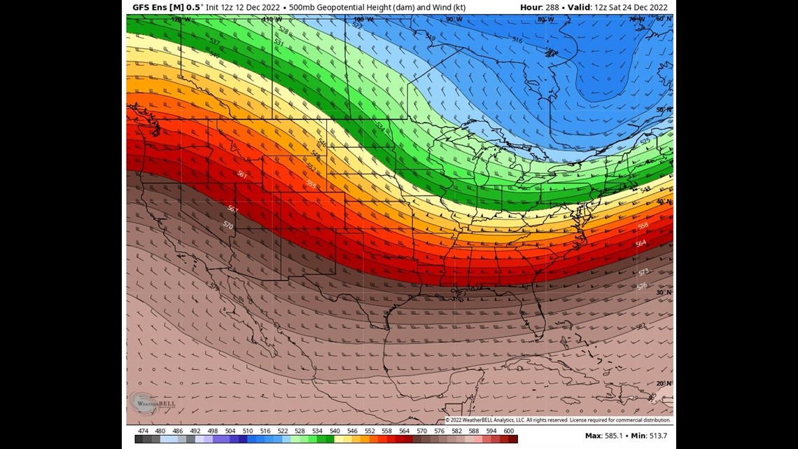
Both the GFS (above) and European (below) ensembles are suggesting upper-atmosphere winds to be 'troughed' across the Eastern US on Christmas Eve. This is a pattern that would yield northwesterly flow across much of the eastern third of the country; in other words, cooler for many.

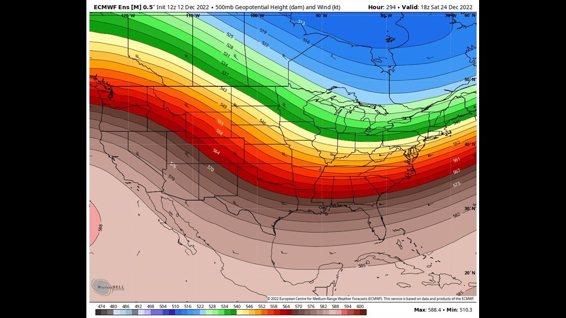
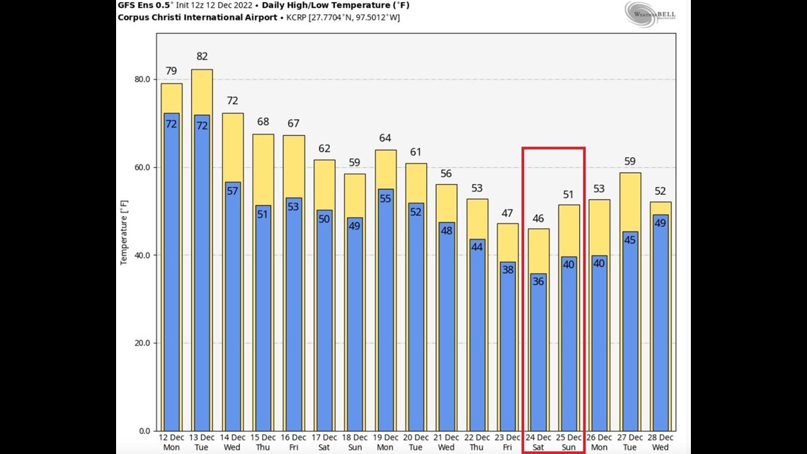
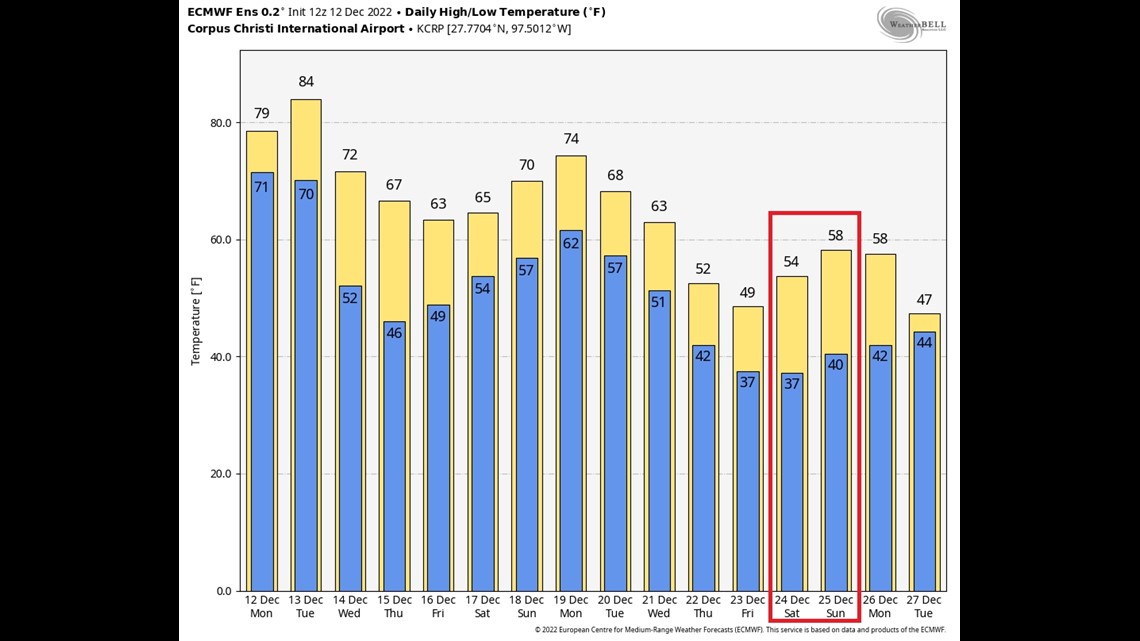
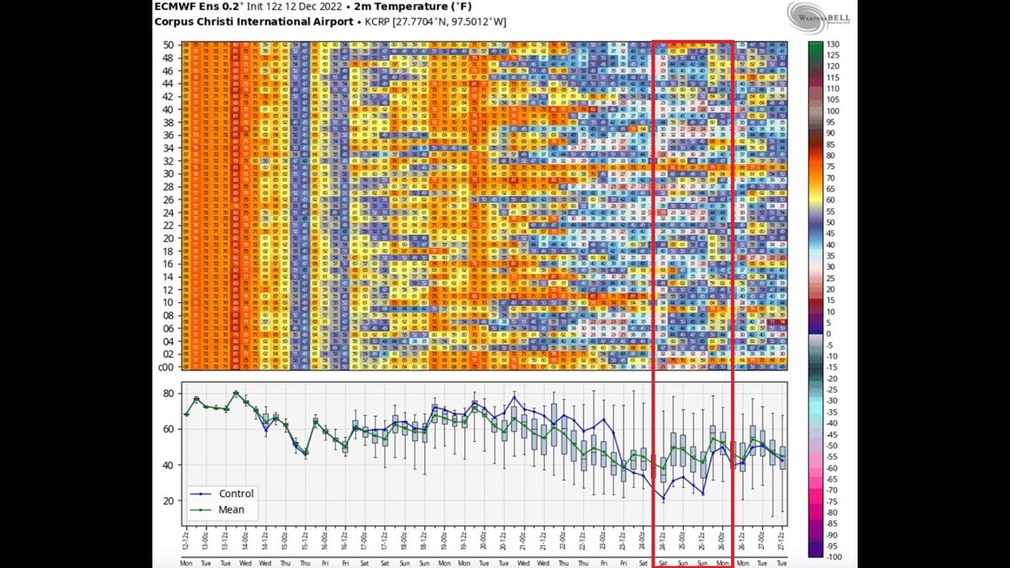
When talking about ensembles, we are looking at many iterations of both the GFS & European models. Further breaking down the temperature outlook, I pulled what each ensemble member is printing leading up to Christmas Day.

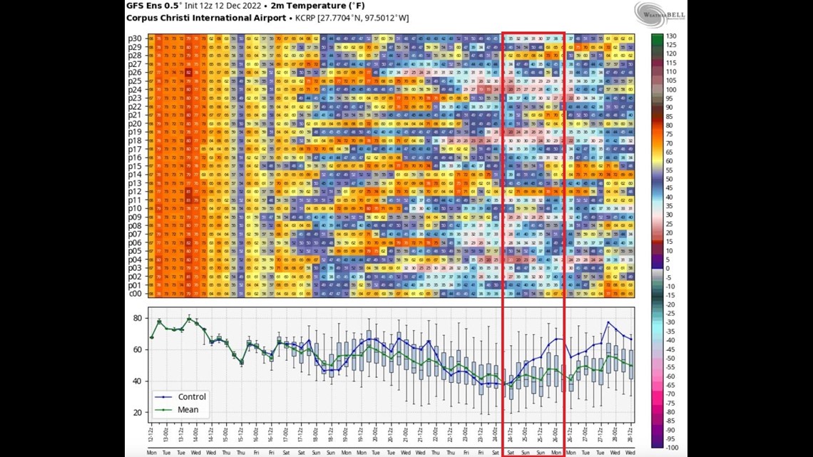
You'll see the 'cooler' colors showing a colder outlook on Christmas Eve and Christmas Day. I boxed that timeframe in red.
Still, there is quite the variance in solutions, but the overall trend is cooler.

Another forecast element to look at is something called the Arctic Oscillation. This teleconnection can give us clues as to how strong the jet stream is around the Arctic. When the Arctic Oscillation is in a positive phase, the Polar jet stream tends to hold stronger around the Arctic, keeping the coldest air poleward. When the AO is negative, the Polar Jet streams winds are more relaxed, allowing colder air to spill southward.

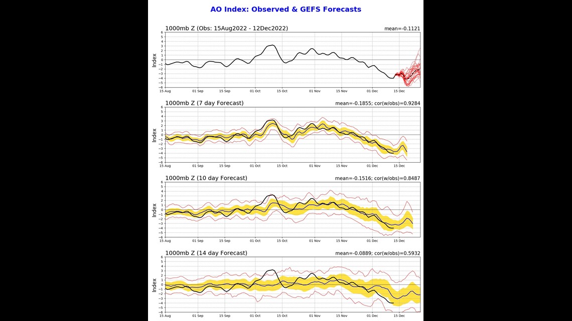
Right now, the AO is in a negative phase and it's forecast to stay in a negative phase through the remainder of December. Another variable pointing to 'cooler' than average weather in South Texas come Christmas.
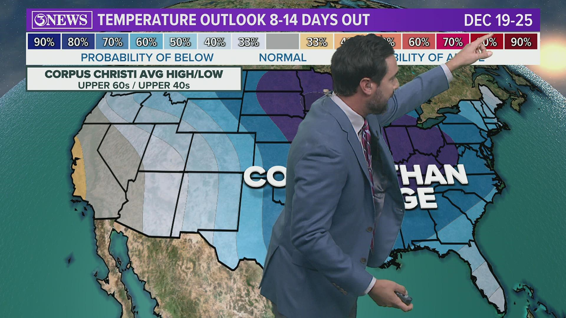
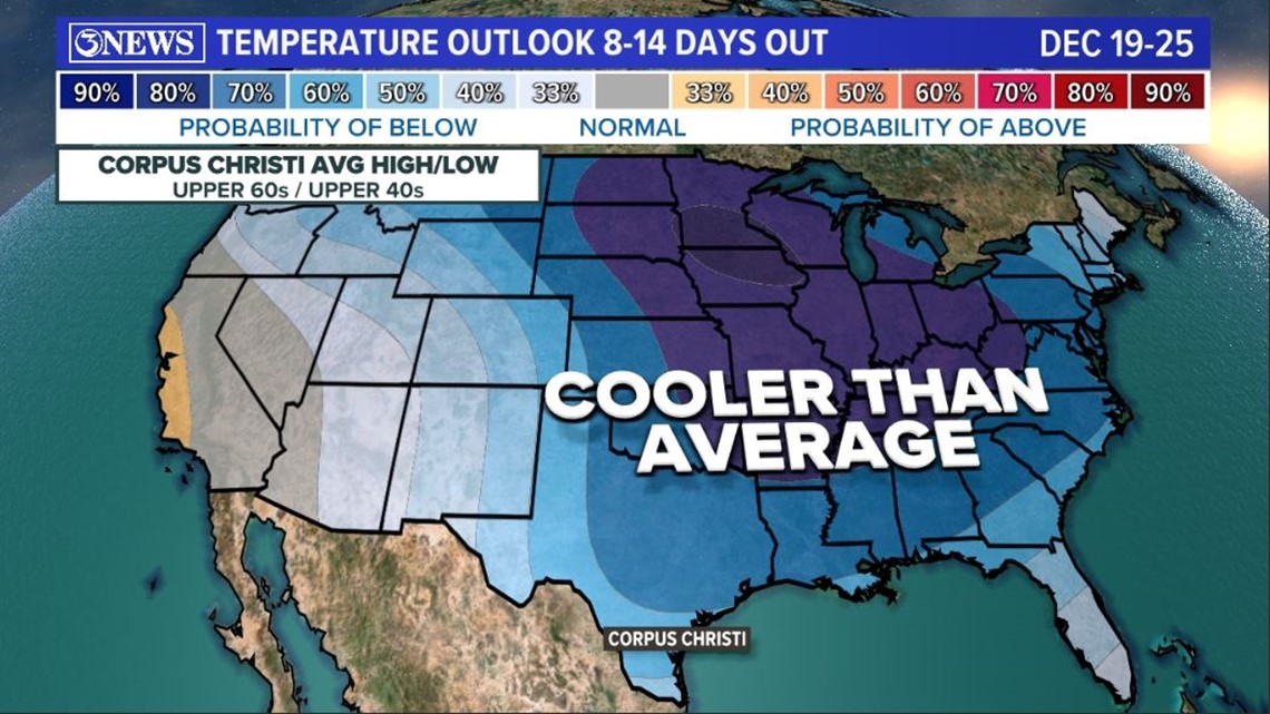
Given all of this information, the Climate Prediction Center is showing a large area of cooler-than-normal temperatures from Dec. 19-25, including Corpus Christi. The probability of below-average temperatures in Corpus Christi is at 60 percent.
Remember: 'Average' for Dec. 19-25 in Corpus Christi is in the upper 60s in the day, and upper 40s at night. So, if temperatures are below that by any amount, this forecast would verify as accurate.

Stay tuned...
Here are the GFS/EURO Ensemble forecast temps.,....

