CORPUS CHRISTI, Texas — FOLLOW ALONG HERE with our new Tropical Update: /article/weather/hurricane/tropical-update-ptc-1-forecast-to-become-a-tropical-storm-moving-into-mexico-wednesday-night/503-69f8ce67-9bc6-48d4-a80e-9617be59244c
Watches & Warnings in effect:
FLOOD WATCH
TROPICAL STORM WARNING (Coastal Counties)
COASTAL FLOOD WARNING

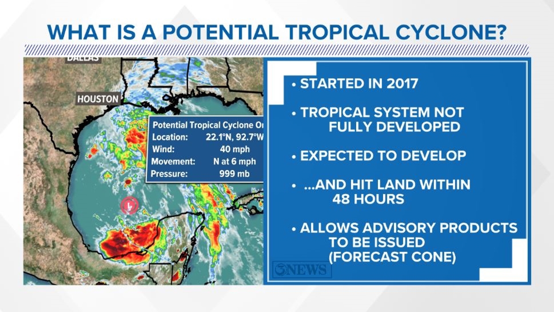
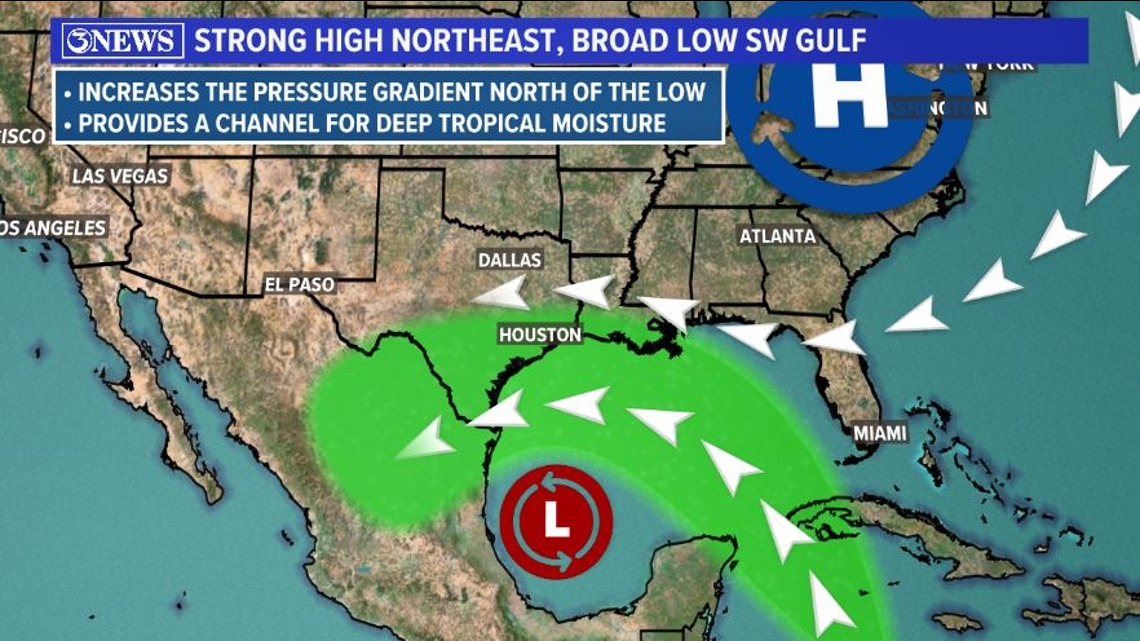
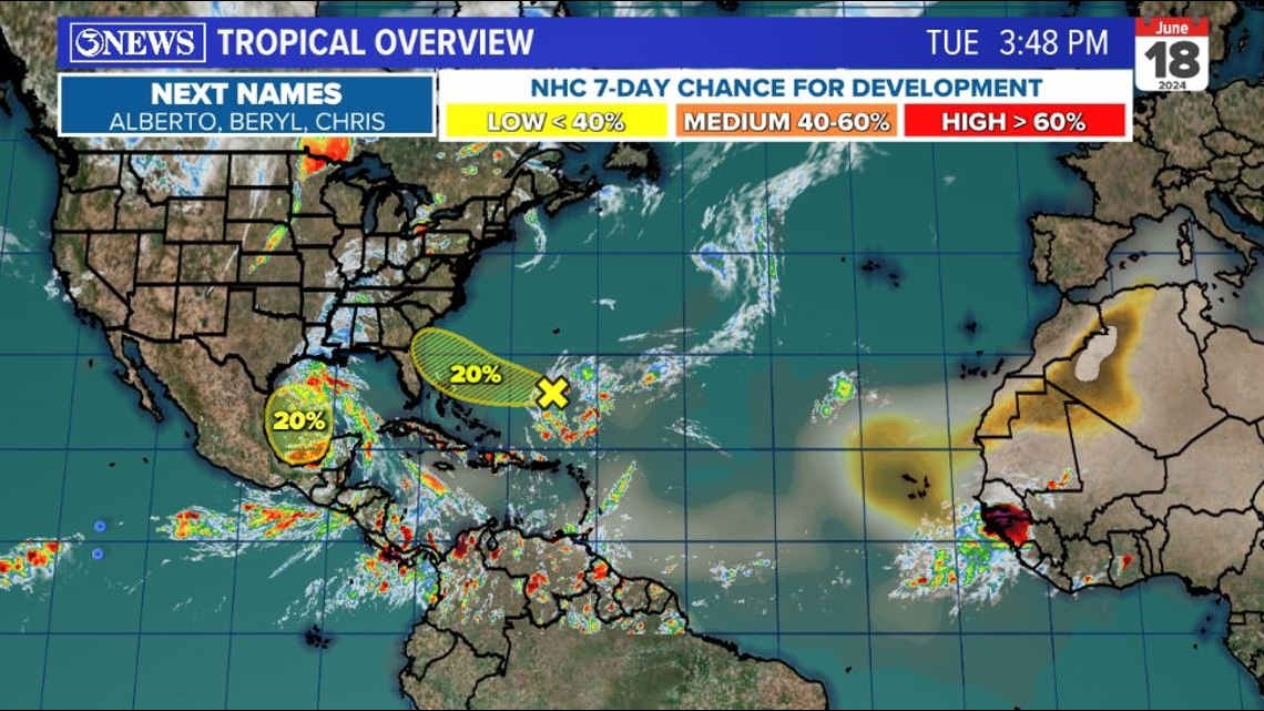
Potential Tropical Cyclone #1 remains in the Southwestern Gulf of Mexico and will eventually work toward and into Mexico between Tampico and the TX/MX border. It may gain tropical storm status prior to landfall. In that case, it would be named Alberto. Even though this system is hundreds of miles away from the Coastal Bend, tropical storm warings are posted for coastal counties in the KIII viewing area.

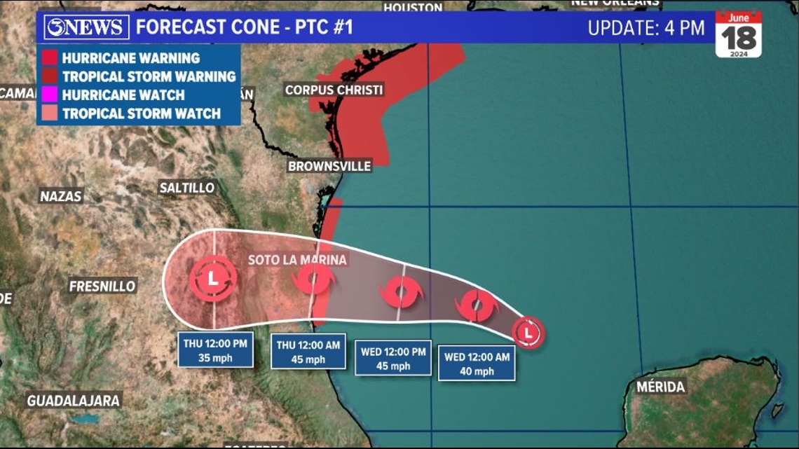
The synoptic set up we currently have is one that allows for a tightening pressure gradient thanks to the difference between a strong region of high pressure in the eastern US and this broad low in the gulf. That difference is why winds are accelerating through the gulf and into Texas.

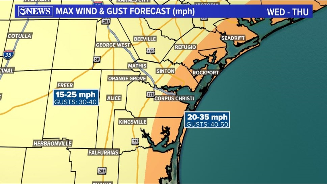
We are anticipating easterly winds to be sustained at 20-35 mph with gusts in th 40-50 mph range in coastal areas on Wednesday. Not quite as windy inland, but certainly still on the breezy side. Low end tropical storm force conditions will be possible in coastal counties, Wednesday.
Given the rain and the gustier winds, it's possible that a few tree branches could break and if one of those falls on a power line, there could be some power outages.

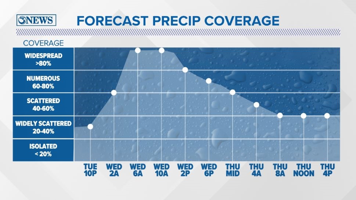
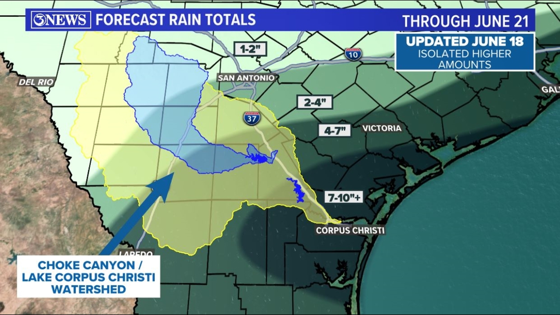
The same swath of wind moving in from the gulf will carry with it a ton of tropical moisture. That moisture will show up as heavy rain into early Wednesday morning. We are expecting rain to be around all day long. Rain will be heavy at times and as the day progresses, the inches will begin to pile up. In our hand-drawn rainfall forecast map, I extended the 7-10" area farther inland and focused in the KIII viewing area. Lots of beneficial rain throughout South Texas. Definitely will help the watershed.

By Thursday, most of the rain will have moved on, but I do still think that some feeder bands with heavy rain will be possible, mainly in South Texas around the back side of the system as it falls apart in Mexico. Feeder bands could drop additional heavy rain in localized areas.

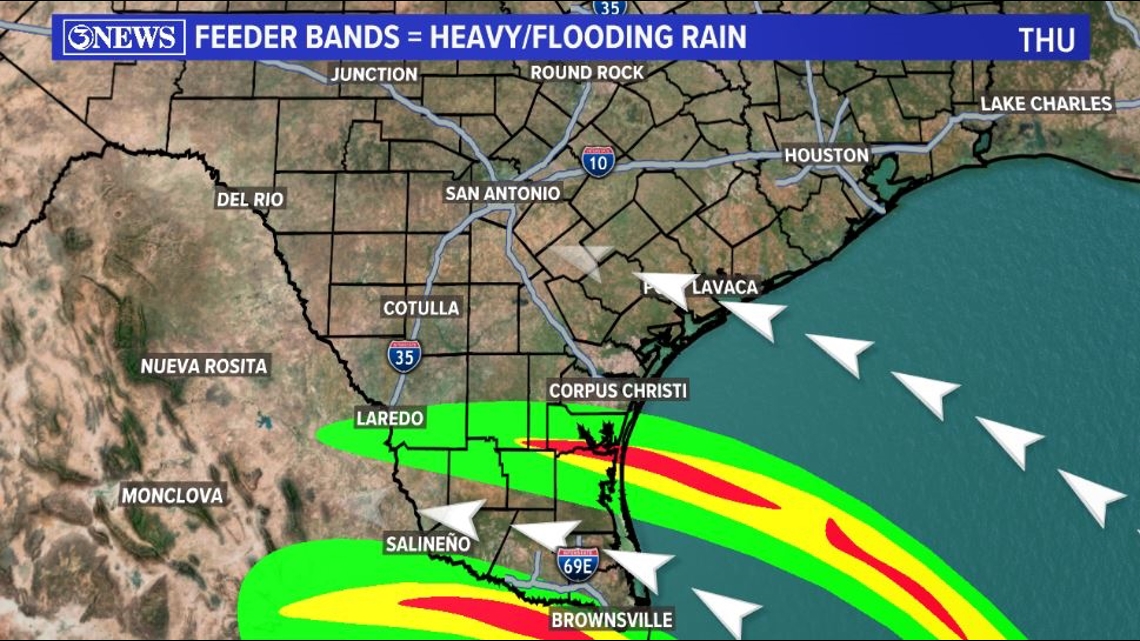
Flooding will be a concern and flood watches are posted through the region through Thursday. It's possible some locations exceed expectations, so be mindful if traveling and remember to turn around, don't drown if you come to a flooded road; even if you are familiar with it.

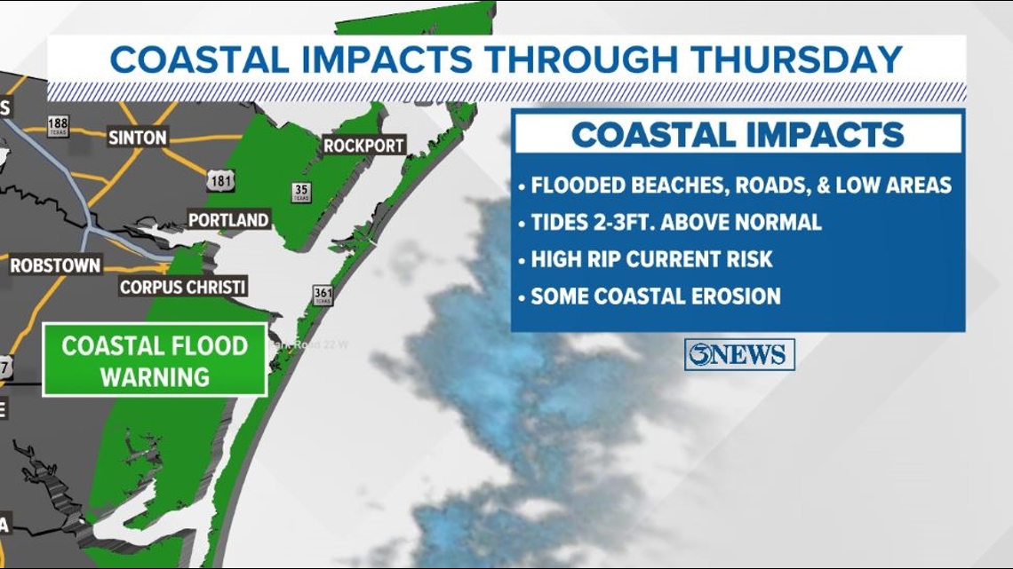
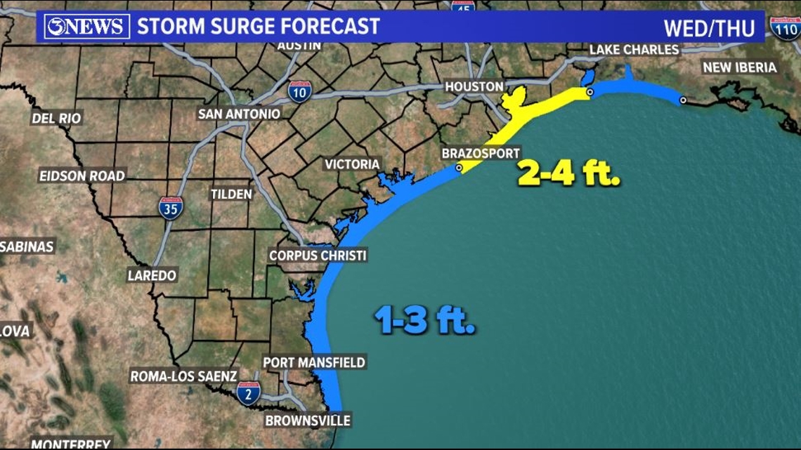
At the beach and coastal areas, coastal flooding is expected with a rise in tides/surge of between 1 and 3 feet. For perspective, that's about 40% of what Hurricane Hanna brought in July of 2020. Still, it'll be enough to flood beaches and lower lying areas near the coast.

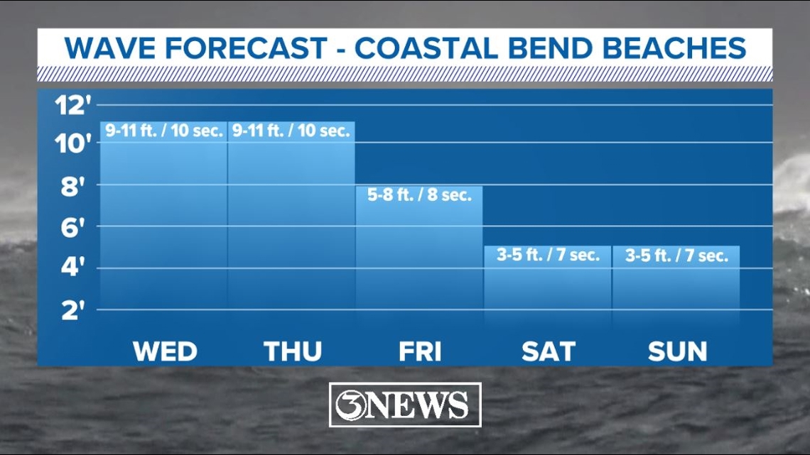
Increased wave heights at longer period swells will lead to dangerous rip currents Wednesday and Thursday. It is not advisable to be in area waters. The beach in general will not be pleasant.

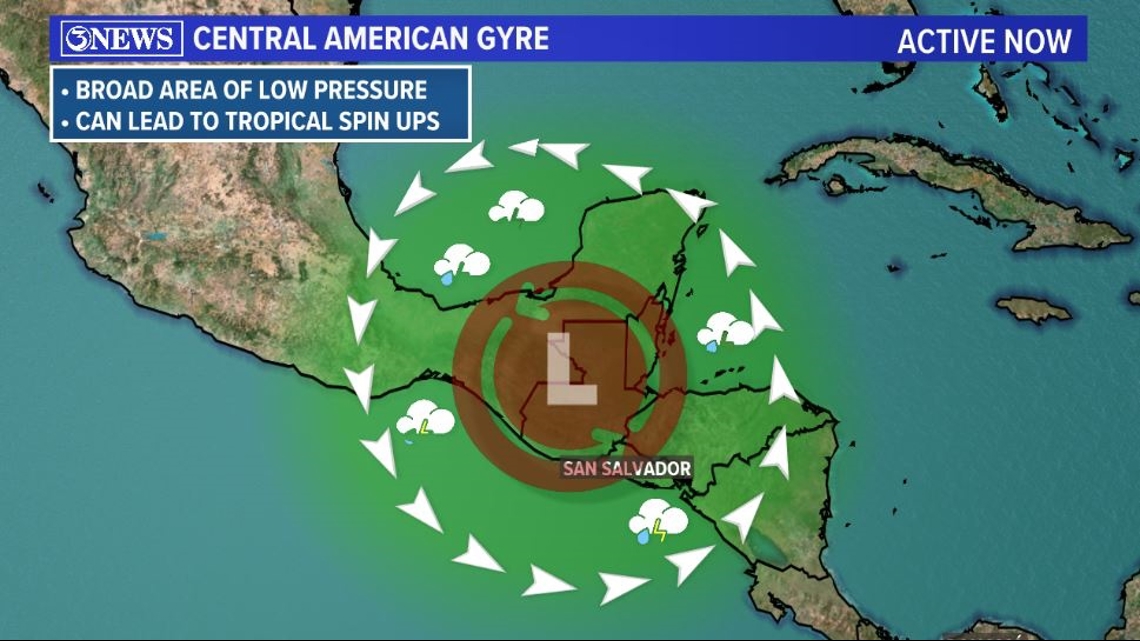
By Thursday/Friday, this system will be over and done with and things will settle down into the weekend. However, the Central America Gyre is still active and there are signs that another tropical spin up could happen over the weekend/early next week. It's not possible to give reliable details on it at this time, but we are aware of it and we will begin to focus on it after we get through Wednesday's rains.


Holt out
We talk about the risk of high surf and dangerous rip currents even when a storm is hundreds of miles away in the 2024 KIII Hurricane Special, you can watch it (or re-watch) it here! The special includes topics like evacuations, hurricane kits, and rip currents - on top of information like the tropical outlook and new data on hurricane-related fatalities. You don't want to miss it!
For more on our local weather, head on over to our forecast post.
_______________________________________________________________
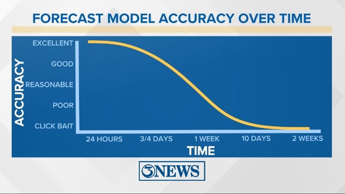
Remember to not "anchor" to the first forecast you see - forecasts change. Also, rely on a credible source for your tropical information and forecasts.

-------------------------------------------------------------
2024 Atlantic Tropical Cyclone Names

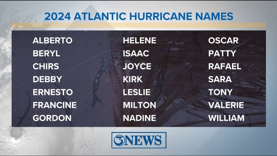
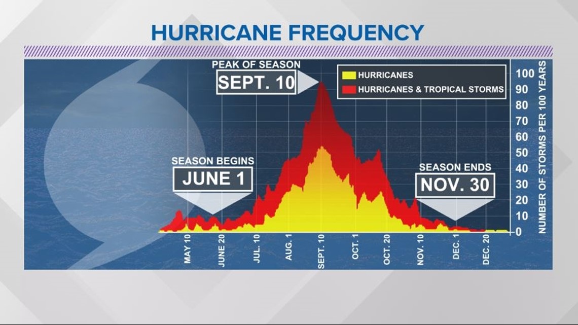
The Atlantic Hurricane Season runs from June 1 to November 30, with the peak of the climatological peak of the season happening on September 10.

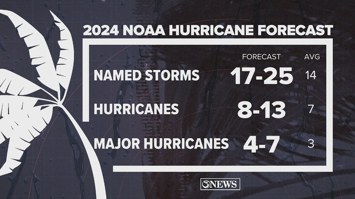
On May 23, NOAA released their forecast for the 2024 Atlantic Hurricane Season. They're predicting an above-average year, with 17-25 named storms. This is the highest pre-season forecast they've ever issued.
The high number of storms forecast is due to near-record sea surface temperatures and the return of La Nina, both of which favor tropical cyclone development. We talk more about those in our Hurricane Special, which you can watch here!