The jet stream is a highway of fast moving air in the upper atmosphere. When an aircraft enters the jet stream, it can either slow down or speed up transportation. If planes are traveling west to east, this is considered a tail wind. This will actually aid in the plane’s speed traveling to its destination because of the favored wind direction and speed. In fact, winds can exceed 250 mph in the jet stream. The opposite is known as a head wind. When a plane is traveling from east to west against the jet stream. This will generally slow the plane down when flying in this direction. Aviation is interesting but what does the jet stream do for our weather?

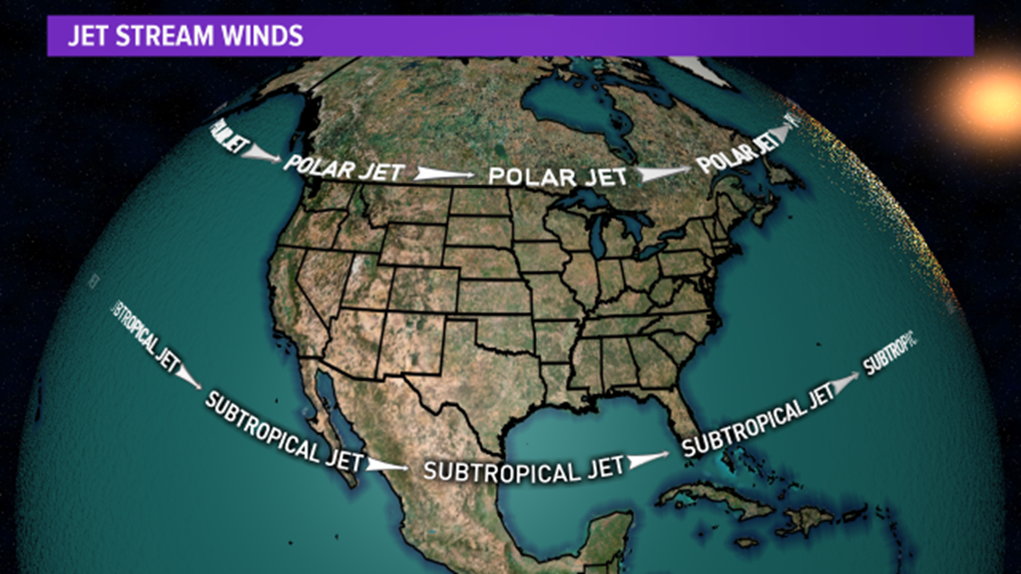
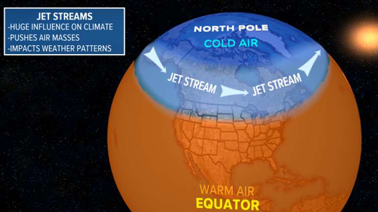
For starters, there are two primary jet streams we recognize. The polar jet and the subtropical jet. The polar jet traverses the northern latitudes while the subtropical jet travels across the lower latitudes. The two jet streams help transport air masses. In fact, the Polar Jet helps transport cooler air from the north while the Subtropical Jet pulls up warmer tropical air from the south. In other words, this is called a ridge of high pressure when warm air surges in from the south. High pressure systems love to push down on the atmosphere. When this happens, the air warms rapidly and this helps the air to heat. When you see a high pressure ridge form, it is a sign of warmth. This is indication by a bell curve in the atmosphere on an upper level map.
As you would imagine, the opposite is cooler air starting to dip down. This is known as a trough and this creates low pressure. This differs from a ridge in its shape and it’s influence on the atmosphere. If a trough is strong enough, it pulls cooler air from the north and helps it plunge southward. In addition, these can create stormy weather and frontal systems. Not all troughs are strong enough to make it to south Texas. However, when we gradually get closer to the winter, these troughs have a tendency to make it farther south. As the earth tilts in the winter, the northern hemisphere is farther away from the sun’s direct influence. This helps the jet stream to dip farther south into the mid and southern latitudes thus giving us more opportunities at seeing cold fronts.

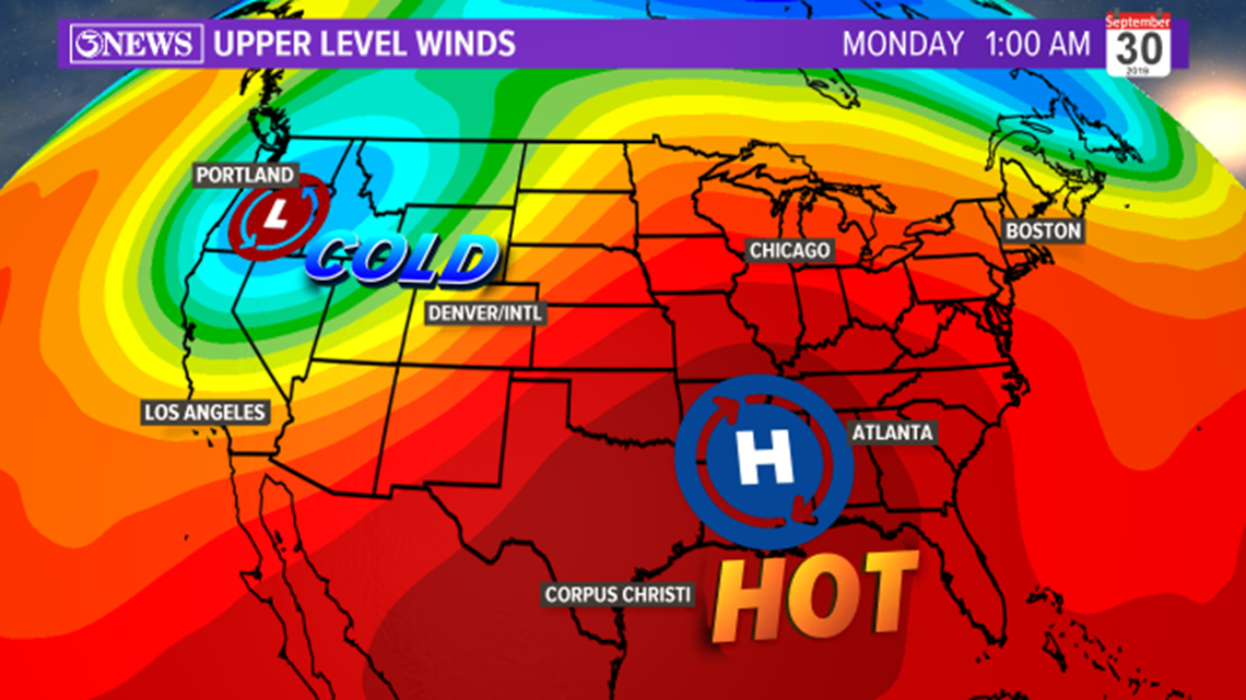
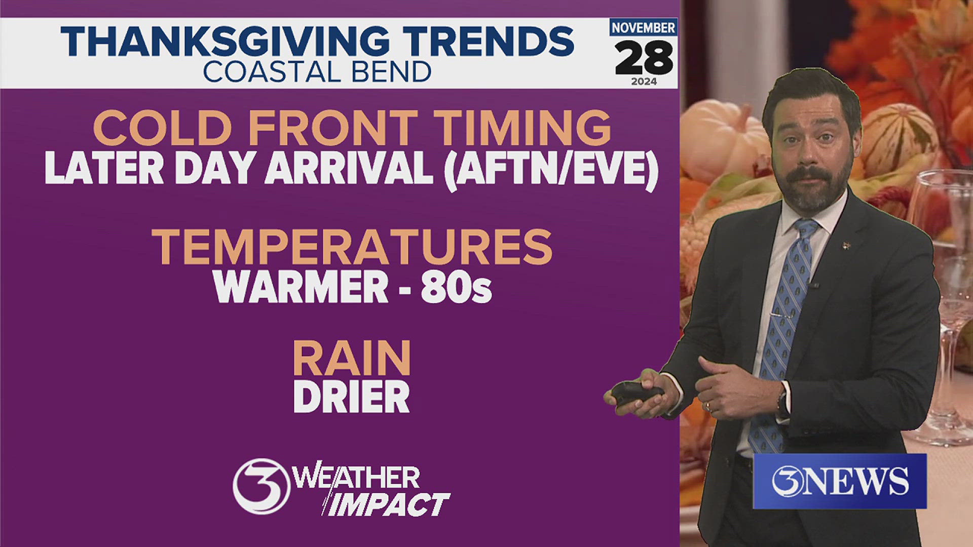
The graphic above is showing what the upper level wind pattern may look into early next week. You'll notice a possible dip in the jet stream (trough) over the Pacific Northwest and a bell curve over the southeast which indicates high pressure (ridge). A trough of low pressure to the north will translate into cold and stormy conditions over the northwest. A ridge will generally warm us up and shut down rain chances for our region. Aside from a few isolated showers in the afternoon, our weather will be sunny and warm due to high pressure through next week.
On our channel, you’ll see us often mentioning the jet stream with the graphic above. Look for the ridges and troughs. When you find them, you’ll notice the regions of the country that are experiencing cooler and warmer weather.