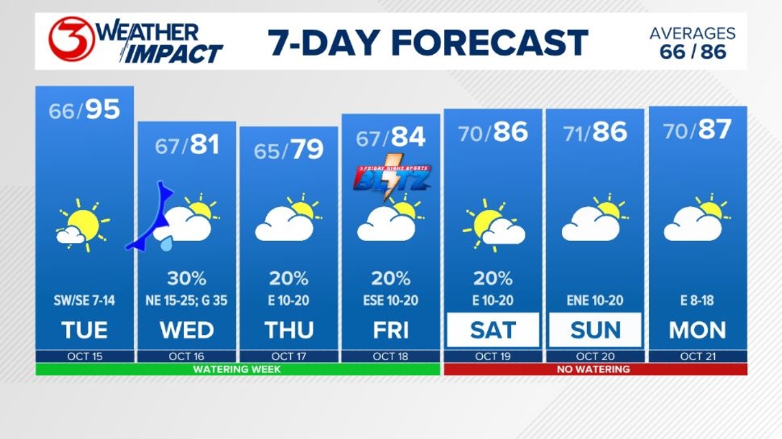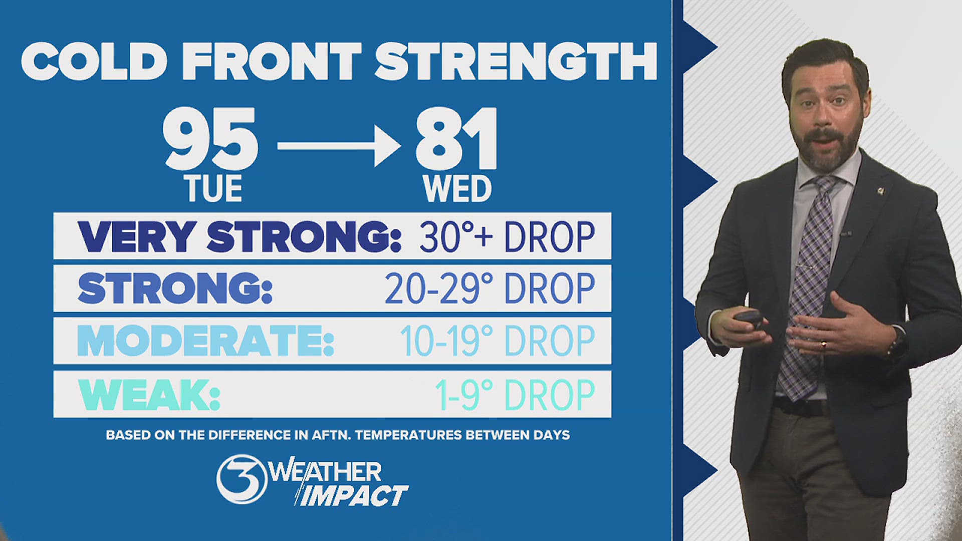
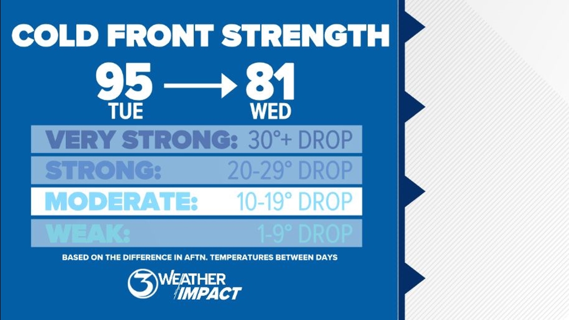
CORPUS CHRISTI, Texas — October is a month that begins to offer South Texas relief from the brutally long and hot summers the region endures. A cold front slated to move in on Wednesday morning will do that. Remember, as we talk about cold fronts, the term 'cold front' does not describe how it feels outside; it describes the change in temperature and air mass brings. In Wednesday's case, it'll be about a 15° difference.

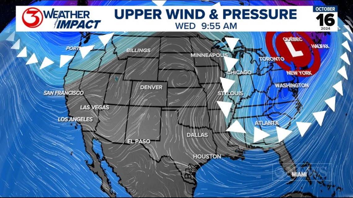
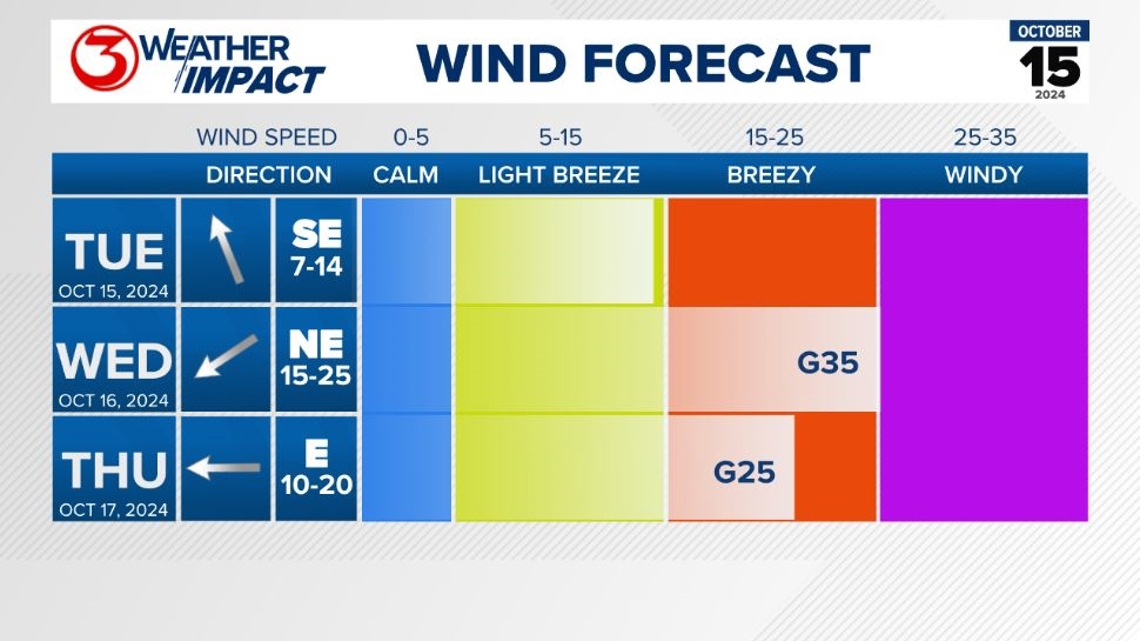
This cold front will be somewhat unusual for the Coastal Bend, because it will be a 'back door' cold front. That term is to indicate that the front will be moving in from the east to northeast, rather than the more common north or northwest direction.
The reason for this is because of the placement of an upper level trough in the eastern half of the country. That spot sends the 'teeth' of the front to the eastern half of the US.

In Corpus Christi, high temperatures will go from the middle 90s on Tuesday afternoon to around 80° Wednesday afternoon. Some modeling is coming in more aggressive for Wednesday afternoon, keeping highs in the 70s, so that's a possibility. Regardless, it'll be noticeably cooler and we're describing the strength on this cold front as 'moderate.'

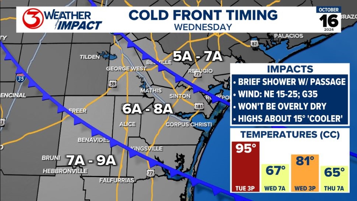
A brief shower will be possible as the front moves through on Wednesday morning. Northeasterly winds then pick up behind the front. They'll be sustained at 15-25 mph, gusting up to around 35 mph.

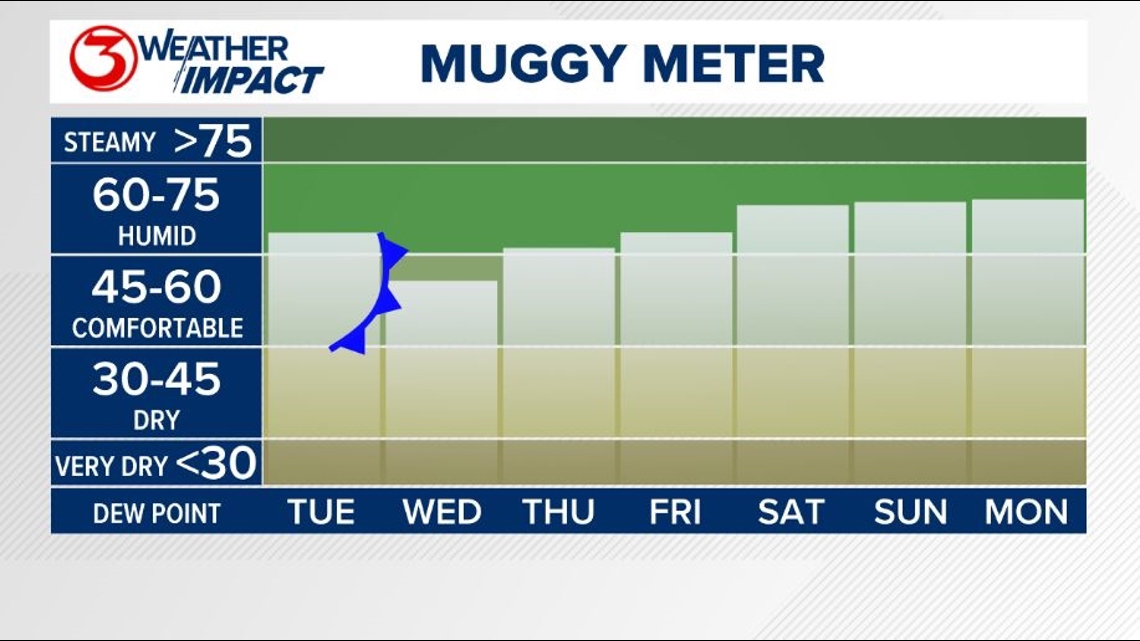
Because the cold front is coming in from the east to northeast, it will not offer a surge of super dry air/low humidity. Our muggy meter does drop into the comfortable category, but then it's back to humid into the weekend.

With that, overnight lows will not be overly cool; in the middle 60s through Friday, then closer to 70° this weekend. Highs top out close to seasonal average, in the middle 80s this weekend. Average high temperatures for mid October are generally in the middle 80s.