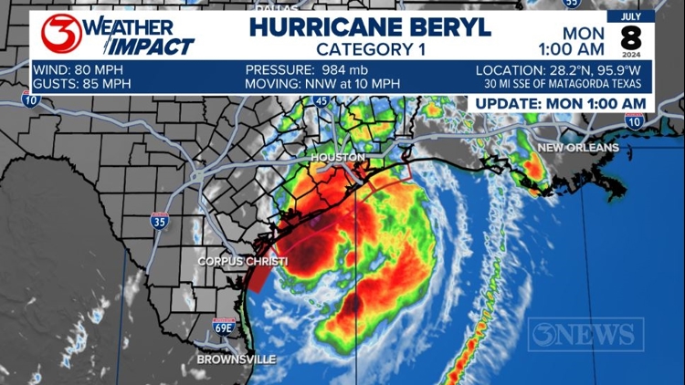
CORPUS CHRISTI, Texas — 4 AM UPDATE: Beryl is approaching the area between Matagorda and Freeport as a Category 1 Hurricane with 80 mph winds.


There is still a chance Beryl will strengthen a bit before landfall. Cat 1 strength wind is still possible through the southwestern side of Houston.

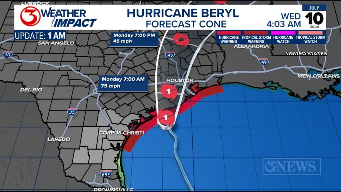
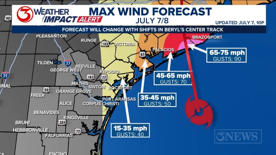
WIND: A landfall east of the Matagorda Bay significantly lowers the worst of Beryl’s impacts for the Coastal Bend. Parts of Aransas, Refugio, and San Patricio Counties and Mustang/North Padre Island may experience low-end tropical storm conditions as Beryl passes by tonight and early Monday morning. Damaging winds expected in the vicinity of landfall, which looks like Matagorda Bay area.

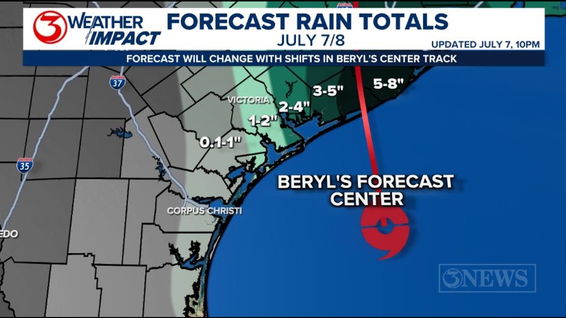
RAIN: The outer bands of Beryl will work into the Coastal Bend throughout Sunday evening and into Monday morning, again…as the storm passes us by in the gulf, en-route to the Middle Texas Gulf Coast. Highest totals will be in close to and east of the center path of the storm. There will likely be a sharp drop off in rain totals west of the storm.

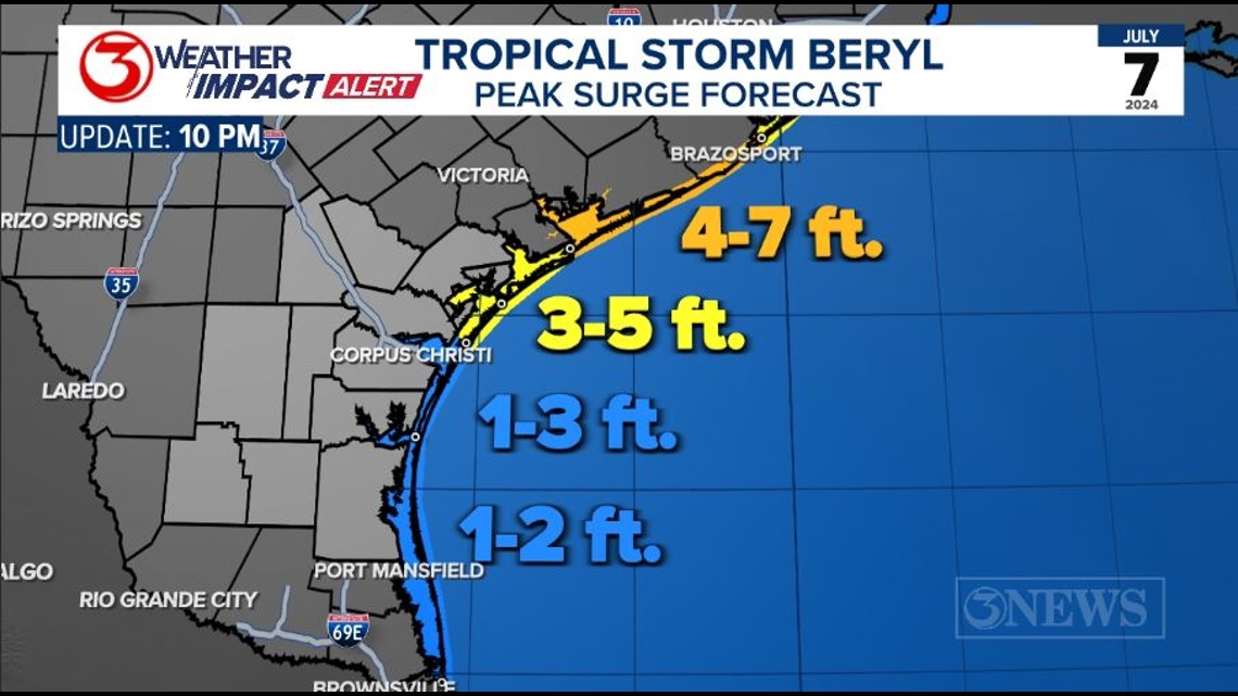
SURGE: Storm surge forecast for the Coastal Bend is generally at 1-3 ft. Of note, as Beryl moves north of the area, winds will turn to out of the NW. That movement may push water into places like the canals on the Island and the bay sides of area barrier islands tonight and early Monday morning.

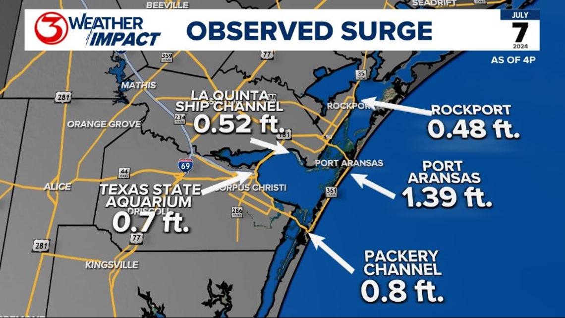
Through 3:30p, tides were running anywhere from a half a foot to a foot and a half above the normal tide height, meaning the surge is looking a little lower than the forecast right now. I am calculating the surge levels by calculating the difference between the normal high tide and the levels being reported from the gauges.

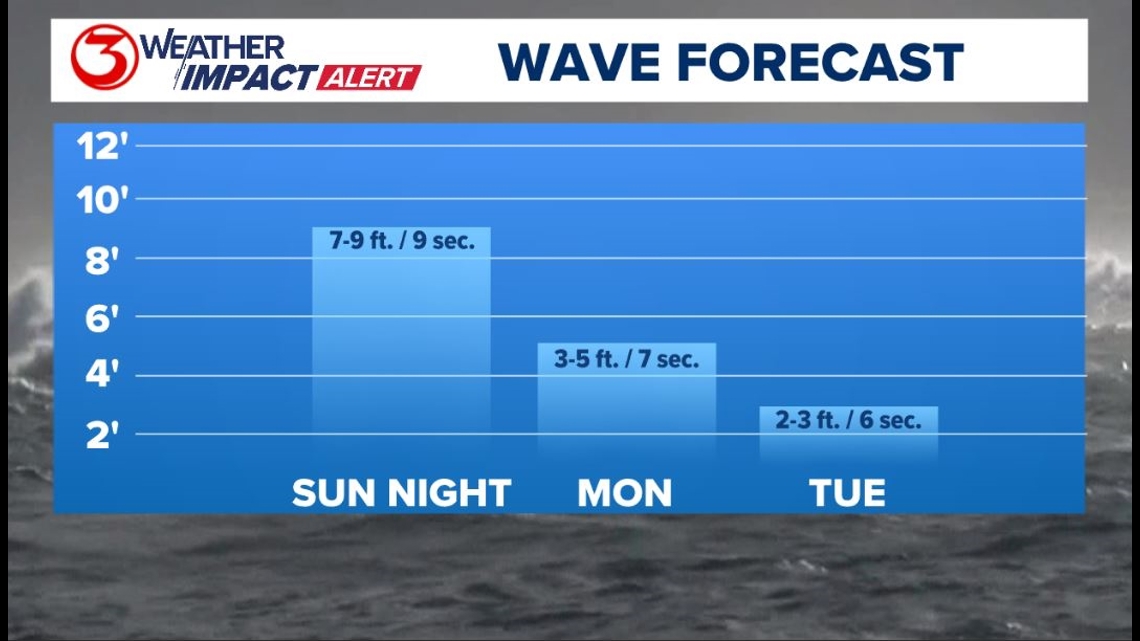
WAVES will be at 7-9 ft overnight and into Monday morning. Throughout the day on Monday, wave heights will steadily recede as Beryl moves on to the north.

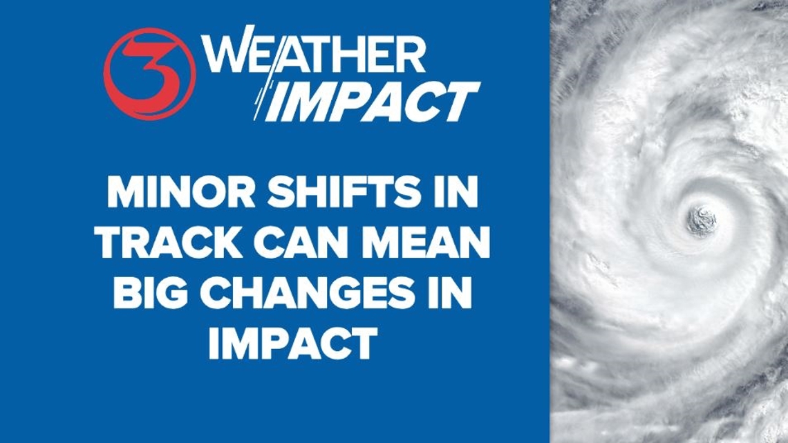
The phrase I’ve been using ‘minor shifts in track can lead to big changes in impacts’ is a very real thing. In this case, those changes are working in our favor, while things have escalated rather quickly for the Matagorda Bay area as that part of the TX Gulf Coast is now bracing for a hurricane tonight. We will continue to be vigilant and highly in tune to any changes between now and landfall, even though the threat in the KIII viewing area is lower as of this writing.

Make sure to check out the 2024 KIII Hurricane Special - you can watch it (or re-watch) it here! The special includes topics like evacuations, hurricane kits, and rip currents - on top of information like the tropical outlook and new data on hurricane-related fatalities. You don't want to miss it!
For more on our local weather, head on over to our forecast post.
-------------------------------------------------------------
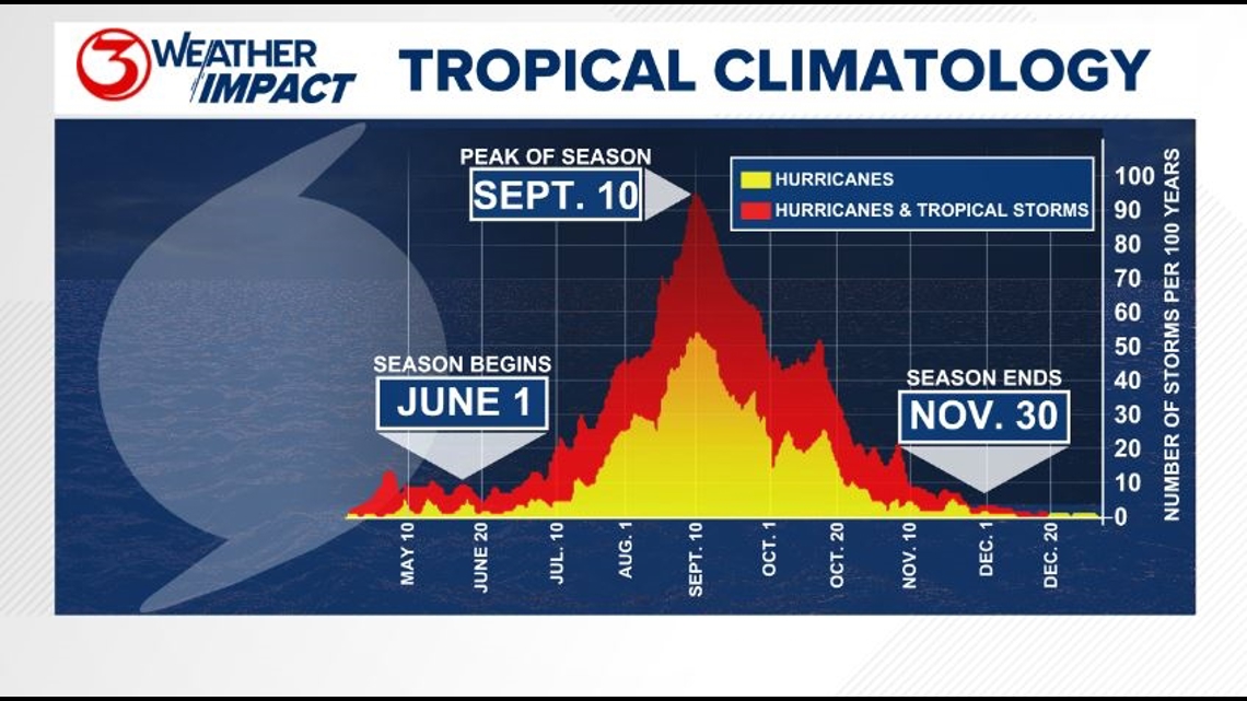
The Atlantic Hurricane Season runs from June 1 to November 30, with the peak of the climatological peak of the season happening on September 10.

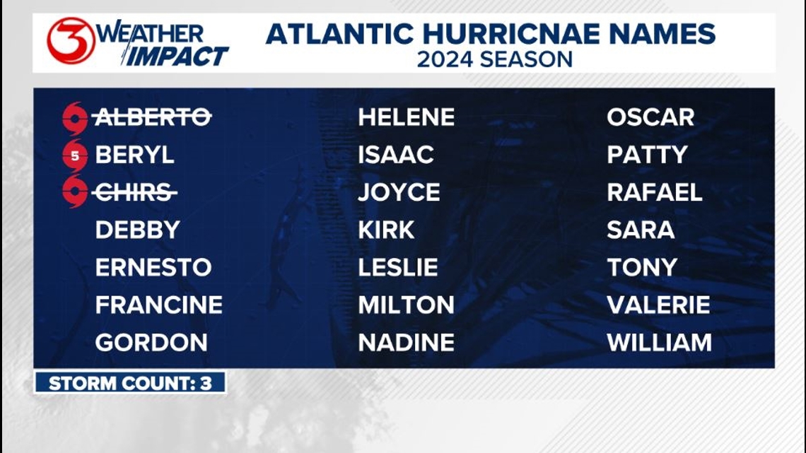
Here are the names for the 2024 Atlantic Hurricane Season. Names are given to tropical cyclones (tropical storms and hurricanes).

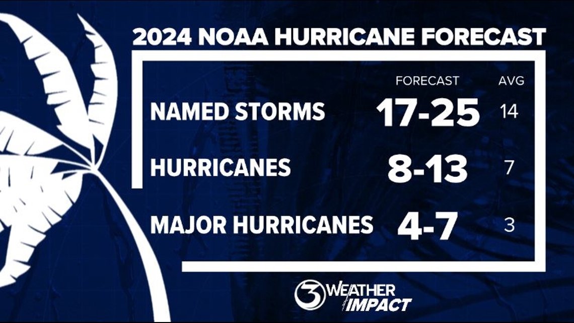
On May 23, NOAA released their forecast for the 2024 Atlantic Hurricane Season. They're predicting an above-average year, with 17-25 named storms. This is the highest pre-season forecast they've ever issued.
The high number of storms forecast is due to near-record sea surface temperatures and the return of La Nina, both of which favor tropical cyclone development. We talk more about those in our Hurricane Special, which you can watch here!

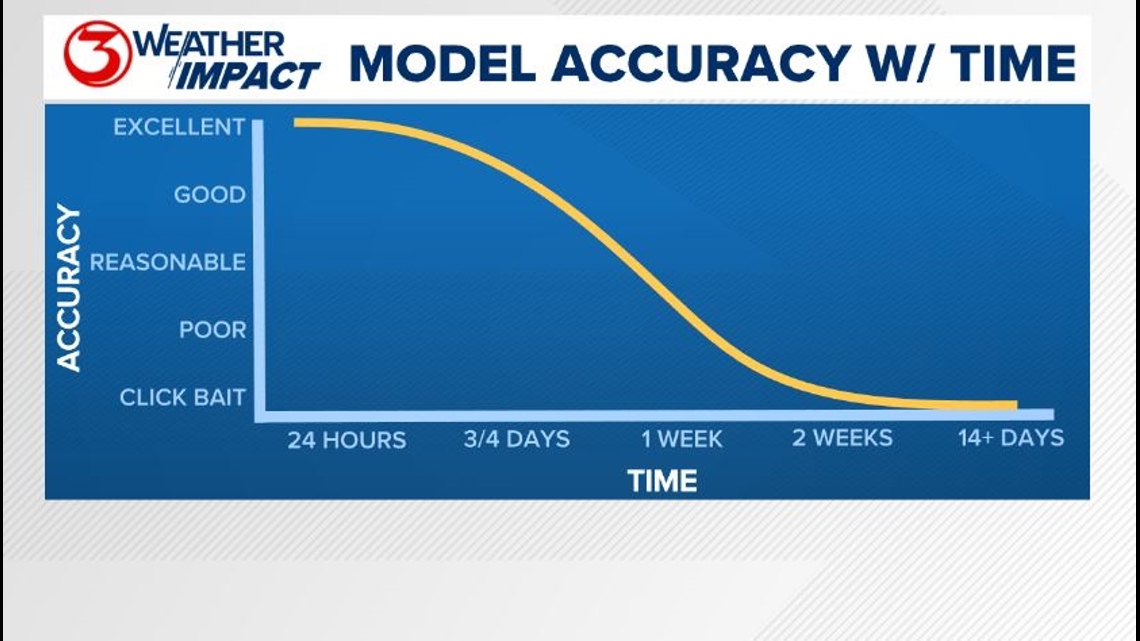
Remember to not "anchor" to the first forecast you see - forecasts change. Also, rely on a credible source for your tropical information and forecasts.