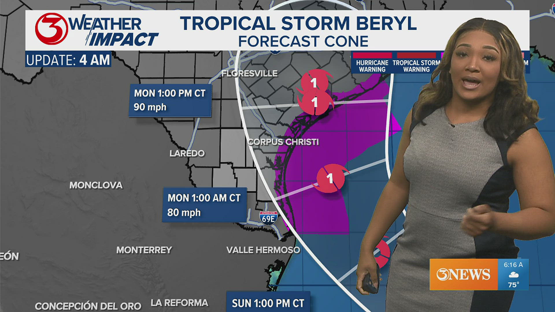
CORPUS CHRISTI, Texas — JULY 6, 4PM FORECAST CONE:
The National Weather Service issued hurricane warnings as well as storm-surge warnings for parts of the Coastal Bend.
The forecast center is between San Antonio Bay and Matagorda Bay, and we are still expecting some impacts locally.
More information to come after the 6 p.m. newscast.

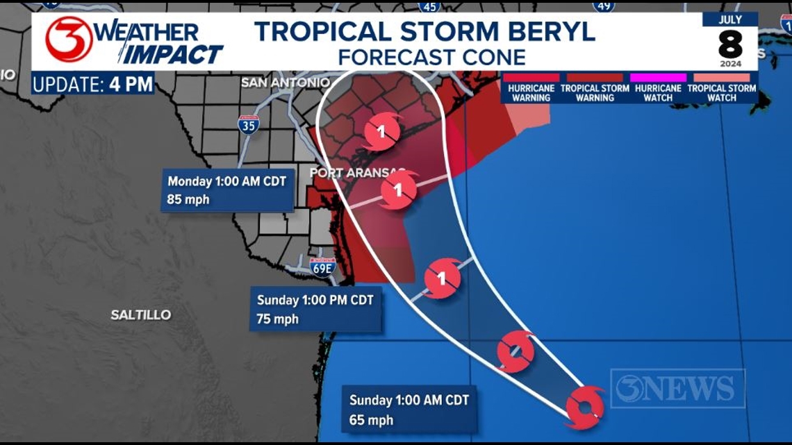
JULY 6, 10 AM BERYL FORECAST CONE:
The 10 AM update from the National Hurricane Center stays fairly consistent from last night's 10 PM cone. Beryl is still expected to strengthen over the warm Gulf of Mexico Water and be a high end Category 1 Hurricane with winds up to 90 mph at landfall along the middle Texas Gulf Coast.

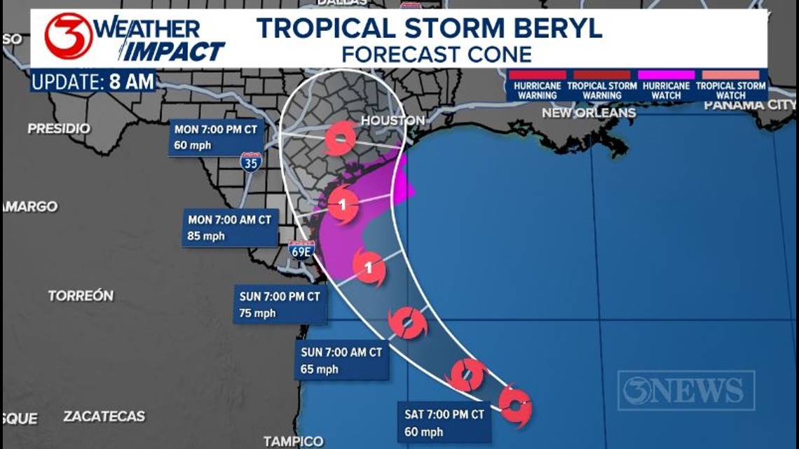
HURRICANE WATCH is in effect for most of the Texas Gulf Coast; as far north as Brazosport. A hurricane watch means hurricane conditions are possible within 48 hours.
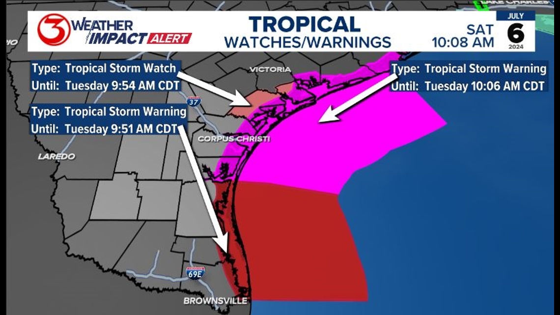
Kenedy County south to The Valley is now under a Tropical Storm Warning and a Hurricane Watch. Much of the Coastal Bend remains in a Hurricane Watch. Refugio County is now under a Tropical Storm Watch.
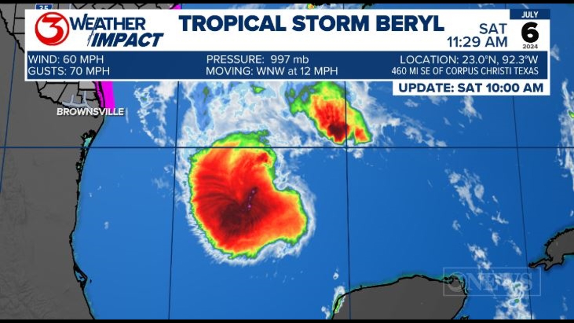
As of 10 AM July 6, Beryl is still a Tropical Storm with sustained winds at 60 mph. It is expected to strengthen as it moves toward the Texas Coast.

BERYL CURRENTS: Beryl is still a very disorganized Tropical Storm and a shell of It's former self. Beryl is still moving west, northwest this morning, but it is expected to turn more northwest by the next update at 4 PM. Wind speed hasn't changed much since last night, sustained at 60 mph with gusts up to 70 mph.

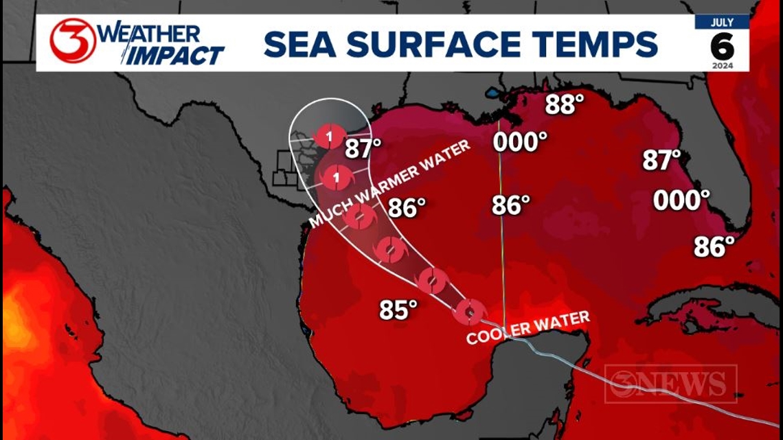
Sea surface temperatures were cooler just north of the Yucatan, right around 80 degrees. Beryl will move into warmer waters along the Texas Gulf Coast. As this happens, Beryl is expected to strengthen to a Category 1 Hurricane before landfall along the mid Texas coastline.

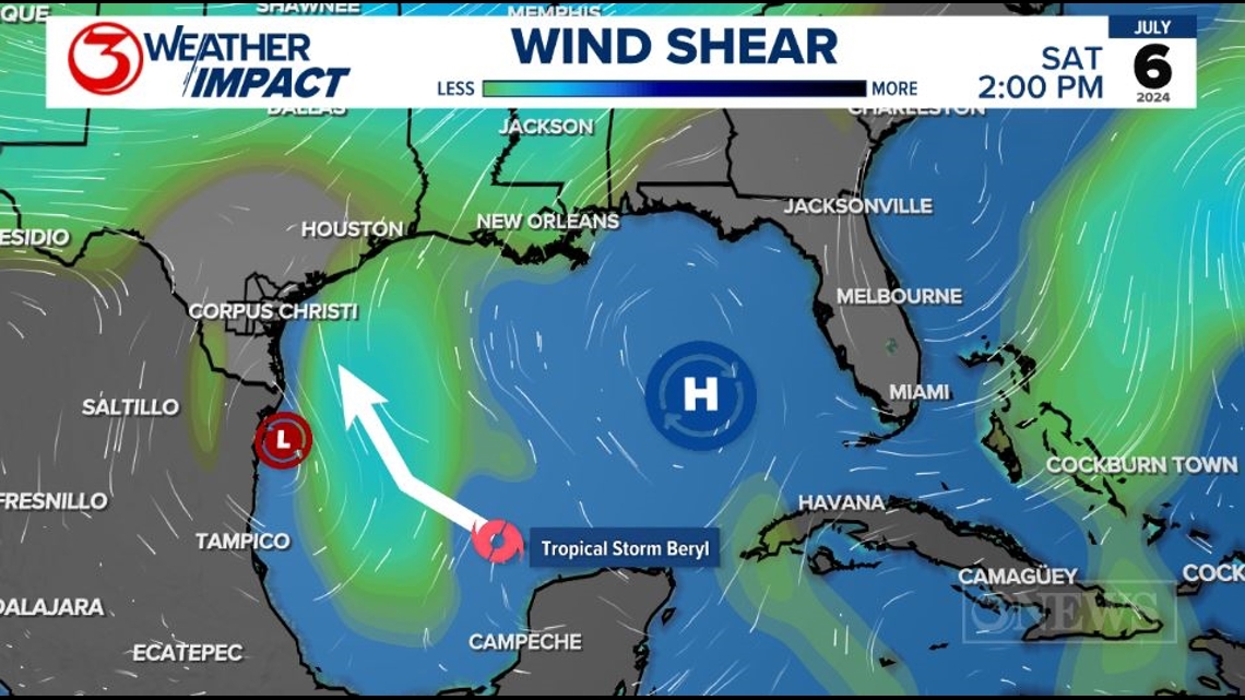
Wind shear in the Gulf of Mexico will also work to slow the growth in Beryl's intensity. Right now Beryl sits between an upper level low to the west and a high to the east. This is creating wind shear, but it will also aid in the turn to the north we have been talking about the last several day.

Overall there has been an shift in the forecast northeast, every run until this morning. A bigger player in how far north Beryl turns will be the amount of influence a trough working through the Plains exerts on Beryl. Tropical systems like to follow these when there are breaks in high pressure, which we will have as Beryl approaches the Texas Gulf Coast Sunday and Monday. Beryl will be pulled like a magnet toward the low pressure trough to the north and then likely follow the jet stream to the NE.

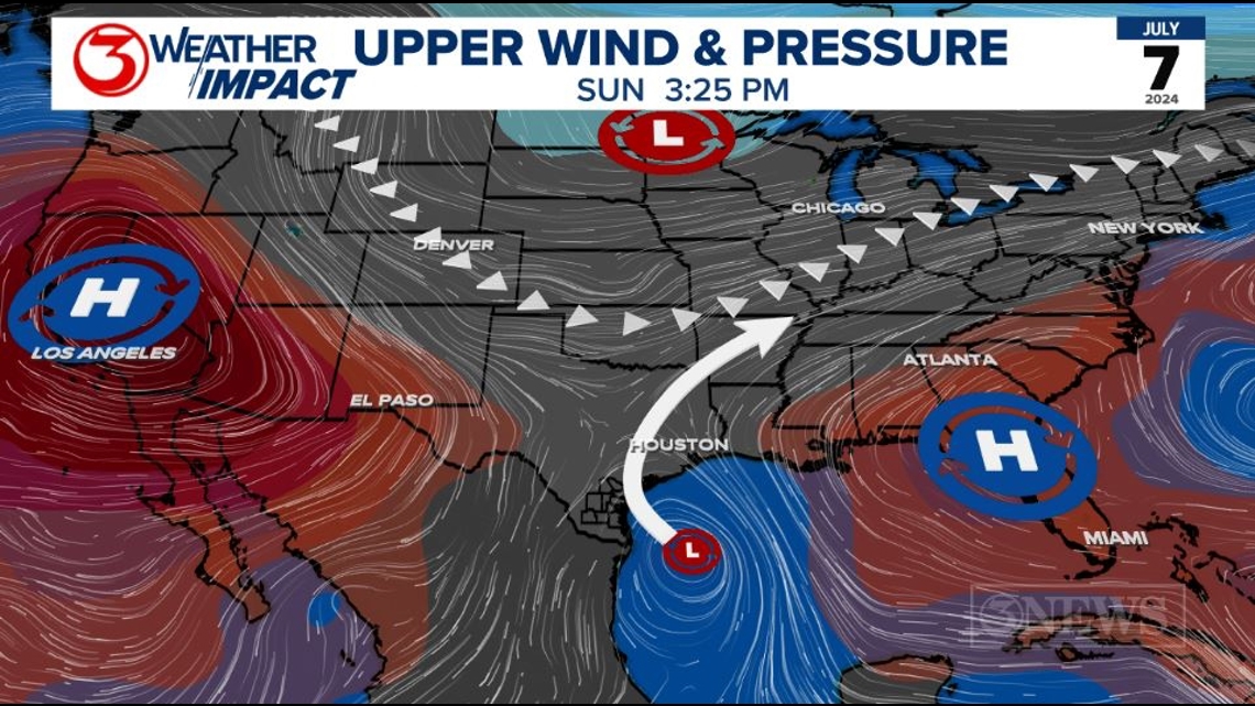
Since July 3, there has been a stead shift in an northeasterly shift in the forecast cone as confidence grows in the strength of the trough to our north. This weaken the subtropical ridge and allow for that northern turn. Every forecast confidence grows in the northern turn over the Gulf of Mexico so the track has continue to shift east. It is important to note these trends from day to day and between each update. Between last night's 10 PM update and this morning's 10 AM update from the National Hurricane Center there has been little changes to the center forecast line. If the steady trend continues confidence on a forecast track and impacts to the Coastal Bend will only increase.

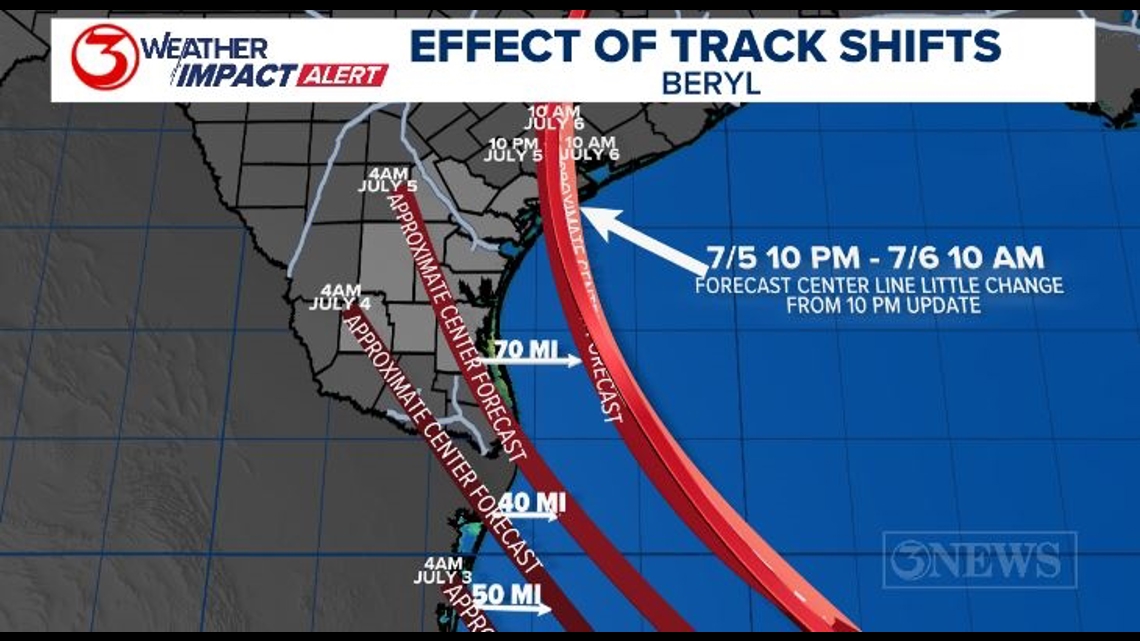
Yesterday had a notable shift, but this morning little has changed. Guidance seems to be settling on the middle Texas Gulf Coast at this time; we’ll call that from Baffin Bay to Lake Jackson. The main trend in the forecast modeling with respect to track today…has been the shift to the north. The track has moved some 85 miles to the east since yesterday.

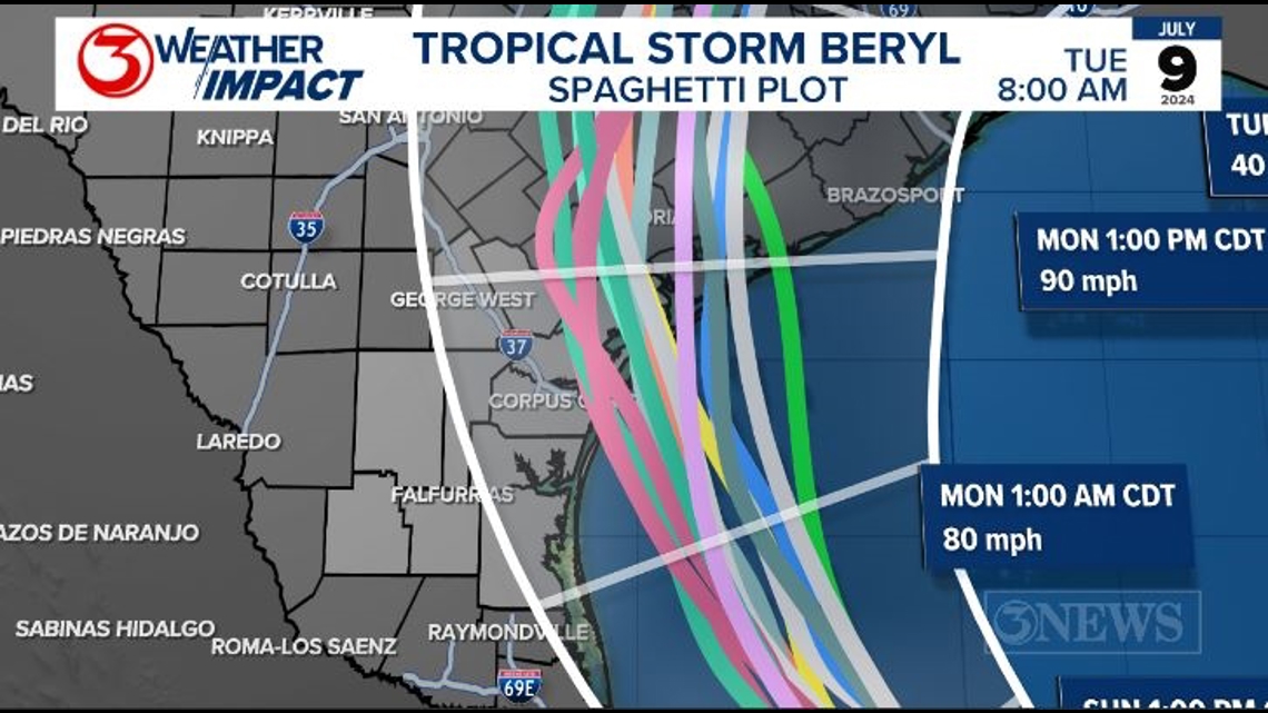
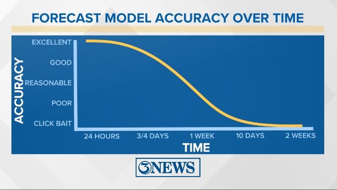
We have been keeping an eye on the latest trends and how models are performing.
Intensity guidance does not have as clear of a trend overall. There are some models that bring a hurricane into the Coastal Bend and others that bring a tropical storm into the middle Texas Gulf Coast. Preparing for one category higher than the NHC cone suggests is a practice that is often employed with respect to strength. Overall, the farther north this gets in the gulf, the more likely it is that it will be a stronger system with more time over water before the eventual Texas landfall.
There’s no reason to believe this trend on the northward shift will stop until the models stop doing it, which hasn’t stopped for about two days now. In fact, coming off the Yucatan, Beryl is still north of where many models have it at its current location. So, until they start to hone in on a spot without shifting more to the north, it’s plausible to believe this shift continues for another day or so.

Now for the forecast impacts…remember what we said yesterday….a small shift in the forecast track can lead to a large change in impacts for a specific location.
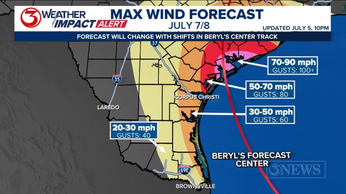
Given the current forecast center of Beryl and the trend in the modeling to the north/east side of the forecast cone, I have shifted the max wind speeds with respect to Beryl over to the Middle Texas Coast for Monday. I do still have high end tropical storm force conditions in the Rockport area and Refugio County. Hurricane conditions possible in the San Antonio Bay/Matagorda Bay area. Inland, generally in non coastal counties of the KIII viewing area, I have 20-30 mph winds with 40 mph gusts.

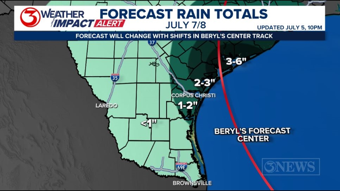
Beryl still does not strike me as a prolific rain producer as it will move through in less than a day’s time, but some locations close to where landfall is will likely pick up to around a half a foot of rain or more. Same change as with the wind forecast…highest totals will be shifting with the forecast center of Beryl. Yesterday, the Valley was in line for most of the rain; not the case today at all.

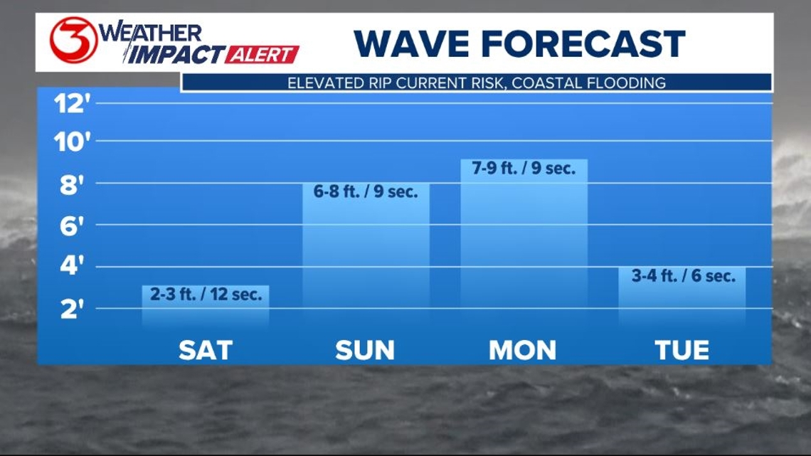
WAVES: Wave period will begin to pick up on Saturday, despite the gulf being very mellow. That increase in wave period will lead to a higher risk for rip currents despite the low wave heights. Surf picks up on Sunday and Monday. We may have some 10 ft. waves on our beaches with Beryl moving in. This will also elevate tides and there will likely be coastal flooding & storm surge in the region.

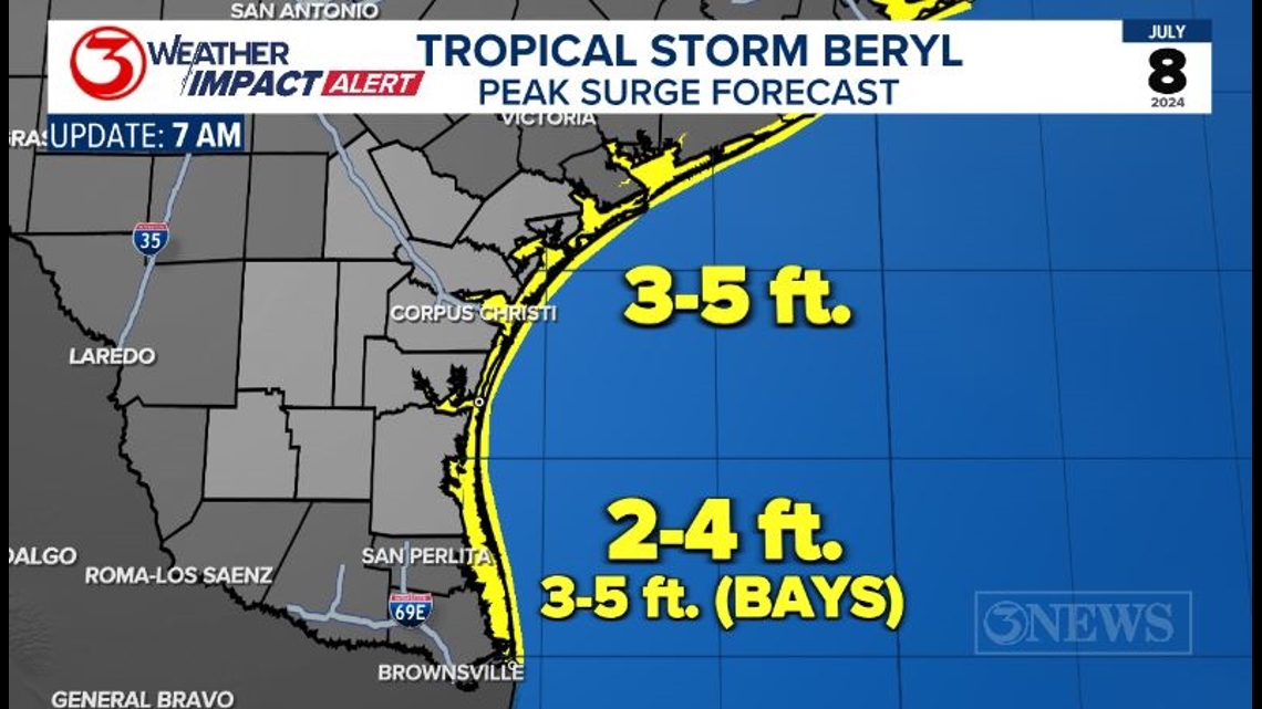
SURGE: Current surge forecast is for 3 to 5 ft. of surge above normal tides. In Alberto a few weeks ago, the surge in the Coastal Bend was about 3 to 3 and a half feet, for perspective.

WHAT TO DO: Given the trend to the east and north that has been happening for the last several days and our relation to where the cone is now, I still do not think it is time to be putting hurricane plans in to action just yet. However, you should be ready to implement your plan at a moment’s notice. FWIW, I have boards ready to put on to my windows at my home at the ready. I have single pane, untreated glass for windows. I will use the next 24 hours or so of forecasts to make my decision there. If this north and east trend holds, the Coastal Bend/Corpus Christi area may get minimal impacts. Stay tuned.
The graphic below does not indicate specific numbers, rather is more to be used as a timing guide for the information written in this post.

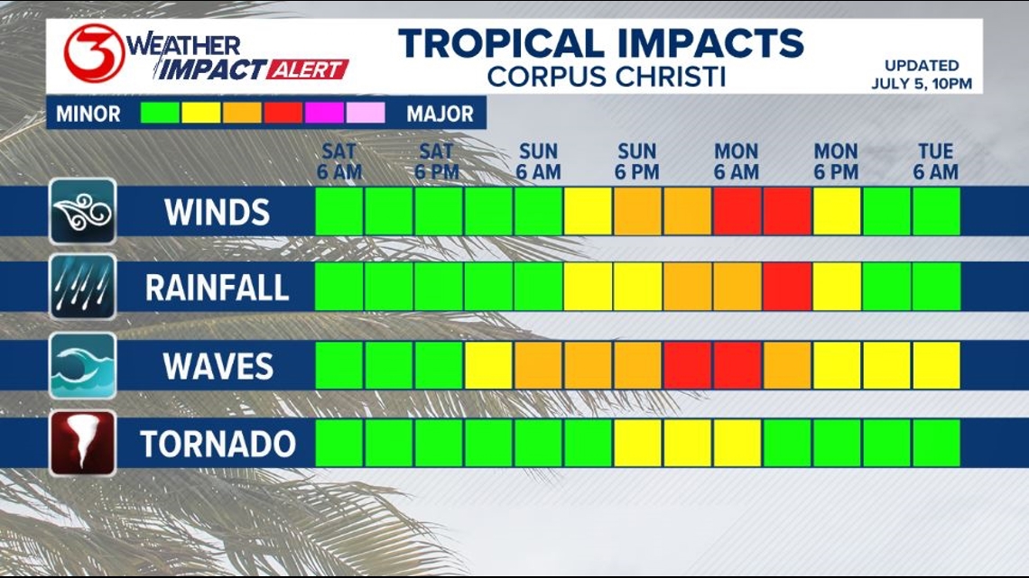
Make sure to check out the 2024 KIII Hurricane Special - you can watch it (or re-watch) it here! The special includes topics like evacuations, hurricane kits, and rip currents - on top of information like the tropical outlook and new data on hurricane-related fatalities. You don't want to miss it!
For more on our local weather, head on over to our forecast post.
-------------------------------------------------------------
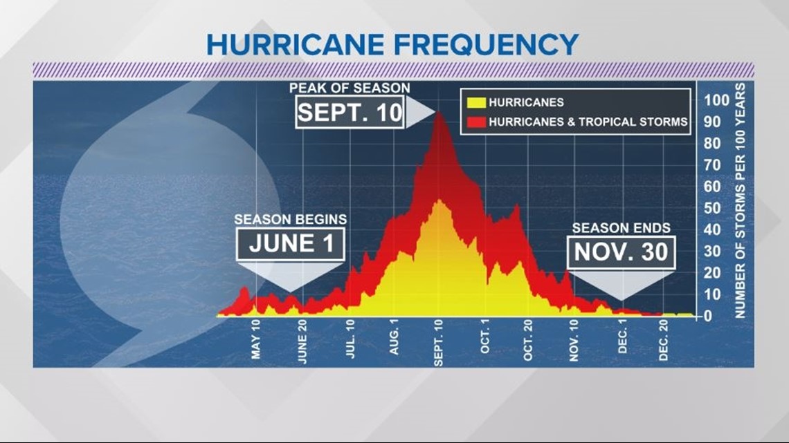
The Atlantic Hurricane Season runs from June 1 to November 30, with the peak of the climatological peak of the season happening on September 10.

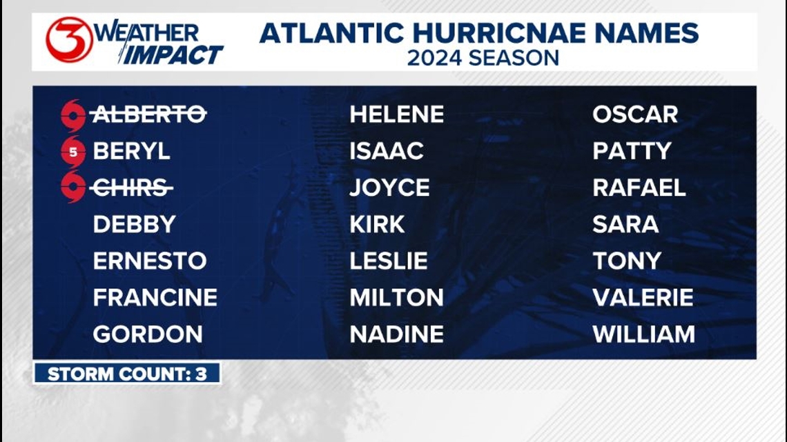
Here are the names for the 2024 Atlantic Hurricane Season. Names are given to tropical cyclones (tropical storms and hurricanes).

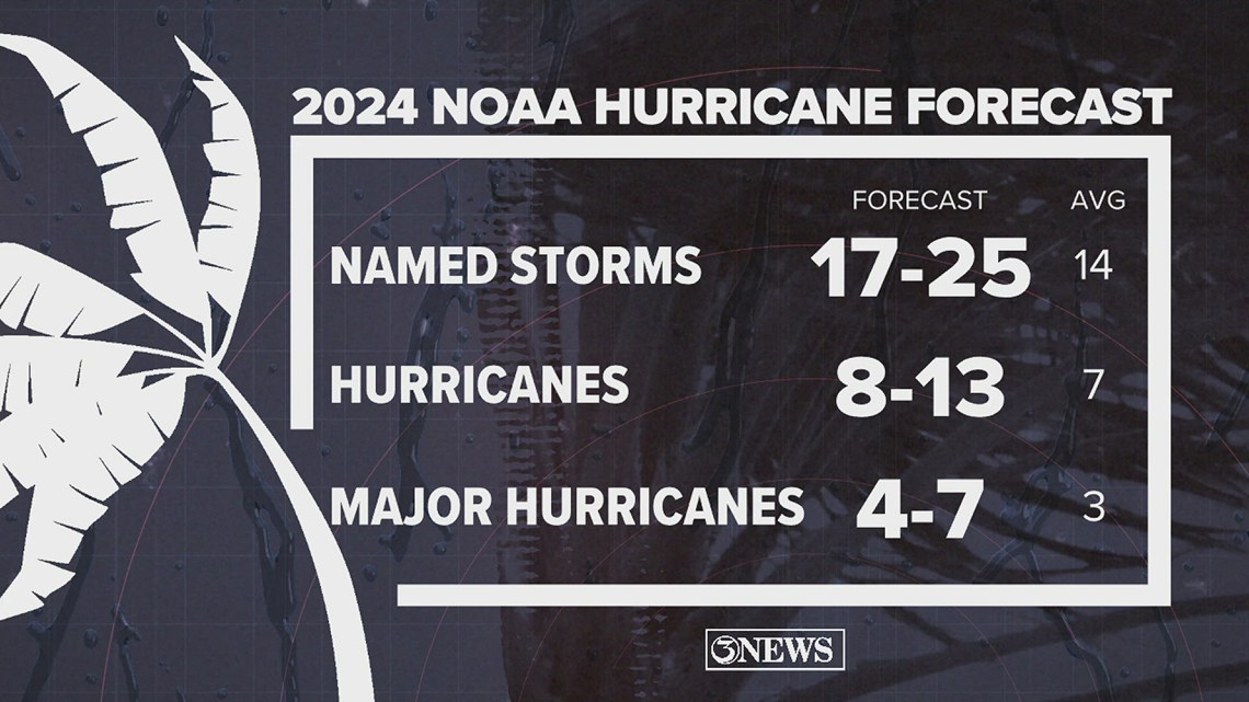
On May 23, NOAA released their forecast for the 2024 Atlantic Hurricane Season. They're predicting an above-average year, with 17-25 named storms. This is the highest pre-season forecast they've ever issued.
The high number of storms forecast is due to near-record sea surface temperatures and the return of La Nina, both of which favor tropical cyclone development. We talk more about those in our Hurricane Special, which you can watch here!

Remember to not "anchor" to the first forecast you see - forecasts change. Also, rely on a credible source for your tropical information and forecasts.

