
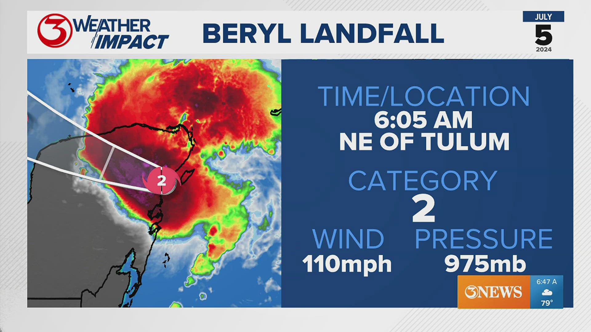
CORPUS CHRISTI, Texas — Beryl moved onshore near Tulum, Mexico with 110 mph winds. The peak sustained wind was 110 mph and the central pressure sat at 975 MB.
Beryl briefly intensified to a category 3 hurricane before landfall but weakened again before landfall this morning.
The latest forecast from the National Hurricane Center has Beryl entering the Gulf of Mexico as a Tropical Storm. Wind shear and interaction with land will continue to weaken Beryl through this evening.

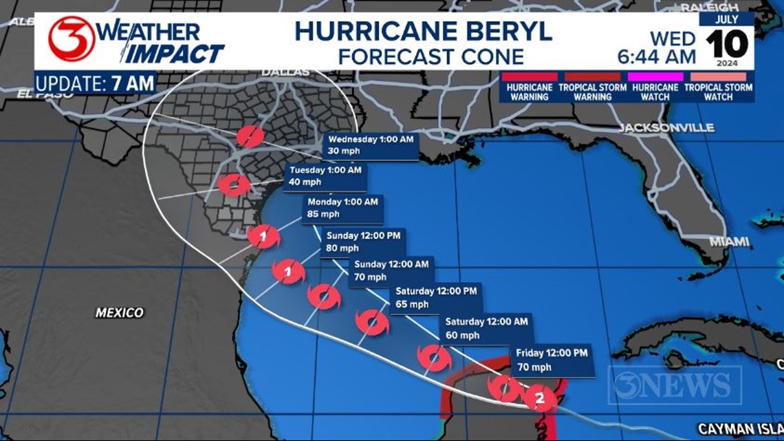
Landfall is anticipated somewhere near the Texas and Mexico border Sunday night. Coastal areas of South Texas and northern Mexico should keep a very close eye on the forecast. Any change in the center forecast line even by 10-50 miles can significantly change the impact felt.
Right now the Coastal Bend should prepare for tropical storm force winds. Beryl may be able to sustain a small area of category 1 (74-85 mph) wind speeds as it moves north through the Coastal Bend.