CORPUS CHRISTI, Texas — Tropical storm and hurricane watches are expected to be issued by the National Hurricane Center later today. This update would likely include a storm surge forecast.
Storm surge happens when strong wind blows across the ocean. Water is then pushed by the wind toward the land.
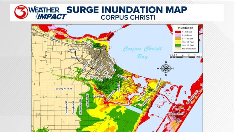
The worst case scenario for storm surge in Corpus Christi would be a landfall near Baffin Bay.
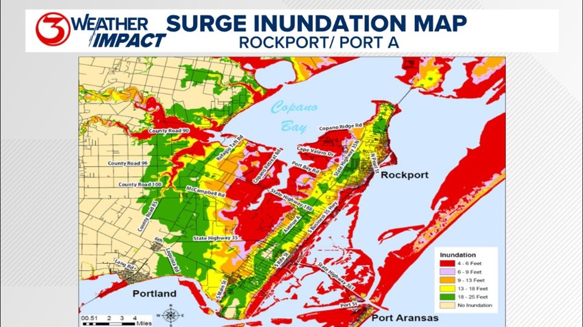
Areas highlighted in red such as, much of Padre Island, and North Beach will see an impact from storm surge first with just 4-6 ft of inundation. As you gain higher ground inland the inundation would need to reach 18 ft for the areas highlighted in green to see flooding from storm surge.

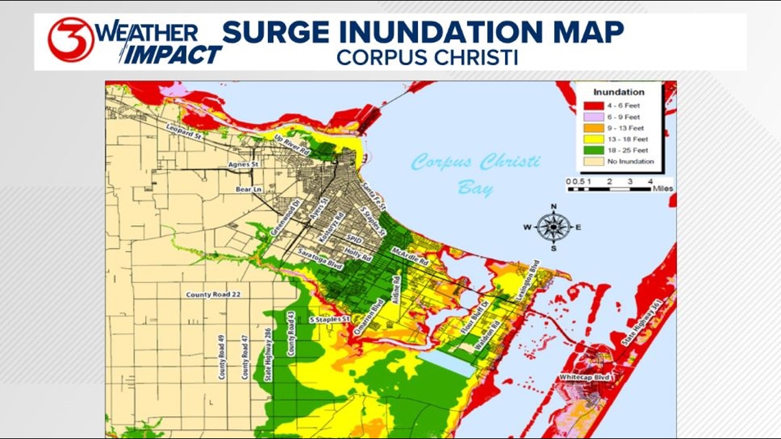
A similar map can be found below for Port Aransas and Rockport.

Make sure to check out the 2024 KIII Hurricane Special - you can watch it (or re-watch) it here! The special includes topics like evacuations, hurricane kits, and rip currents - on top of information like the tropical outlook and new data on hurricane-related fatalities. You don't want to miss it!
For more on our local weather, head on over to our forecast post.
-------------------------------------------------------------
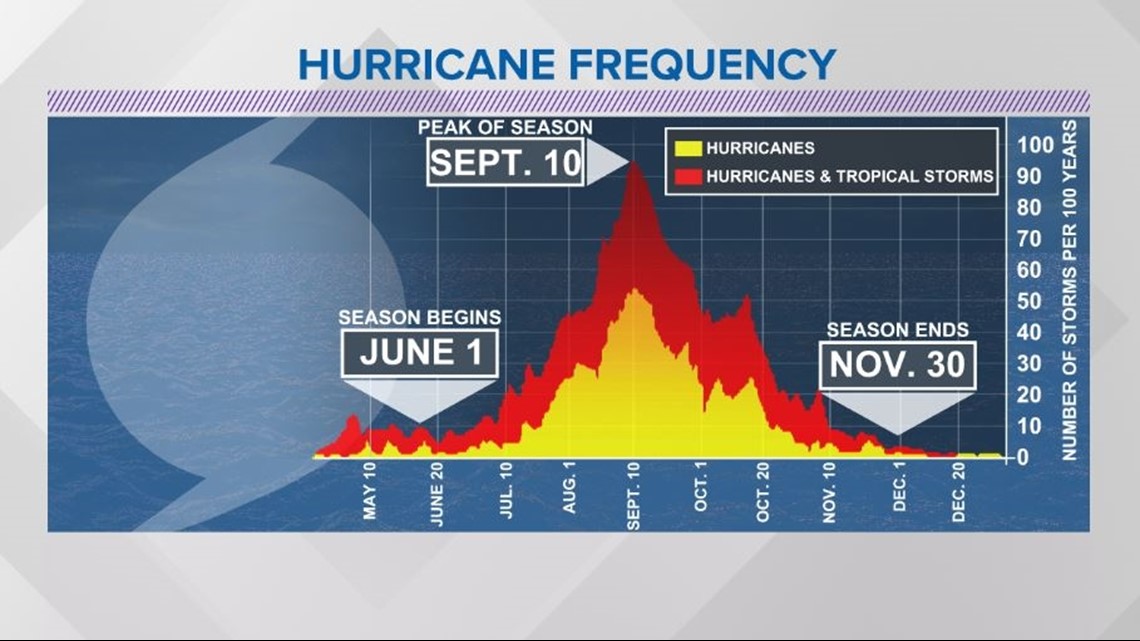
The Atlantic Hurricane Season runs from June 1 to November 30, with the peak of the climatological peak of the season happening on September 10.

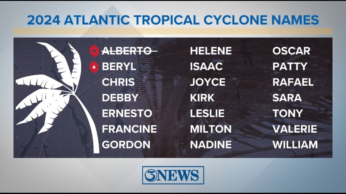
Here are the names for the 2024 Atlantic Hurricane Season. Names are given to tropical cyclones (tropical storms and hurricanes).

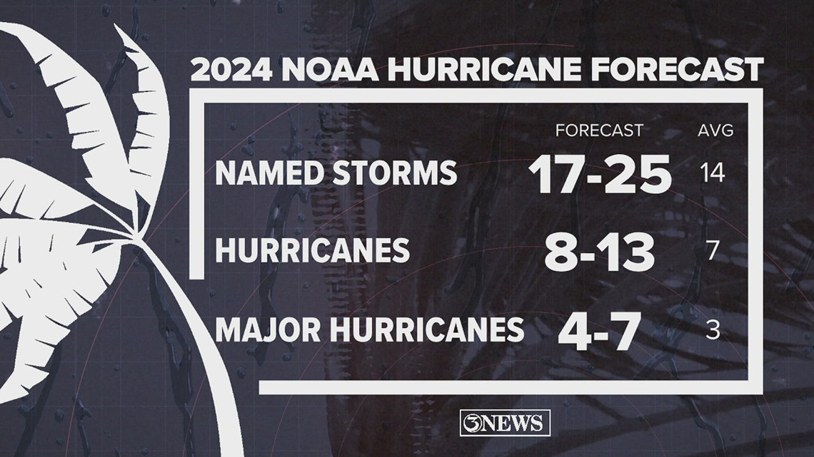
On May 23, NOAA released their forecast for the 2024 Atlantic Hurricane Season. They're predicting an above-average year, with 17-25 named storms. This is the highest pre-season forecast they've ever issued.
The high number of storms forecast is due to near-record sea surface temperatures and the return of La Nina, both of which favor tropical cyclone development. We talk more about those in our Hurricane Special, which you can watch here!

Remember to not "anchor" to the first forecast you see - forecasts change. Also, rely on a credible source for your tropical information and forecasts.

