CORPUS CHRISTI, Texas — New this morning the National Hurricane Center is planning on issuing Hurricane and Tropical Storm Watches for a portion of South Texas and the Northern Mexico Gulf Coast. Confidence is growing for landfall in this region and models continue to show more agreement and become more consistent.
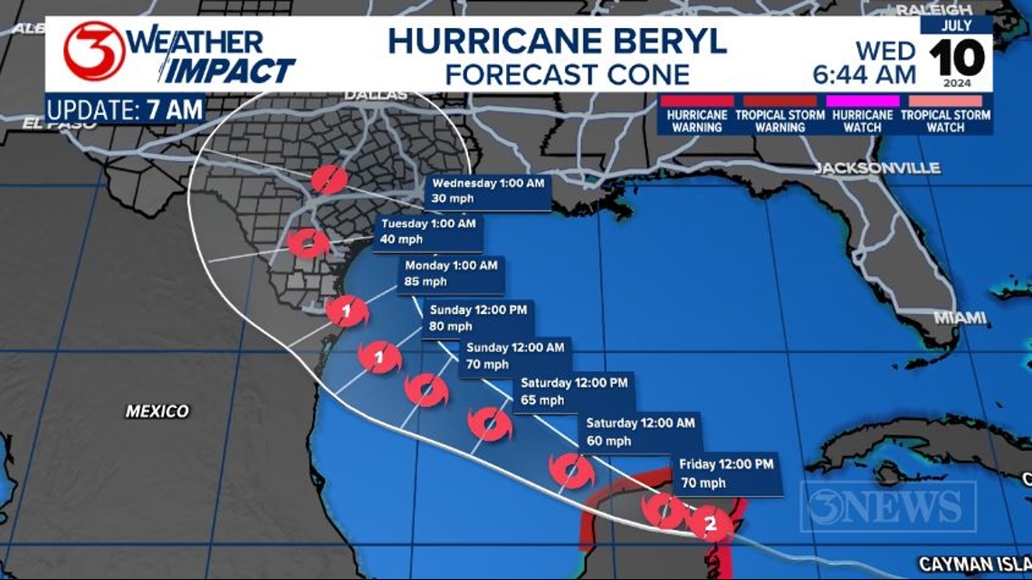
The latest NHC forecast cone updated at 7 AM shows a potential landfall near the Rio Grande Valley on Sunday night/Monday morning. The storm moves north into South Texas on Monday. The NHC also notes that a quick intensification in the 12-18 hours prior to landfall is also possible.

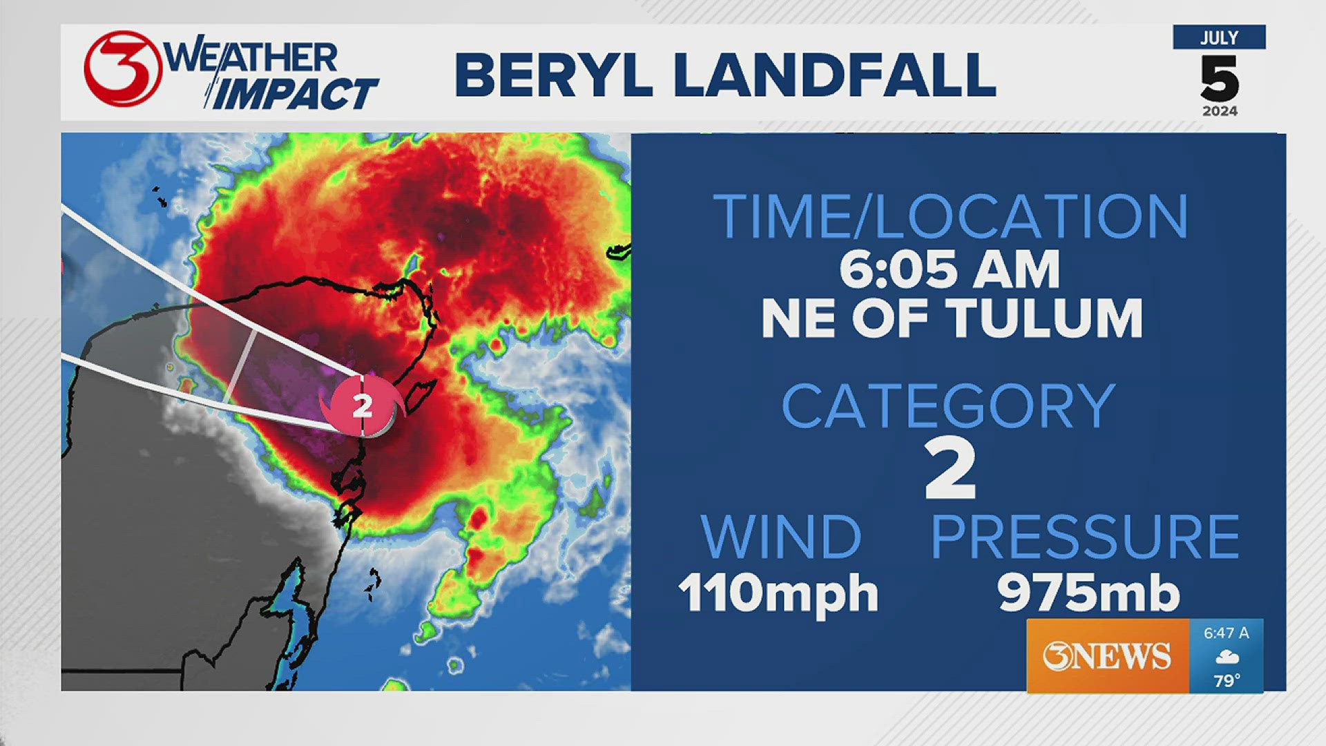
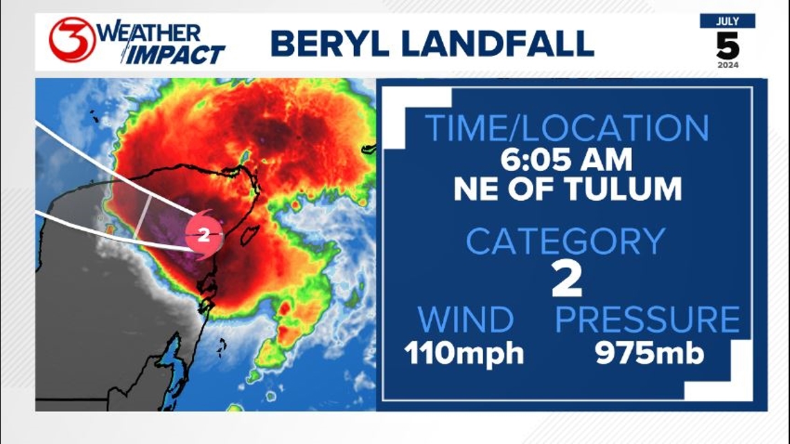
Beryl moved onshore near Tulum, Mexico at 6:05 AM Friday. The peak sustained wind was 110 mph and the central pressure sat at 975 MB.
Beryl briefly intensified to a category 3 hurricane before landfall but weakened again to Category 2 before landfall.

Confidence in the forecast for the Texas Coast will only grow as Beryl moves into the Gulf of Mexico. Right now there is still a bit of uncertainty on the exact path Beryl will take as it has its eye set somewhere near the Texas/Mexico Border.
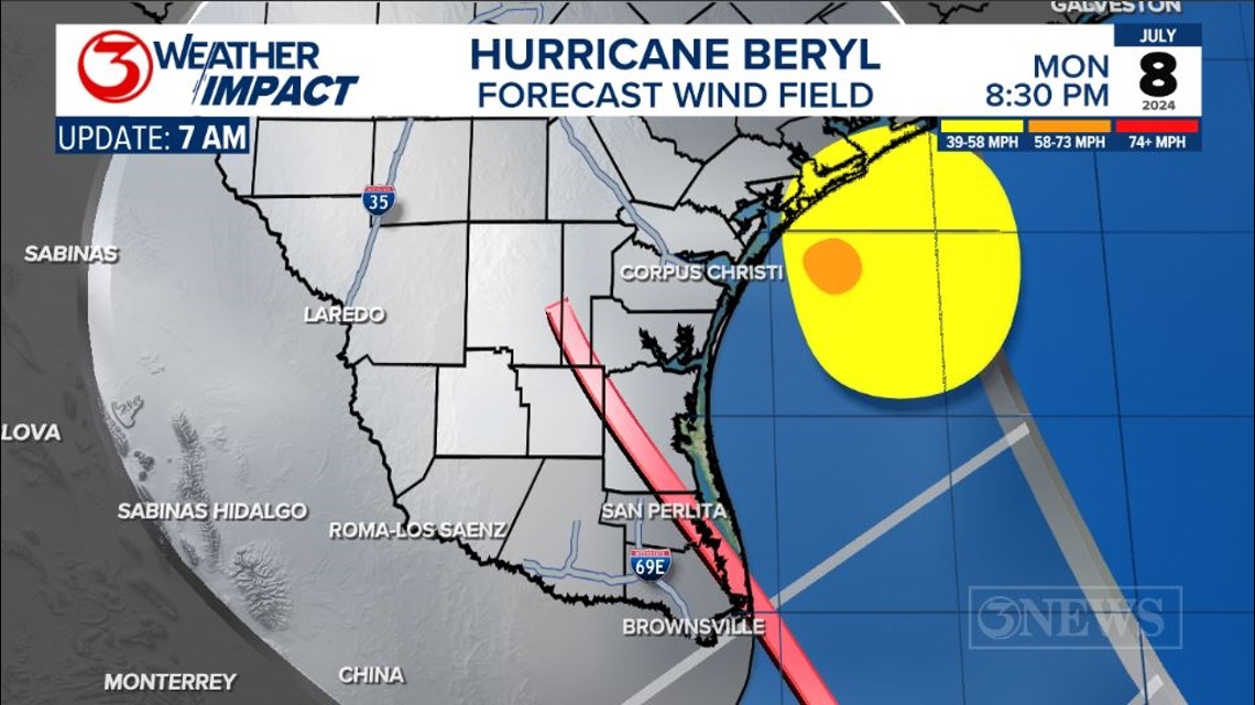
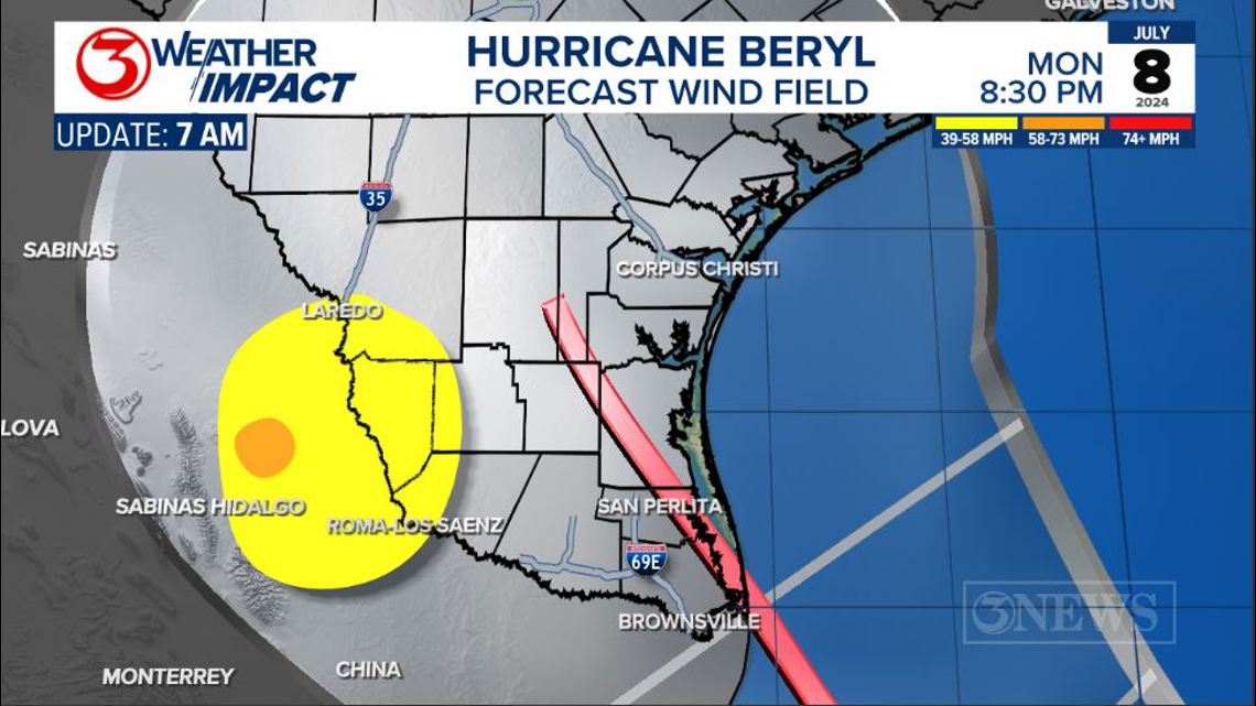
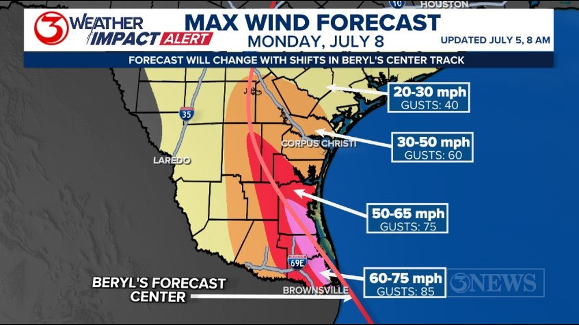
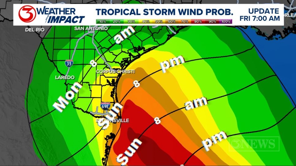
The path after landfall could have a significant impact on the Coastal Bend. Let's start with the wind forecast. The latest track from the NHC takes the center of the storm right through the Coastal Bend. This is a scenario where the impact would be higher in the Coastal Bend. The yellow circle indicates where low-end tropical storm winds are possible, and the orange circle shows where high-end tropical storm winds are possible. Tropical storm winds are 39-73 mph.

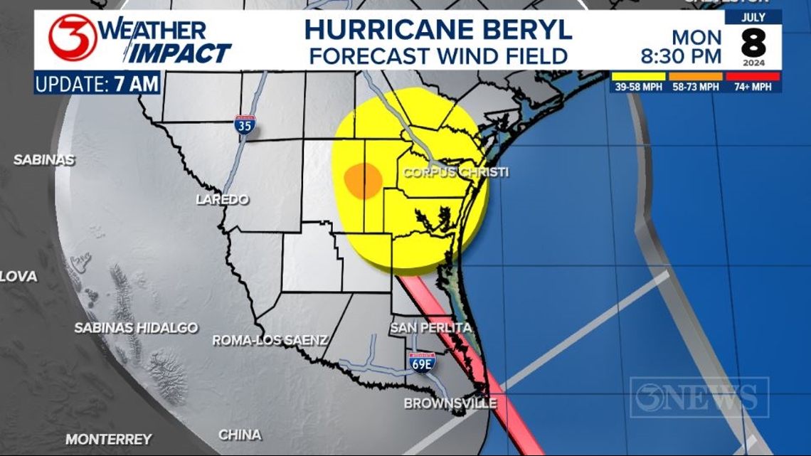
Remember the forecast cone will shift between now and Monday. The center of this line could wind up anywhere in the region highlighted in silver between the cone.
So a shift in the cone by just 100 miles to the east would keep most of the strongest wind over the Gulf of Mexico.

While a shift 100 miles to the west will keep most of the strongest wind in Mexico and right along the Rio Grande River.

It is important to remember there will be changes and shifts in that center line between now and landfall. Any little chance may dramatically chance what happens at your house. It's always best to be prepared for the worst case scenario and be thankful for the best case.
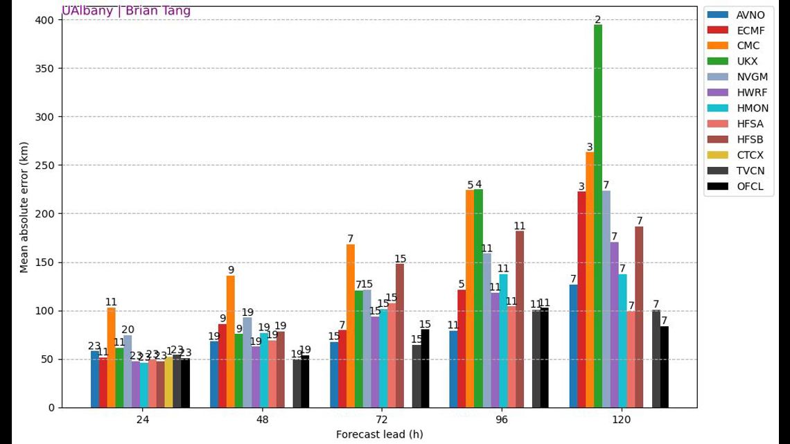
Regarding forecasting, we have decided to stick with the NHC forecast track. The centerline they have drawn throughout Beryl continues to be among the most accurate, even more so than many computer models we use. The chart below shows the average distance in KM each model is off by over 7-23 different runs of the model.

Basing our local knowledge off the NHC forecast line, here is a look at the wind speeds we expect across the Coastal Bend on Monday.

Again this will change based on the current forecast from the National Hurricane Center, but they are the experts, and there's no sign in the data that we should go against their forecast.
The latest track suggests tropical storm force wind speeds would arrive Sunday night/ Monday morning. They may continue through Monday evening.

The latest rainfall forecast for Sunday - Tuesday (July 9) does bring a chance of 4-6 inches for most of the Coastal Bend. Again this will change quite drastically depending on how far east or west the center of the storm tracks through the region.

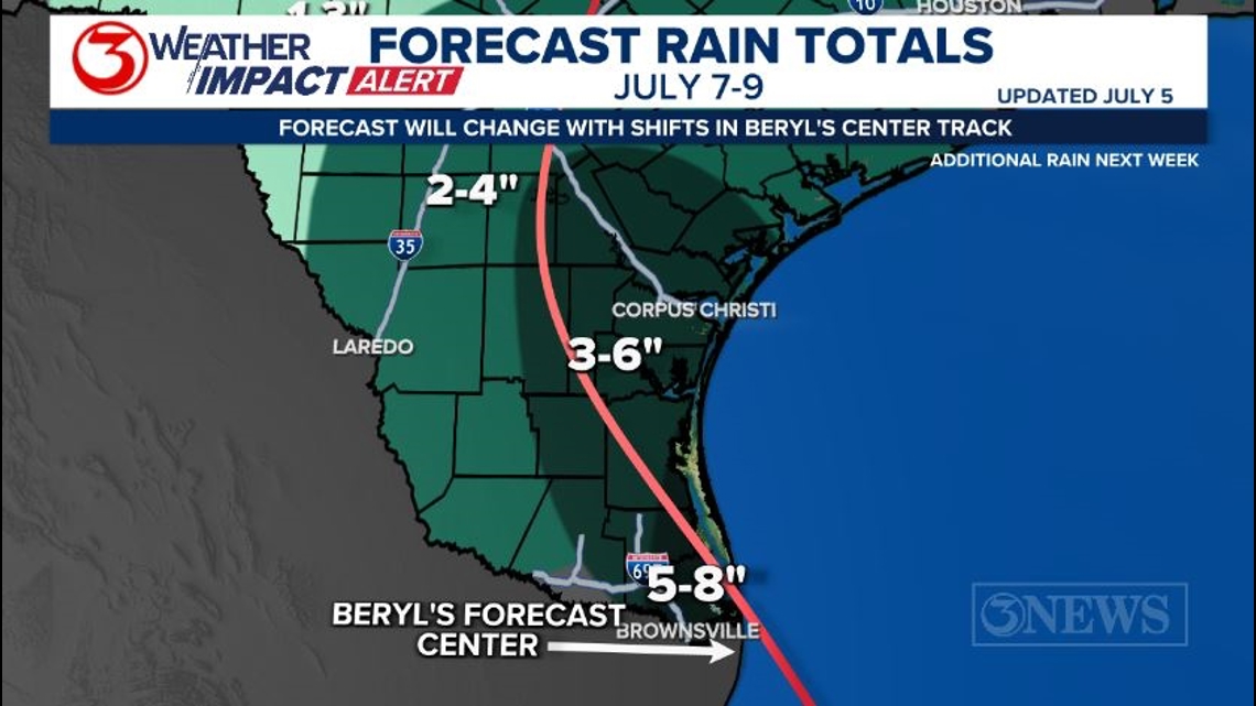
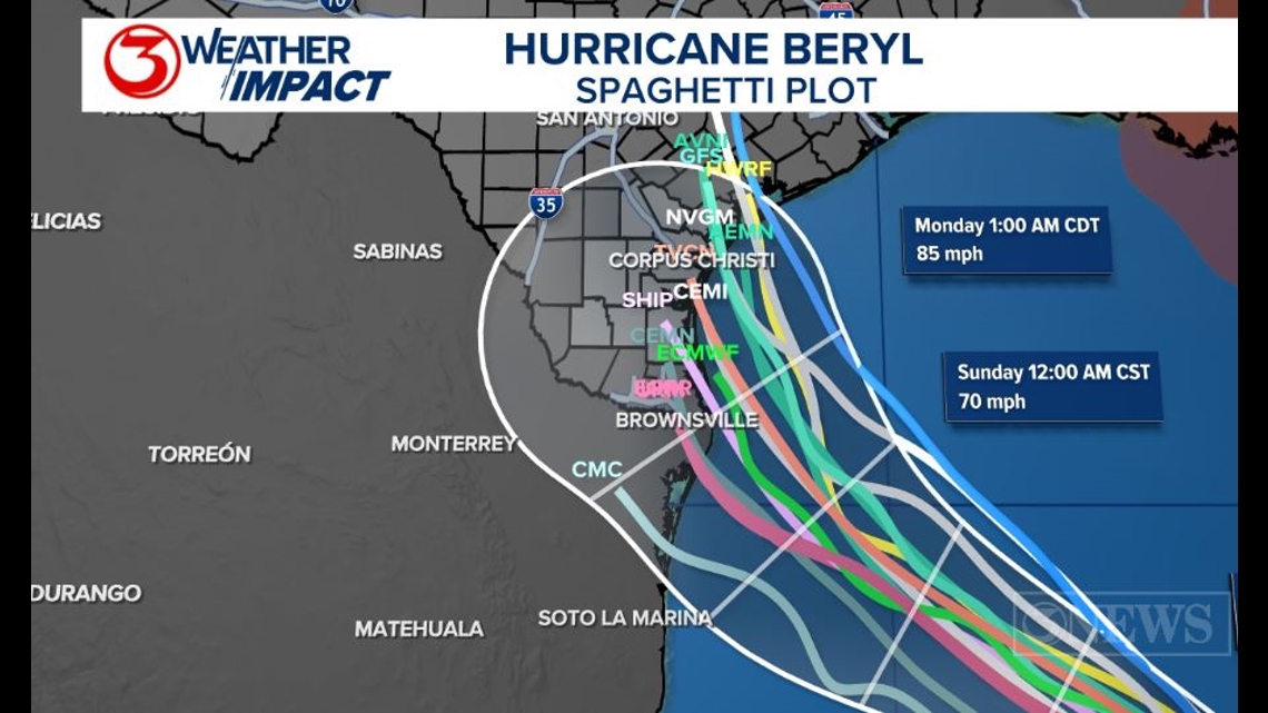
It might have been a little aggressive putting out a wind and rain forecast this far from landfall. We are a little worried that guidance continues to shift north every day. The latest spaghetti plot now shows a majority of the models moving on land somewhere between Brownsville and Matagorda Bay. Remember wherever the centerline shifts the rainfall will shift with it, just like the wind. Historically the NHC forecast track error, on average, is about 100-150 miles at 3 to 4 days out. Something to consider.

Overall, it looks like Monday is going to be the most impactful day of weather in the Coastal Bend as Beryl moves in close to the TX/MX border. Stay weather aware and keep up with the latest forecasts as there will be shifts in the days leading up to landfall. Small shifts in a situation like this can lead to a big change in the impacts a location receives.

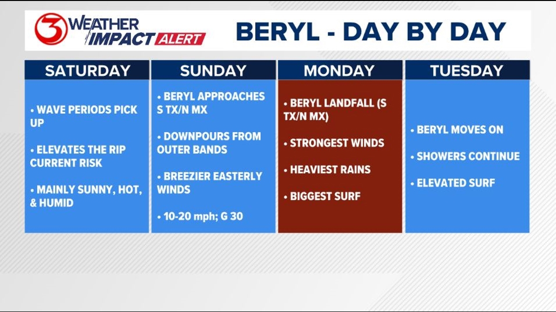
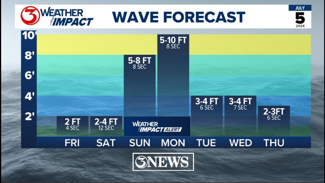
We are still anticipating dangerous surf conditions from Beryl. this is still very likely regardless of the track. Also keep in mind the higher the wind is here, and throughout the Gulf of Mexico the worse the storm surge forecast will be. Minor Coastal Flooding is possible today with a new moon. The rip current risk goes up on Saturday with a longer period. The surf turns dangerous as swell heights increase with stronger wind in the Gulf of Mexico on Sunday and Monday.

Make sure to check out the 2024 KIII Hurricane Special - you can watch it (or re-watch) it here! The special includes topics like evacuations, hurricane kits, and rip currents - on top of information like the tropical outlook and new data on hurricane-related fatalities. You don't want to miss it!
For more on our local weather, head on over to our forecast post.
-------------------------------------------------------------
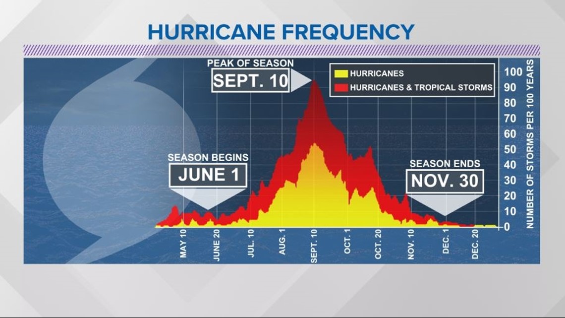
The Atlantic Hurricane Season runs from June 1 to November 30, with the peak of the climatological peak of the season happening on September 10.

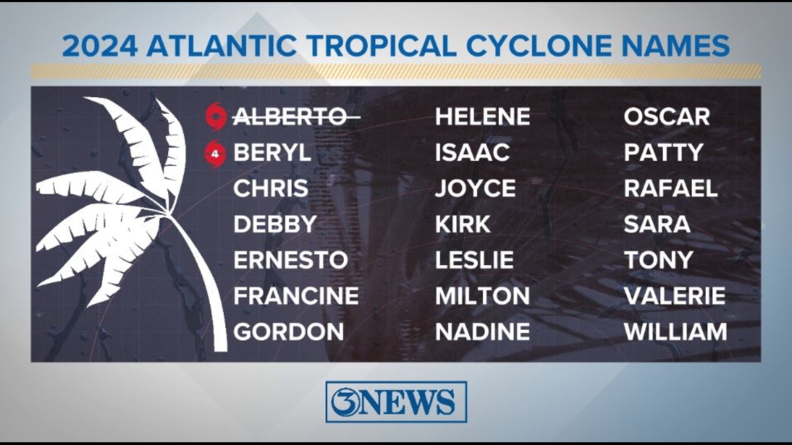
Here are the names for the 2024 Atlantic Hurricane Season. Names are given to tropical cyclones (tropical storms and hurricanes).

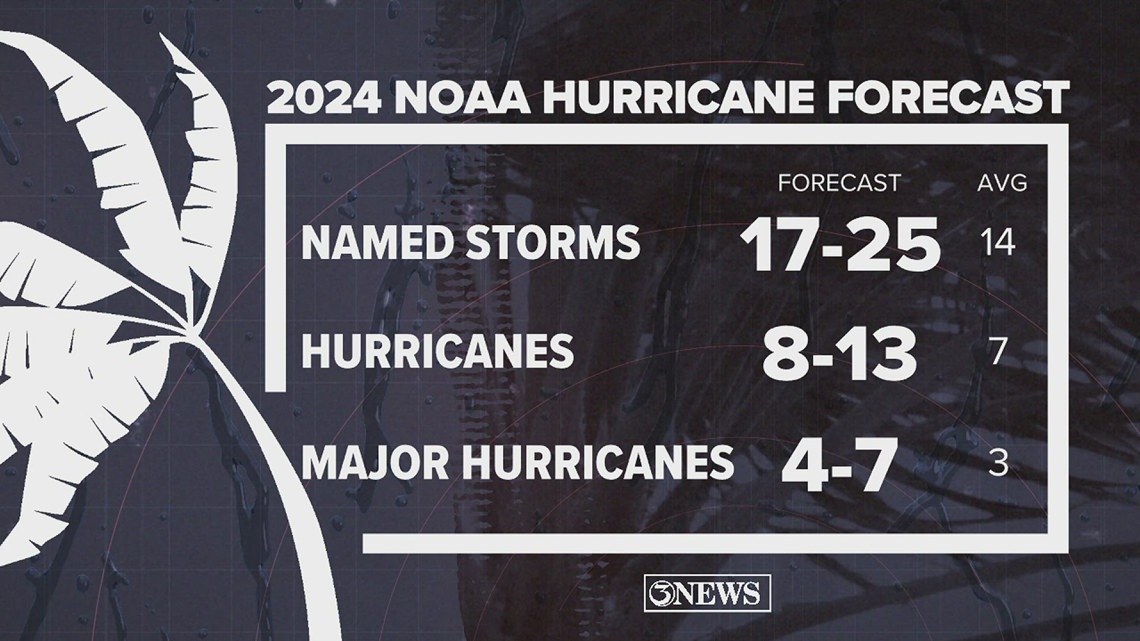
On May 23, NOAA released their forecast for the 2024 Atlantic Hurricane Season. They're predicting an above-average year, with 17-25 named storms. This is the highest pre-season forecast they've ever issued.
The high number of storms forecast is due to near-record sea surface temperatures and the return of La Nina, both of which favor tropical cyclone development. We talk more about those in our Hurricane Special, which you can watch here!

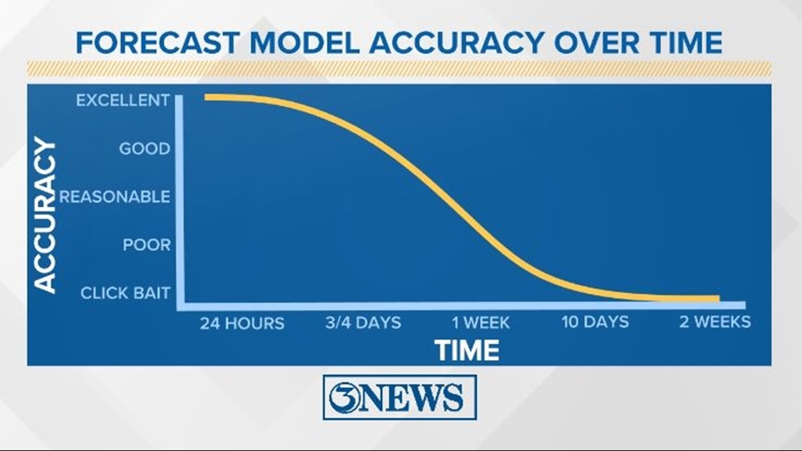
Remember to not "anchor" to the first forecast you see - forecasts change. Also, rely on a credible source for your tropical information and forecasts.