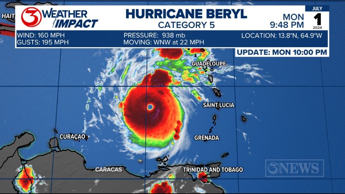
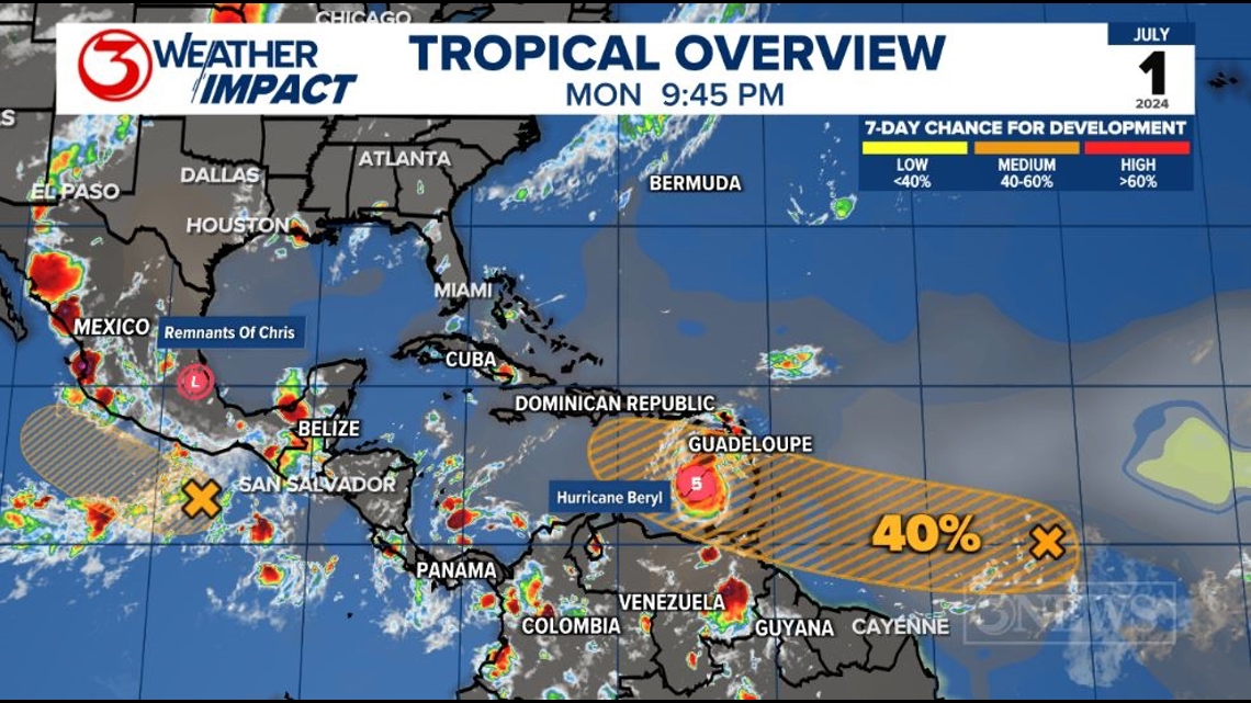
CORPUS CHRISTI, Texas — Beryl reached category 5, major hurricane in the Eastern Caribbean on Monday night.

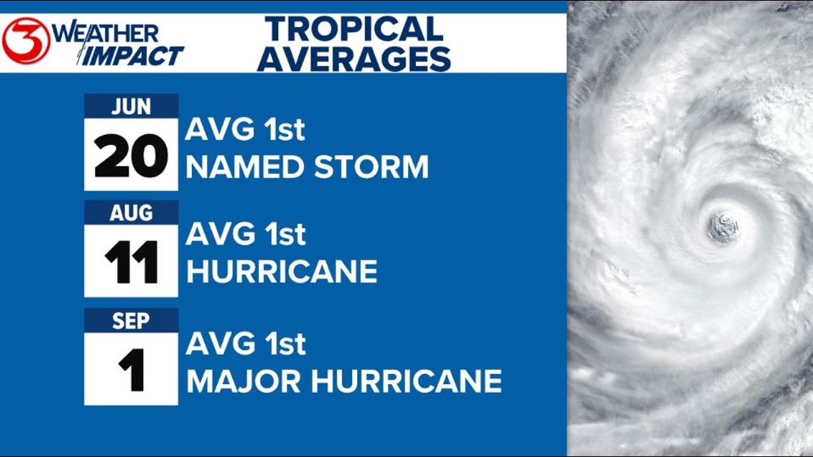
Compared to climatology, Beryl has been way, way ahead of schedule. Usually, the first hurricane doesn't develop until early August. Beyond that, the first major hurricane (category three and up) doesn't typically happen until September.

Hurricane Beryl reaching category 5 status on July 1 is the earliest category 5 storm on record in the Atlantic/Caribbean/Gulf of Mexico. Hurricane Emily reached category 5 status on July 17, 2005. In 1980, Hurricane Allen developed on July 31, but didn't reach cat 5 status until August 5.
The National Hurricane Center is also flagging another tropical wave, Invest 96L, for a medium chance to develop over the next 7 days. Chances on this disturbance have been falling today. Not terribly concerned about this feature right now, although it will follow Beryl.

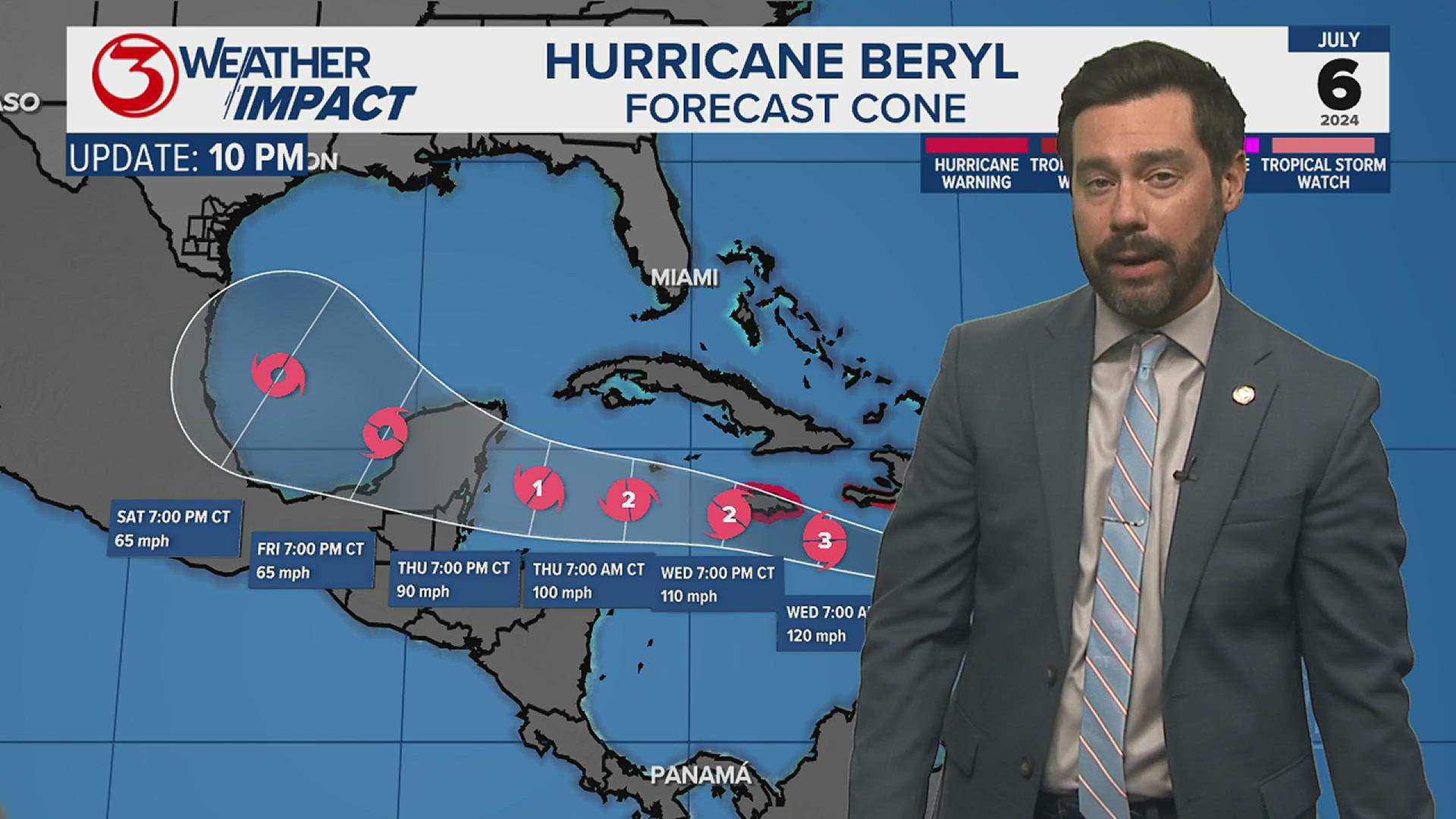
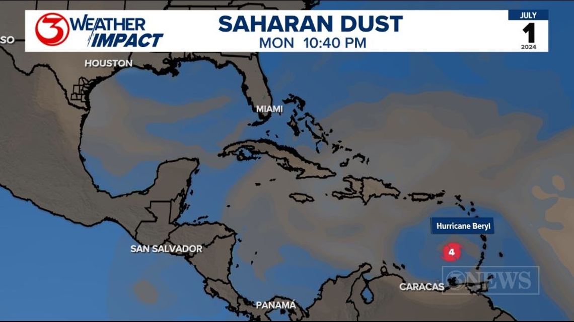
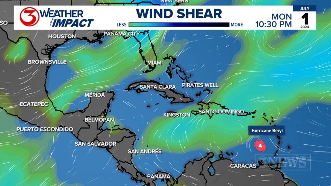
Beryl is forecast to gradually lose strength crossing the Caribbean Sea this week. It'll interact with some wind shear and Saharan Dust as it plows westward, passing close to Jamaica on Wednesday.

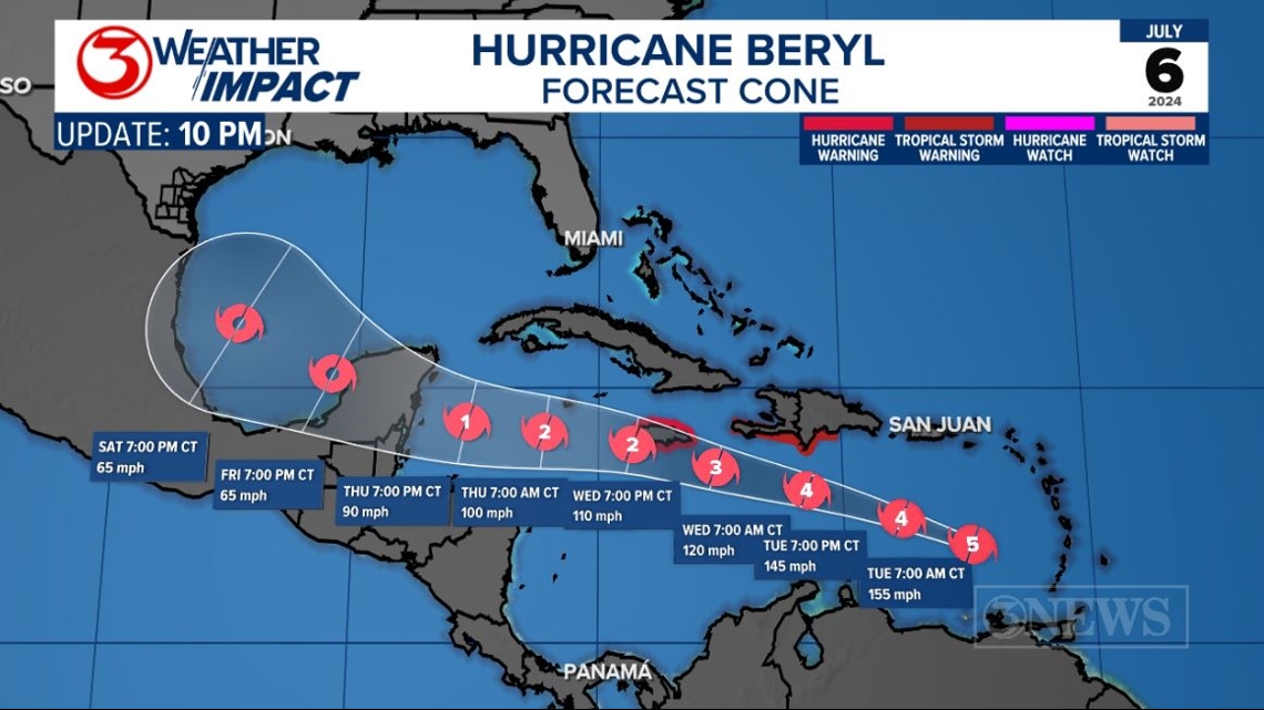
By Friday, Beryl is forecast to be a category 1 hurricane, crossing the Yucatan Peninsula. The land interaction at this time should further weaken Beryl. Current forecast calls for a tropical storm in the SW Gulf on Saturday. Beyond that, the forecast is rather murky.


The land interaction with the Yucatan will have a lot to say about the eventual outcome of this storm in the gulf. A track on the southern end of the forecast cone could mean interaction with Central America prior to reaching the Yucatan, then a trek over a larger section of the Yucatan Peninsula. That scenario would likely mean a weaker storm staying farther south in the gulf this weekend.

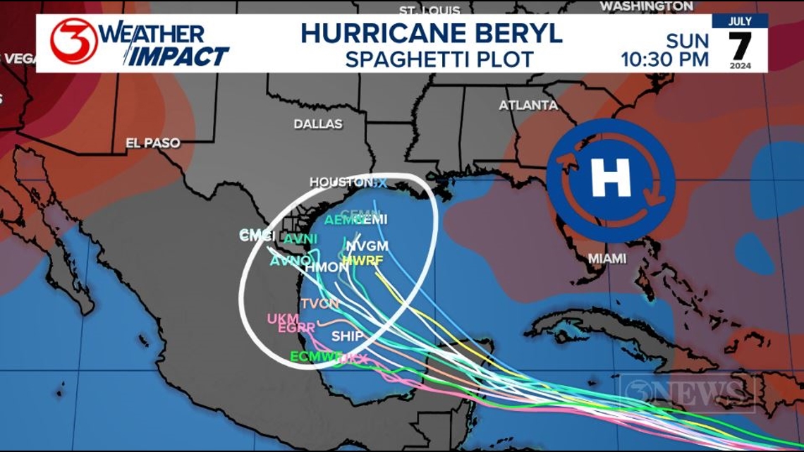
As Beryl gets into the SW Gulf, the region of upper level high pressure that is currently sitting over Texas will have moved to the East. That movement will allow for at least the possibility for a bend to the north in the Gulf of Mexico over the weekend/early next week. Exactly how far north is up for debate. A stronger storm crossing the North Yucatan would likely have a higher probability of bending north around the high to the northeast. A weaker system would likely continue WNW into Mexico. It's also possible for something in between. Spaghetti plot shows anywhere between Mexico and Louisiana as possible.
A lot of the forecast modeling sends Beryl into Mexico on Sunday or Monday...July 7/8. That seems like a reasonable solution at this point. Definitely not set in stone. I wish I could give definite answers on impacts now, but it's too fuzzy of a forecast at this time.
It is too far out for any concrete and definite answers for any CONUS location at this time. Better clarity will start to present itself later in the week. There is plenty of time to prepare and right now is a good time to have a plan ready to go if you need to act; whether it's for Beryl or a future storm down the road.
Holt out
Beryl makes history: Beryl is the strongest hurricane to occur in June in the Atlantic Basin ever on record. This just serves as a reminder that this season is forecasted to be an above average year.

Make sure to check out the 2024 KIII Hurricane Special - you can watch it (or re-watch) it here! The special includes topics like evacuations, hurricane kits, and rip currents - on top of information like the tropical outlook and new data on hurricane-related fatalities. You don't want to miss it!
For more on our local weather, head on over to our forecast post.
-------------------------------------------------------------
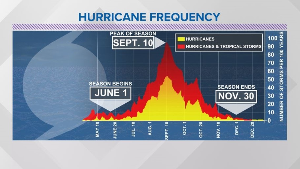
The Atlantic Hurricane Season runs from June 1 to November 30, with the peak of the climatological peak of the season happening on September 10.

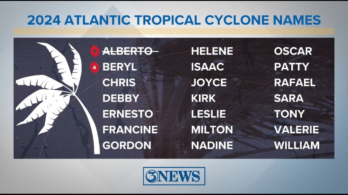
Here are the names for the 2024 Atlantic Hurricane Season. Names are given to tropical cyclones (tropical storms and hurricanes).

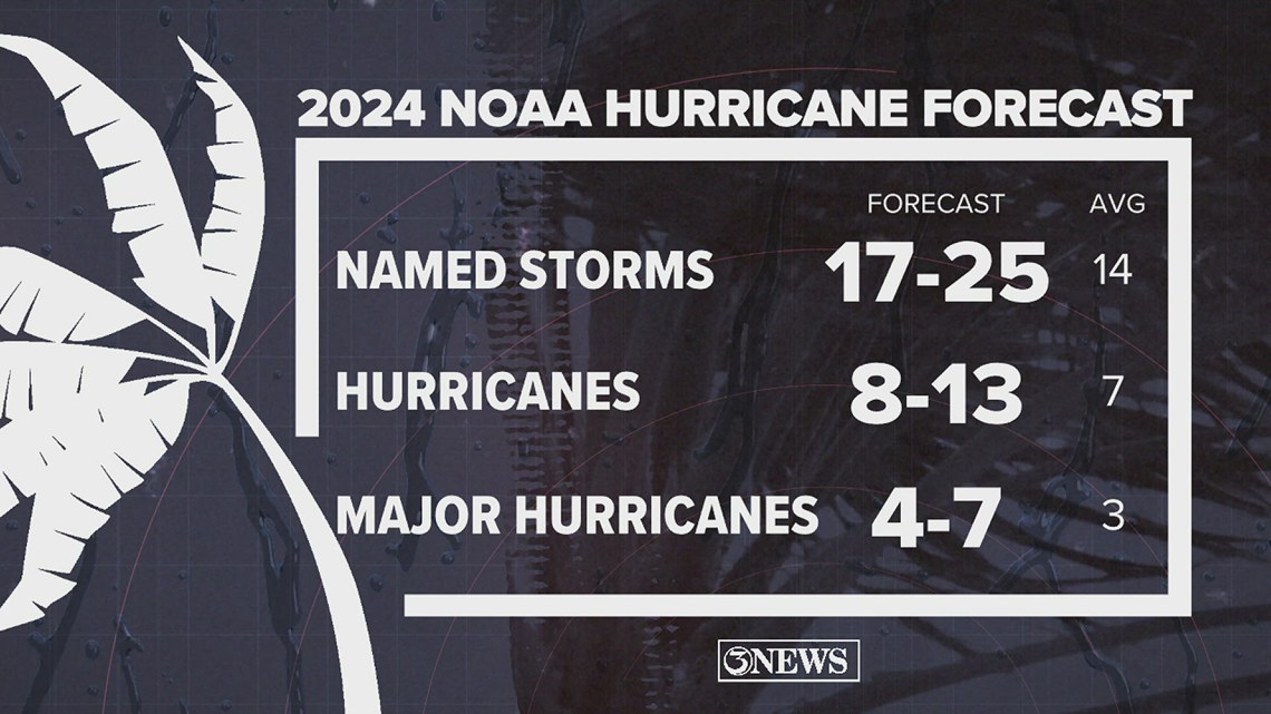
On May 23, NOAA released their forecast for the 2024 Atlantic Hurricane Season. They're predicting an above-average year, with 17-25 named storms. This is the highest pre-season forecast they've ever issued.
The high number of storms forecast is due to near-record sea surface temperatures and the return of La Nina, both of which favor tropical cyclone development. We talk more about those in our Hurricane Special, which you can watch here!

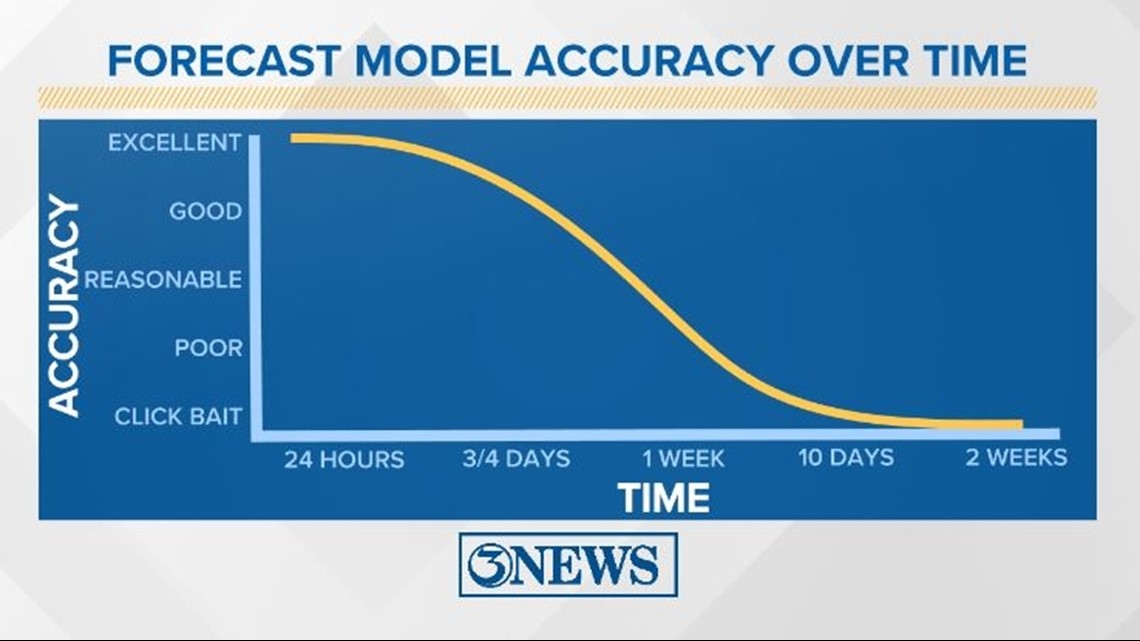
Remember to not "anchor" to the first forecast you see - forecasts change. Also, rely on a credible source for your tropical information and forecasts.