CORPUS CHRISTI, Texas — The tropics are well awake pretty early into the season so we will break things down by each system. The tropics are looking more like August, similar to the high temperatures we've been dealing with in South Texas. Beryl is the only June hurricane in the Atlantic Basin to reach Category 4 on recent record. In July there have been five hurricanes at, or higher than Category 4. The previous record holder for the earliest to reach Cat 4 was Dennis in 2005. Dennis developed on July 4 and reached Cat 4 on July 7. August has 60 Cat 4 or greater storms. That's when the high strength is typical because it tends to be the hottest month in the Tropical Atlantic.
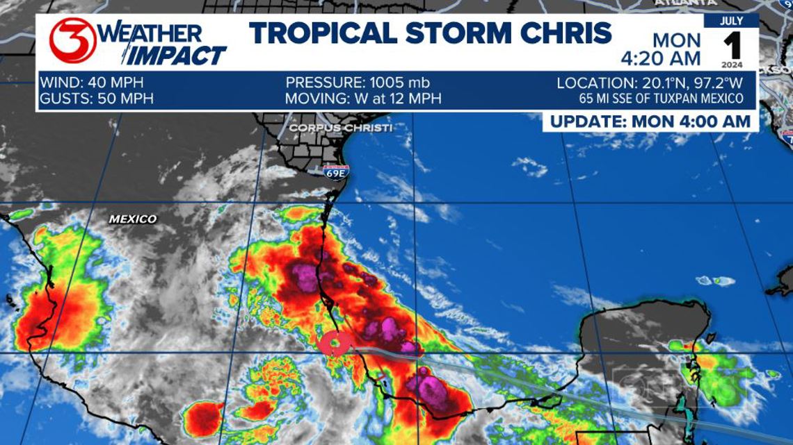
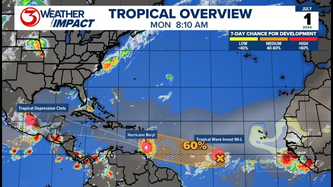
Tropical Depression Chris: Chris made landfall near Playa Navarro, Mexico as a Tropical Storm early Monday morning. The system continues to weaken as it moves inland. Heavy rainfall with the possibility of mudslides and tropical storm force gusts are the main threats for Mexico. I don't expect the Coastal Bend to see much rain from this system. A spotty sea breeze shower is possible today, but most stay dry.

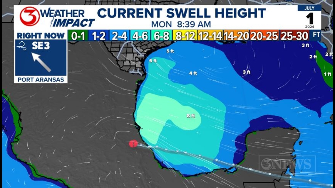
The Coastal Bend will continue to see slightly larger waves and a rip current risk from Chris. Current swells are around 5-6ft every 8 seconds and will fall throughout the day.

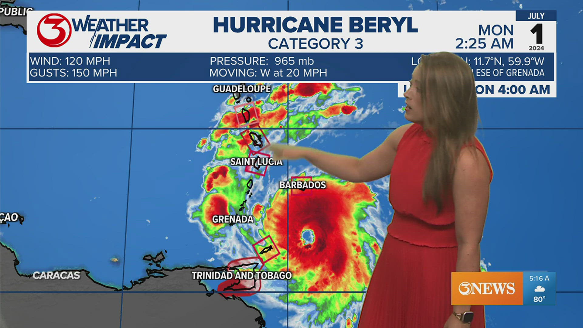
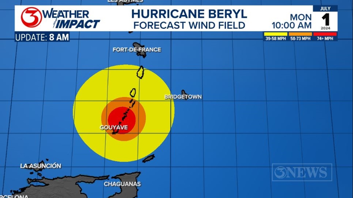
Hurricane Beryl: Hurricane Beryl went through an eyewall replacement cycle between 4 and 7 AM Monday. It briefly weakened during this time but strengthened to a Category 4 storm as it approached the Windward Islands of the Caribbean. Eyewall replacement cycles are common in Major Hurricanes. The process is likely similar to how thunderstorms will die out and then pulse back up. The old convection around the eye naturally weakens and new convection develops a little farther out from the center. The new eyewall is typically a little larger in diameter and therefore extends the reach of the hurricane-force winds.

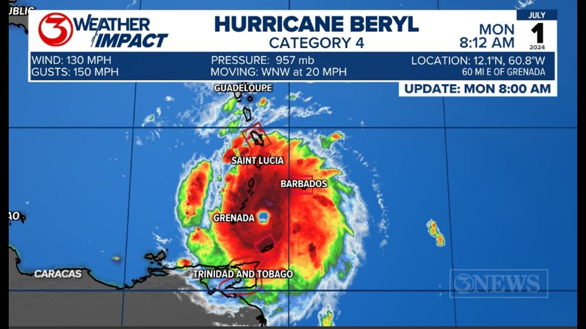
This means more of the Windward Islands will see hurricane-force winds shown by the red and orange circle, and tropical storm-force winds shown in yellow.

The forecast cone brings the system to the Yucatan Peninsula by Friday morning and possibly the Gulf of Mexico by Saturday morning.

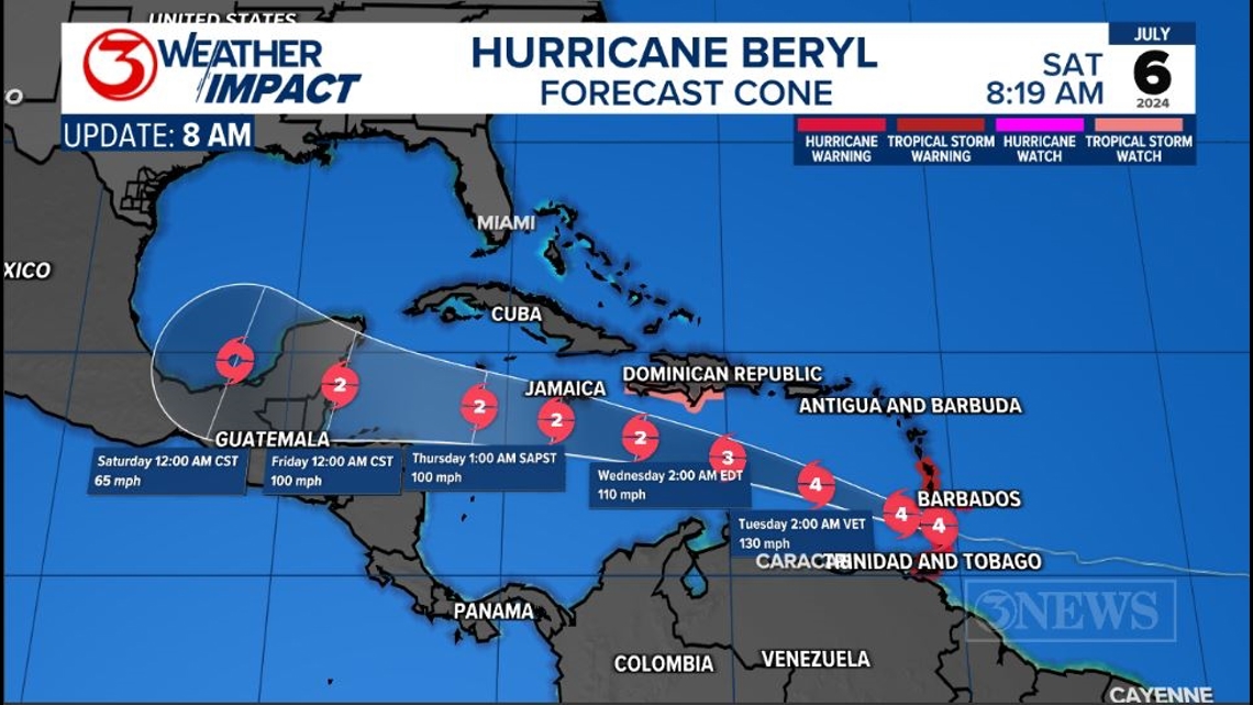
Wind shear in the western Caribbean Sea is why we are expecting Beryl to weaken. Additional interaction the the Yucatan is why the forecast brings it down to a Tropical Storm by Saturday.


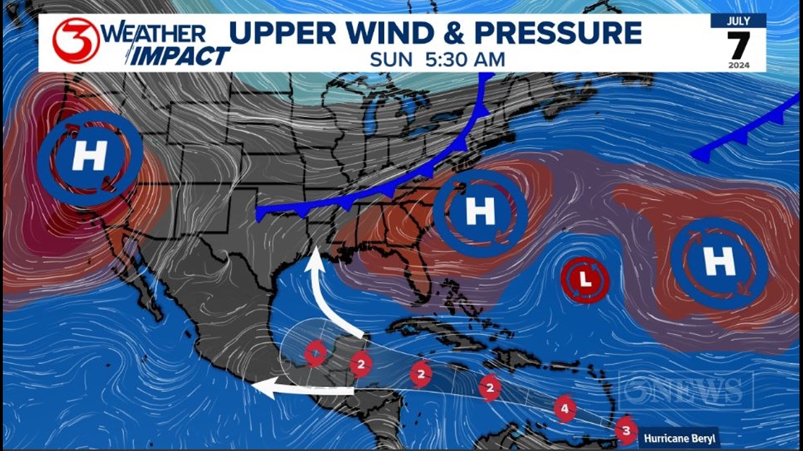
There is still much uncertainty once it leaves the Caribbean. The problem is a trough/cold front that is in the forecast for the United States. This front won't make it to South Texas, but it would weaken the high pressure. A split in the high pressure could allow Beryl to turn north.

We will have more clarity by the middle of the week. Have a plan to check the forecast while you are also enjoying the Fourth of July. It's not a bad idea to start being prepared this week.
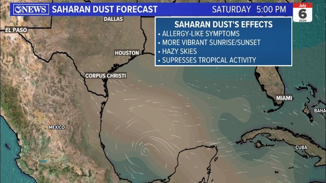
INVEST 96L: The NHC lowered the chance of development from 70-60% this morning. This system is interacting with some Saharan Dust and some cooler sea surface temperatures to the north. There is still a chance it will reach tropical depression strength by the middle of the week as it moves in the same area as Beryl.

Saharan Dust is also another feature that suppresses tropical activity. With us being about a week out, no one knows for certain where Beryl will end up at this time, but we do have some factors expected to be in place to help weaken the system.

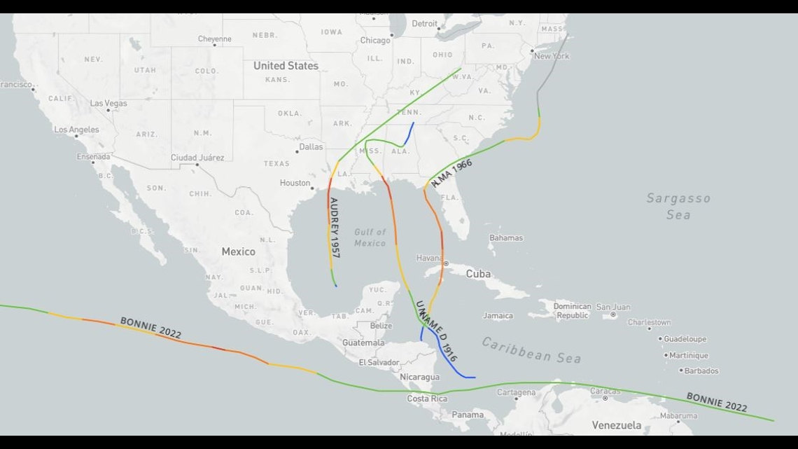
Things to keep mind: The tropical overview map, looks more like August than late June. This time of year, we'd normally be seeing systems developing from tropical waves coming off Central America or even the Windward Islands. Instead, we're seeing long-track tropical waves moving off the West coast of Africa through the main development region of the Atlantic.

Tropical Storm Alberto was on pace with its timing. The first named storm of the season usually appears June 20, and we were right on track with Alberto being named just the day before. But Beryl on the other hand, is way ahead of it's time. Beryl isn't just the first hurricane of the season but the first major hurricane, Category 3 strength and higher. This is even more so of a reason to make sure you are prepared this hurricane season.

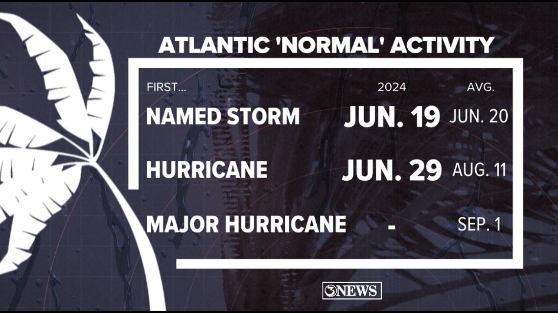
Beryl makes history: Beryl is the strongest hurricane to occur in June in the Atlantic Basin ever on record. This just serves as a reminder that this season is forecasted to be an above average year.

Make sure to check out the 2024 KIII Hurricane Special - you can watch it (or re-watch) it here! The special includes topics like evacuations, hurricane kits, and rip currents - on top of information like the tropical outlook and new data on hurricane-related fatalities. You don't want to miss it!
For more on our local weather, head on over to our forecast post.
-------------------------------------------------------------
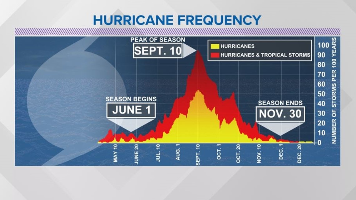
The Atlantic Hurricane Season runs from June 1 to November 30, with the peak of the climatological peak of the season happening on September 10.

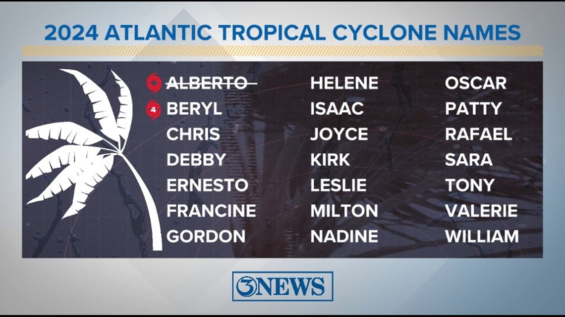
Here are the names for the 2024 Atlantic Hurricane Season. Names are given to tropical cyclones (tropical storms and hurricanes).

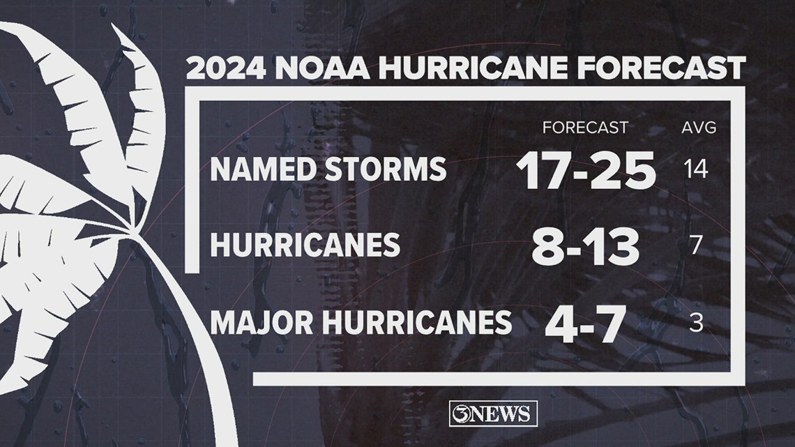
On May 23, NOAA released their forecast for the 2024 Atlantic Hurricane Season. They're predicting an above-average year, with 17-25 named storms. This is the highest pre-season forecast they've ever issued.
The high number of storms forecast is due to near-record sea surface temperatures and the return of La Nina, both of which favor tropical cyclone development. We talk more about those in our Hurricane Special, which you can watch here!

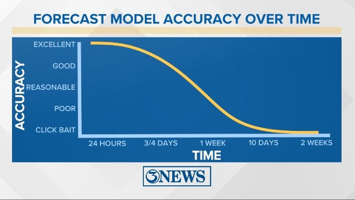
Remember to not "anchor" to the first forecast you see - forecasts change. Also, rely on a credible source for your tropical information and forecasts.