CORPUS CHRISTI, Texas — EDITOR'S NOTE: ASince this weather blog's publication, Invest 98L has been upgraded to Tropical Storm Imelda and has made landfall in Freeport, Texas.
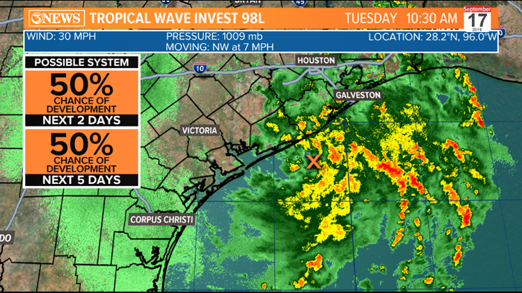
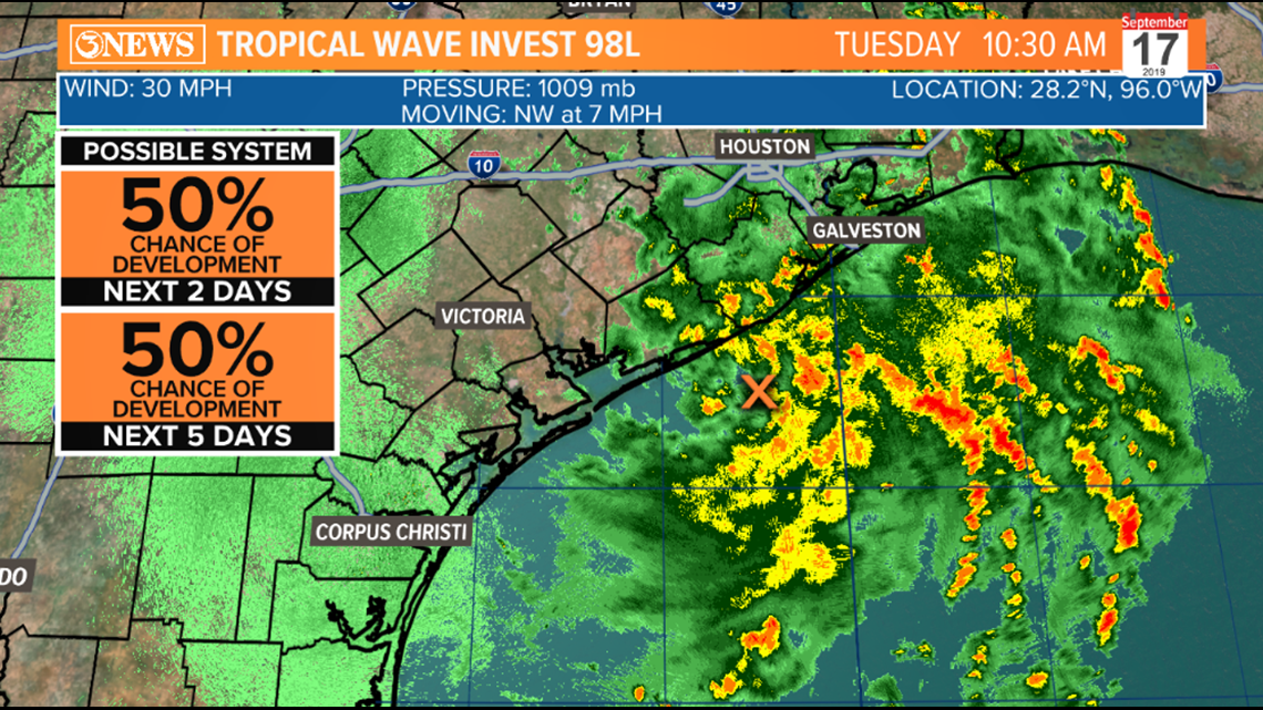
Radar presentation on Tropical Invest 98L is showing a closed center of circulation, which should be enough to be deemed a tropical depression. The National Hurricane Center has upped the chance to 50% for this to happen and I wouldn't be surprised if this was officially called a tropical depression prior to moving ashore just east of Matagorda Bay and Palacios later this afternoon. If winds of over 39 mph are found with the closed low center, it would be classified a tropical storm. Regardless of what this feature is officially called, it will be a big rain-maker in Southeast Texas and Houston Tuesday and Wednesday before working north, through East Texas Thursday and Friday. Some locations near Houston could get a half a foot to a foot of rain.

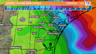
For the Coastal Bend, the more organized this feature becomes, the more our rain chances will trend down. A central area of low pressure will effectively draw rain/wind into the center, away from the Coastal Bend. If this feature would have stayed more unorganized, we would have seen more widely scattered showers across more of the Texas Gulf Coast, and the flooding threat wouldn't have been as concentrated over Houston. As it stands, Southeast Texas/Houston is in line for numerous heavy downpours and a flooding concern.
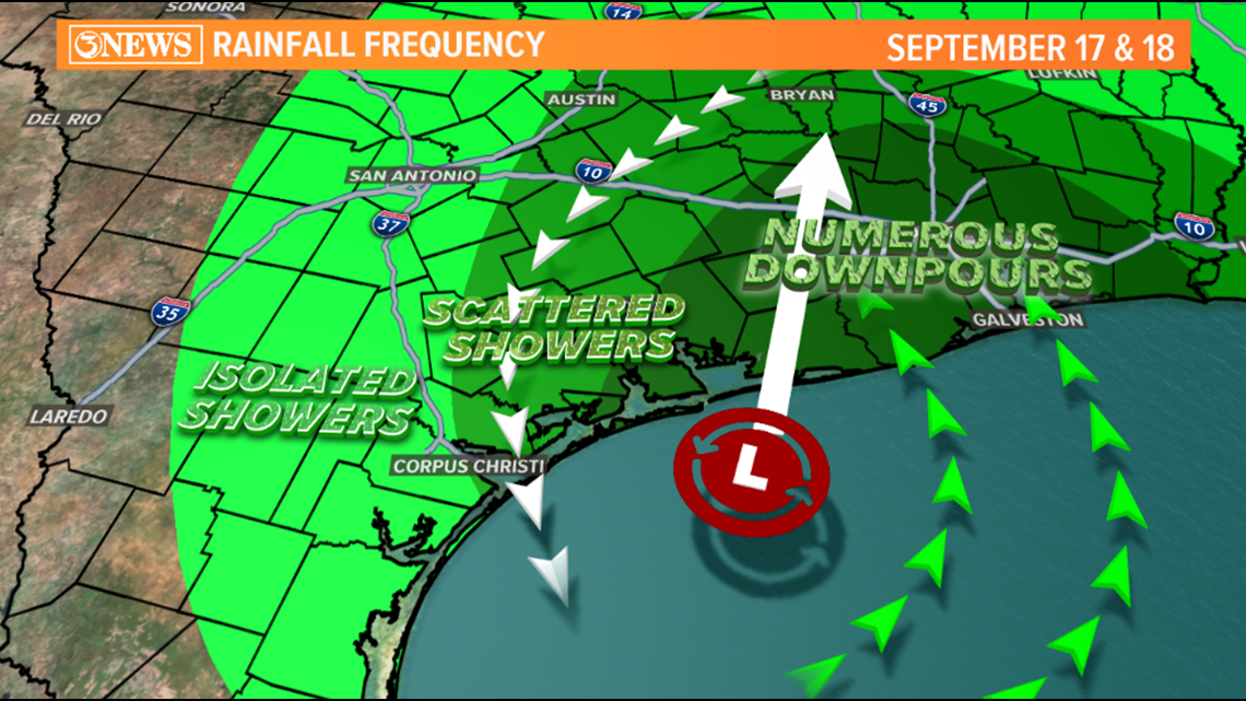
With rain being more isolated in the Coastal Bend and moving around the western side of this feature, rain totals will not be impressive. Areas east of HWY 181 may make a run at 1" of rain, but it'll be hard. West of I-37 and in Corpus Christi, rain will be harder to come by. It's likely that Corpus Christi only gets a quarter of an inch or rain, if that. Some inland places west of HWY 281 may not get anything at all. I attached a map of the rainfall gradient and you can see how forecast rain totals ramp up as you work northeast of the Coastal Bend.