
CORPUS CHRISTI, Texas — 4 PM UPDATE
Tropical Storm Beta forms in the Gulf of Mexico
MAX winds at 40 MPH with higher wind gusts
Forecast cone has remained similar. Pushing north through Saturday then pushing west closer to Corpus Christi. It's here where's there lots of uncertainty. Rain will be dictated how close it comes and how far west or north it moves.
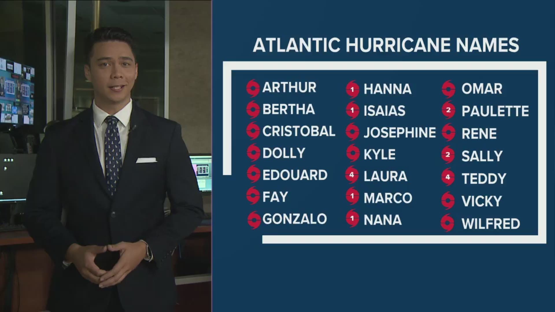
Wow...to say confusing would be an understatement. It's usually poor practice to say what a storm will eventually be named when talking about the future of it, but with what transpired this morning, I'm at a loss. We are now into the Greek Alphabet of names, something that has only happened once before - in 2005 - 28 named storms that year.
Tropical Depression 22 remains Tropical Depression 22 (as of11:30am, Friday). But between 10am and 1130am, both Wilfred and Alpha (over PORTUGAL) were both deemed to have developed by the National Hurricane Center. These two features were both marked as tropical waves with a low to medium chance to develop this morning AND Tropical Depression 22 was forecast to attain Tropical Storm status by 11AM, Friday...so the assumption that it would be Wilfred is valid. Because of the naming of Wilfred and Alpha prior to TD22, many meteorologists (including yours truly) incorrectly assumed that Tropical Depression 22 would eventually be Wilfred. That is incorrect. Tropical Depression 22 will be whatever Greek letter is up next at the time the National Hurricane Center says Tropical Depression 22 is a tropical storm. List below:

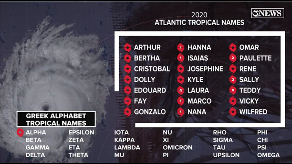
All of that being said, the forecast information on Tropical Depression 22 remains the same, it's the naming process that is confusing because of the assumption that it would be the next named storm on the list.

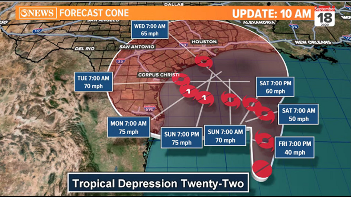
Tropical Depression 22 stays just below tropical storm strength this morning, but may reach tropical storm status later today.
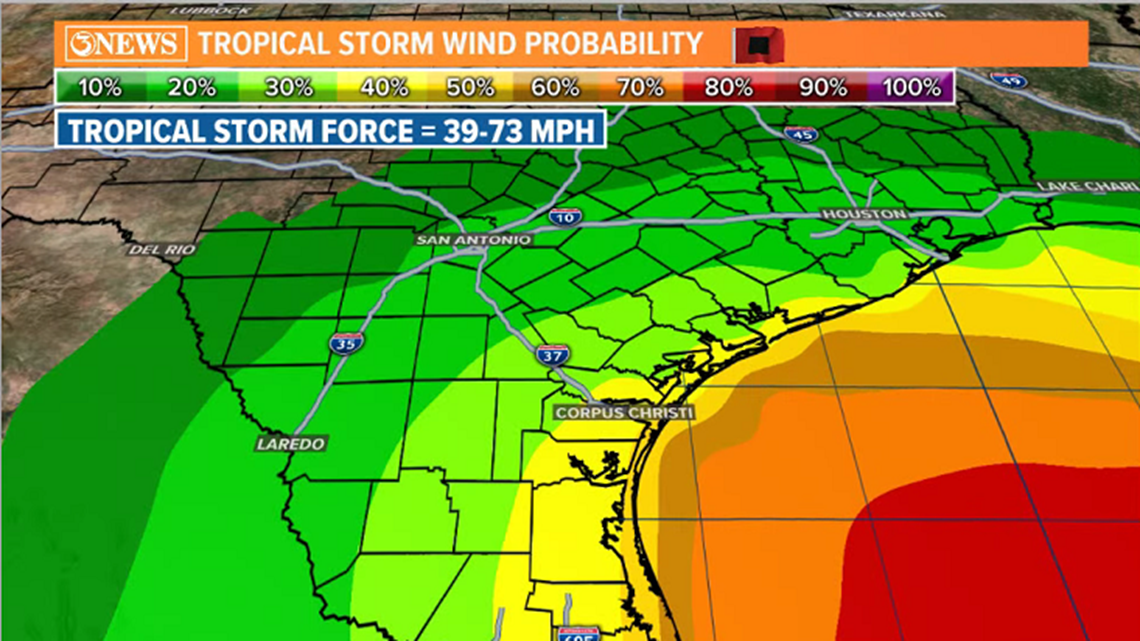
Forecast cone remains similar to last update, bringing this storm north, then bending west, toward the TX Gulf Coast over the weekend. While the storm may stay off-shore, it will likely pass close enough to deliver tropical storm force (30-50 mph wind) conditions to the coastal areas of the Coastal Bend Monday and Tuesday.
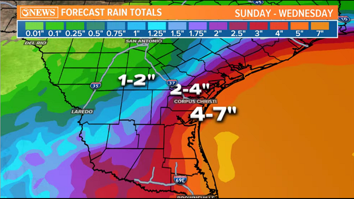
Heavy, flooding rains remain the biggest threat. Because of the high uncertainty in the forecast cone after the weekend....note the nearly perfect circle of the cone Monday-Wednesday....rainfall numbers will fluctuate a bit until more clarity is found into next week. That being said, this may end up being a big rain producer for a lot of the Texas Gulf Coast. Some model data has been suggesting a foot or more of rain for some.
To stress, there is still high uncertainty into next week. Stay up to date with the most current forecast numbers as they will shift with the track.


Holt, out.