On Tuesday morning, the National Hurricane Center (NHC) announced new forecast products and updates to previous forecast products for the 2024 Hurricane Season.
Spanish Text Products
Spanish-language text products and advisories aren't anything new. What is new are the types of text products that will be available in Spanish. This is the first updated service announced by the NHC.
The products offered in Spanish will be expanded to include Public Advisories, Tropical Cyclone Discussions, Tropical Cyclone Updates, and Key Messages from the NHC. These products will be issued experimentally, meaning they could still undergo changes.
In 2023, artificial intelligence (AI) techniques that translate issued products from English to Spanish were tested. These AI translation techniques will continue to be used for the 2024 Hurricane Season.
Forecast Cone with Inland Watches/Warnings
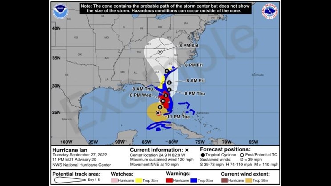
Arguably one of the biggest updates for this year is the addition of inland tropical storm and hurricane watches and warnings to the forecast cone graphic.
Previously, only coastal watches and warnings were overlaid on the forecast cone. The updated version will add the inland watches and warnings to only the Continental United States. Areas outside of the Continental US will continue to just have coastal watches and warnings overlaid on the map.
It may look a bit messy, but the hope is that the addition of these warnings to the forecast cone image will help communicate the wind risk during tropical cyclone events.
This is something that broadcast meteorologists have been doing for a few years - showing watches and warnings with the forecast cone at the same time. Again, this is to help illustrate that storm hazards can extend beyond the forecast cone.
An experimental version of this forecast cone graphic will be issued beginning or around August 15, 2024. It should be released within 30 minutes of the initial release of advisories.


Extending Tropical Storm Wind Forecasts
The NHC forecasts the size of a tropical cyclone's wind field using radii forecasts. Each quarter, or quadrant, represents the extent of tropical storm-force winds from the center of a storm. These forecasts are being extended to include Days 4 (96 hr) and 5 (120 hr).
Tropical storm wind radii forecasts were previously only issued out to Day 3 (72 hr). Hurricane wind radii forecasts will continue to only be issued out to Day 2 (48 hr).
As a storm approaches its landfall, this should provide an advanced lead time on where, when, and what to expect in terms of wind speed.
New Watches/Warnings on Intermediate Advisories
Another beneficial update we're getting is that the NHC and National Weather Service will now be allowed to issue new tropical watches and warnings on intermediate advisories.
This means we can get the most current and valid watches and warnings more frequently than just four times per day (4am, 10am, 4pm, and 10pm CDT), which is when the regular advisories are issued.
The types of watches and warnings that could be updated in these intermediate advisories are tropical storm, hurricane, and storm surge.
Embedded Website Links in Advisories
Speaking of advisories, the Tropical Cyclone Public Advisories will now include website links. This will reduce their length and direct their focus on significant and impactful weather hazards.
Experimental Rainfall Graphic
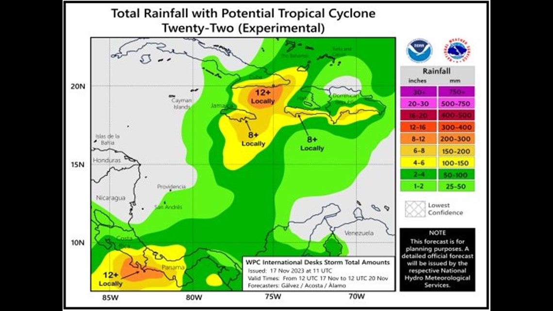
The NHC will partner with the Weather Prediction Center to issue an experimental rainfall graphic for the Caribbean and Central America this season.
While it doesn't directly impact the Coastal Bend, the graphic should allow for better communication of the rainfall forecast in this area of the tropics.


