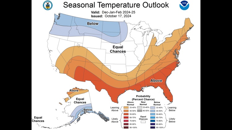
CORPUS CHRISTI, Texas — The Climate Prediction Center, a branch of NOAA, released their Winter Outlook for December, January, and February today - October 17. They have much of the Southern US expecting a warmer and drier than average Winter season. Let's unpack...

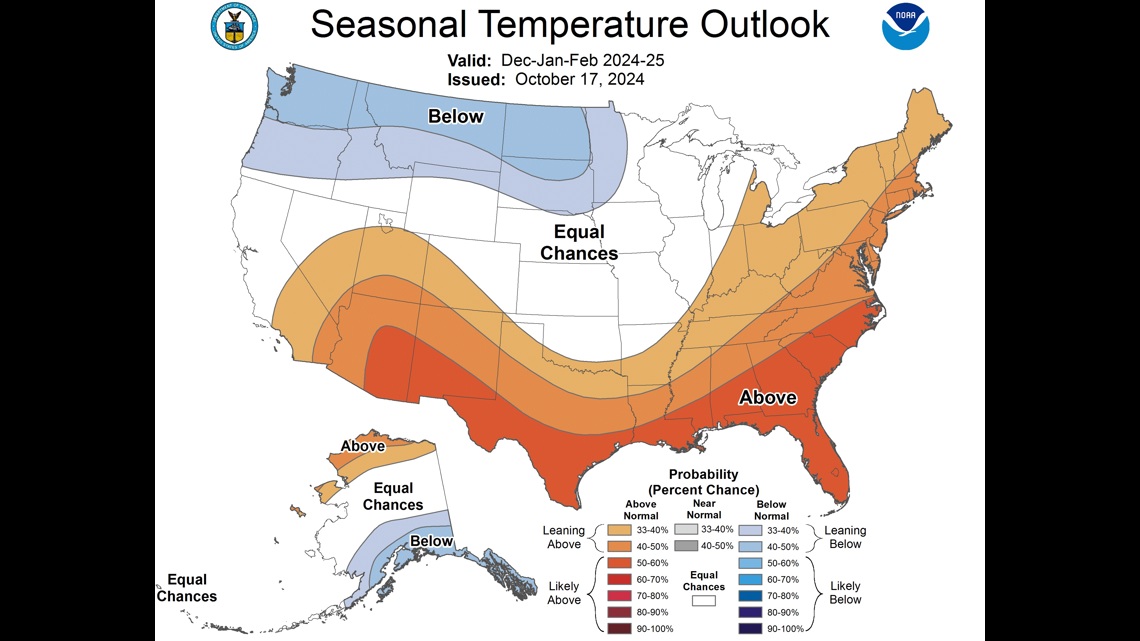

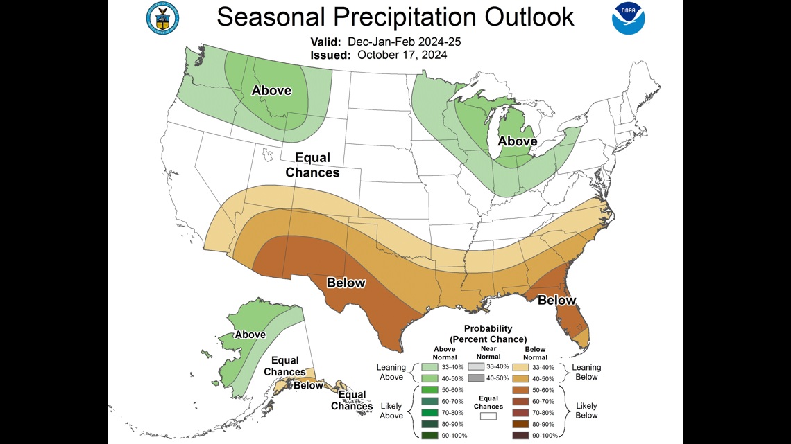
The maps the CPC released today have a strong correlation with what one would expect to see during a La Niña winter. La Niña tends to deliver drier and warmer winters, on average, to the southern US.
La Niña develops when sea surface temperatures are running cooler than average by at least a half a degree Celsius in the Eastern Equatorial Pacific waters.

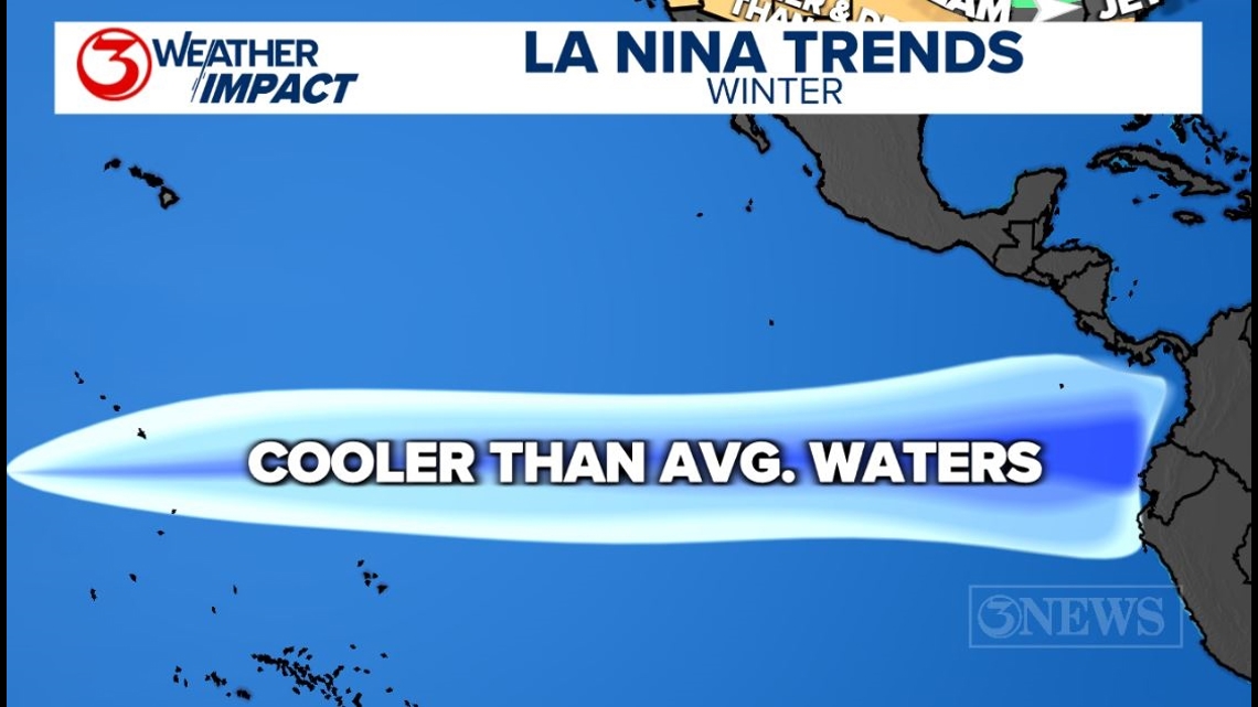
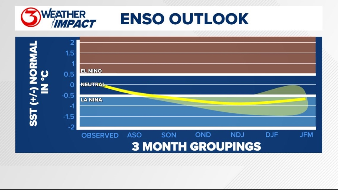
The El Niño Southern Oscillation Index, the metric we use to decipher El Niño/La Niña will be moving into a La Niña phase this winter with sea-surface temperature dropping in the Eastern Equatorial Pacific waters. There is about a 70% chance for this happening.

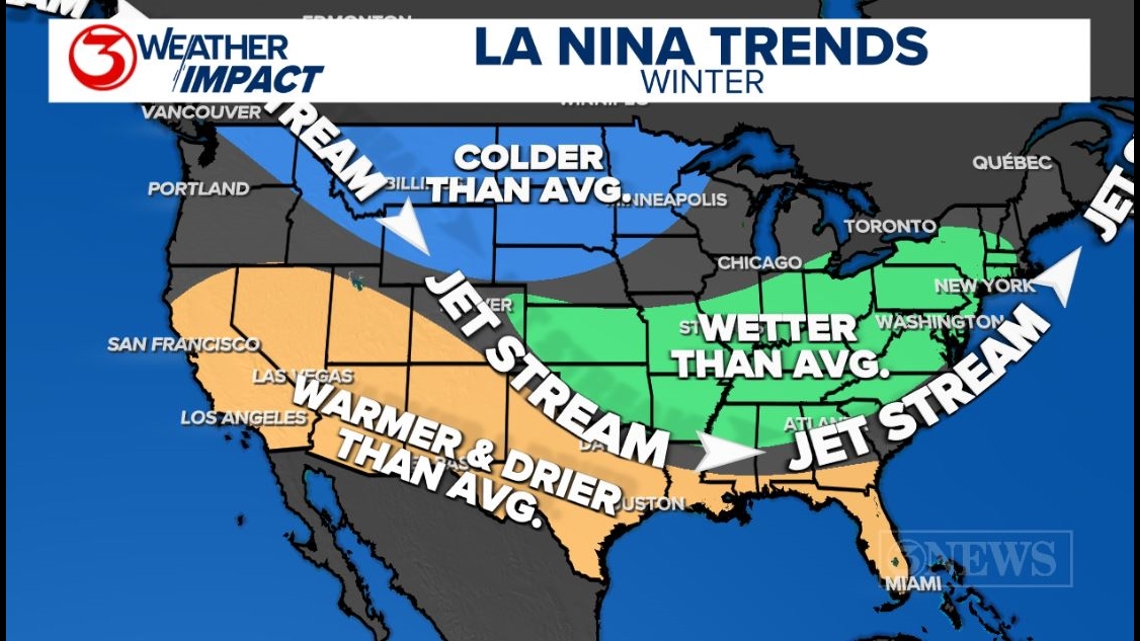
When La Niñas develop, we see adjustments to the polar jet stream over the Continental US. The jet stream tends to be wavier during the winter. This is referred to as a meridional pattern. The pattern typically involved a ridge in the west and a trough in the east. This isn't always the case, but it's the tendency.
Because of this ridge/trough pattern, warmer than average conditions tend to prevail under the ridge and the storm track sends systems in from the Northern Plains, into the SE US. The storm track sending systems into the SE US also makes that part of the country wetter than average.

So what does it mean for Texas; specifically, the Coastal Bend? This, to me, is where these seasonal outlooks can be somewhat misleading.
It's easy to look at these maps and make the assumption that it's going to be warm and dry throughout the entirety of winter here. But that's not the case at all.
The meridional pattern (wavier jet stream) means that there will undoubtedly be cold snaps that do happen in South Texas. There will also be runs of above average weather. That's the way it is here -- it's variable. It fluctuates. When we talk about 'above average' -- remember -- it is with respect to what average is.
For example, if the average high temperature for a day is 70° and we hit 72°, then that day will be 'above average', but it won't necessarily be warm. We always need to have that framework in our minds when looking at things with respect to average. Ask yourself, 'what is average'.
In the winter of 2020/2021, we were in a La Niña pattern. Remember what happened in February of that winter? Yes, the big freeze!
Even though the trend for warmer than average winters is a thing for this part of the world, it does not guarantee big cold snaps will not happen. The winter of 2020/2021 ranks 78th warmest/59th coldest on record in Corpus Christi -- so a little colder than average, despite the ongoing La Niña that winter.
Something to think about.
The prevailing storm track is one that sends storm systems through the SE US and then northeast toward the Canadian Maritimes. That puts South Texas in a position to get the drier sections of these systems. In my opinion, it is more likely to see the drier than average rainfall part of the La Niña trend verify than the warmer than average trend.
Comparing La Niña to El Niño, the latter will often be wetter with more of a sub-tropical flow over South Texas off the Pacific. That flow often has more moisture in it, which tends to deliver more rain than average. Because of the increased cloud coverage, temperatures also tend to be cooler than average during an El Niño.

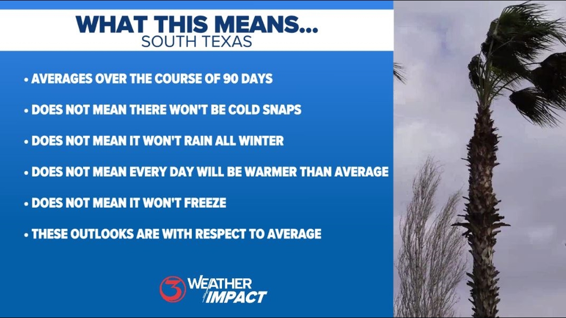
To conclude, La Niña does not guarantee every day will be warm in South Texas this winter: It means that the average temperature over the course of the season will probably end up being above-average.
It does not mean there will not be cold snaps. It does not mean it will not rain all winter. It does not mean every day will be warm. It does not mean it will not freeze. There will be ups and downs and we will forecast them as they come.
La Niña winters tend to offer the Coastal Bend more 'sunny delights' as drier cold fronts pass through, which is nice after the long and brutally hot summers we endure every year.