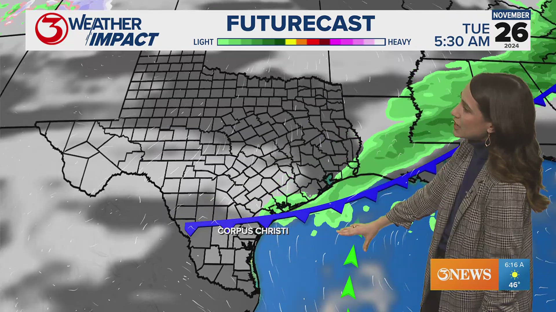
CORPUS CHRISTI, Texas — By late Thursday into Friday, the rain, wind and other impacts from Tropical Storm Alberto should be over. Our weather will settle down into the weekend.
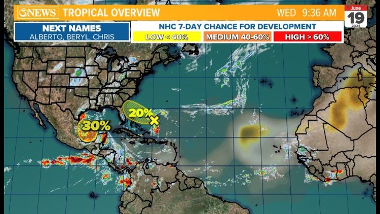
However, the Central American Gyre is still active, and there are signs that another tropical spin-up could happen over the weekend or early next week.

As Chief Meteorologist Alan Holt highlights here, the European Ensemble model shows the second system could follow the same trajectory as the first system, moving over the Bay of Campeche and into eastern Mexico.
It's to be determined what possible impacts we could see from a second tropical system. It's not possible to give reliable details on it at this time. It's something to watch not worry about, but we are aware of it and will begin to focus on it after we get through Wednesday's rains.


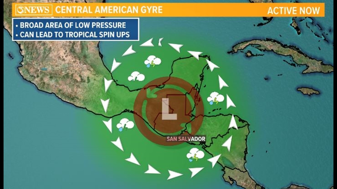
What is the Central American Gyre?
The National Ocean Service explains a gyre as a "large system of rotating ocean currents." Large wind movements typically help form these currents.
There are a lot of different types of ocean currents -- both large and small. Larger, sustained currents -- like the Gulf Stream -- get specific names.
And collectively, these larger, more permanent currents make up a "system of currents" called gyres.
The NOS identifies five major gyres:
- North Pacific Subtropical Gyre
- South Pacific Subtropical Gyre
- North Atlantic Subtropical Gyre
- South Atlantic Subtropical Gyre
- Indian Ocean Subtropical Gyre
The Central American Gyre is a large area of low pressure that -- you guessed it -- forms over Central America. During the early and late parts of hurricane season, the Central American Gyre can be a source of tropical development. That's typically in May and June and then again in October and November.
These systems can produce tremendous amounts of rain and lead to flooding in the areas where they set up.