CORPUS CHRISTI, Texas —
On cue:
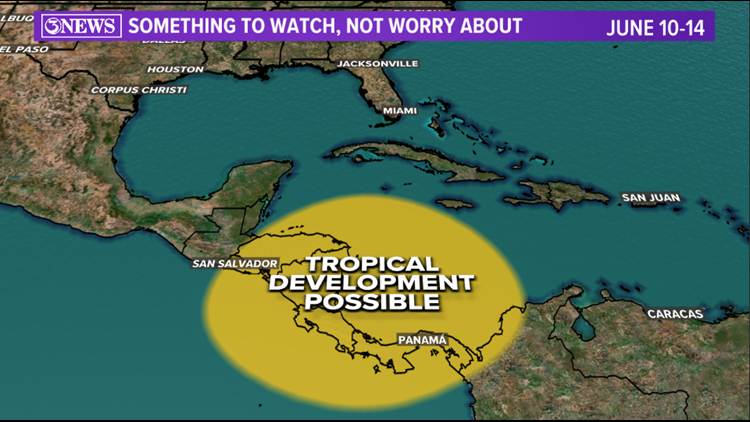
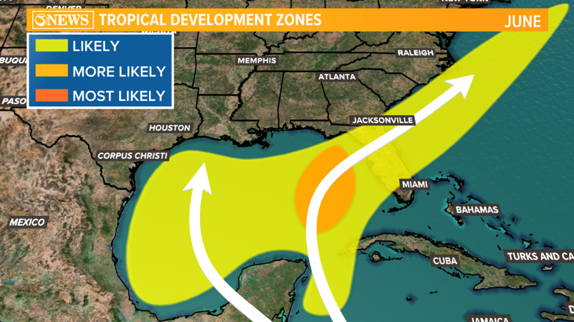
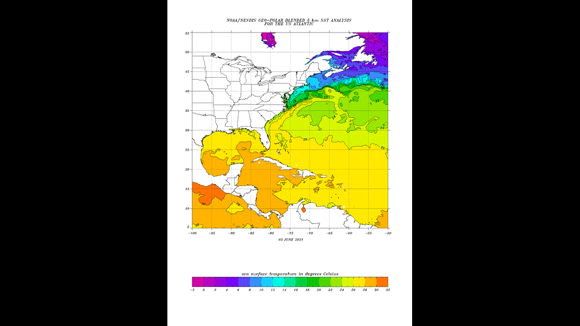
The first month of hurricane season has us keeping tabs on possible tropical development in the South Caribbean late next week - June 10-14. The Caribbean and Gulf of Mexico are the most likely spots for June tropical systems, thanks to their quicker to warm waters. To date, in the low 80s (28C on the map).

Forecast model ensembles have been persistent with developing something in the Southern Caribbean Sea sometime June 10-14. You can see both the GFS and EURO ensembles (images below) eluding to something in the Caribbean - EURO valid June 11, GFS valid June 12.

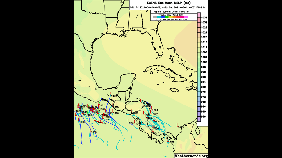

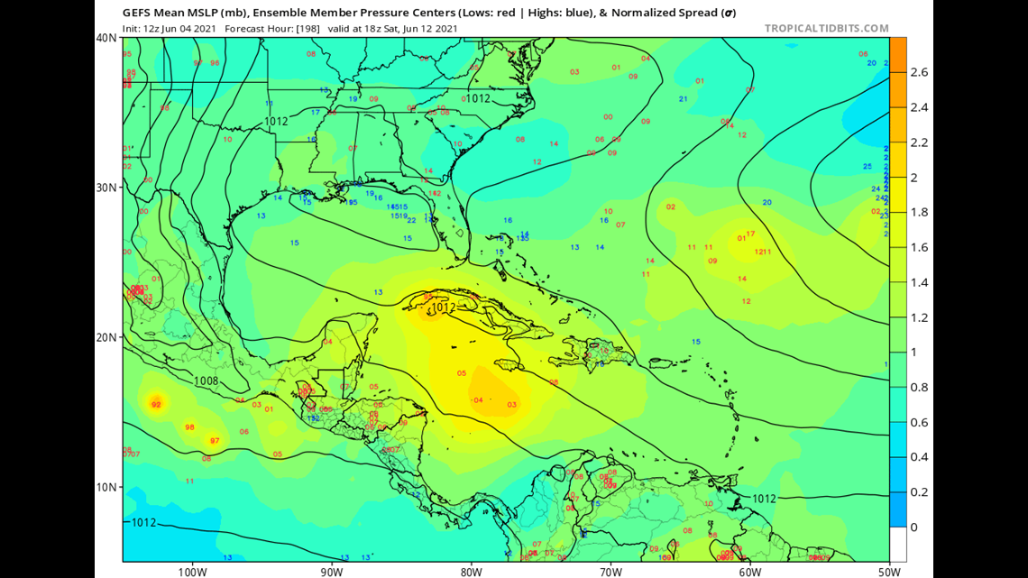
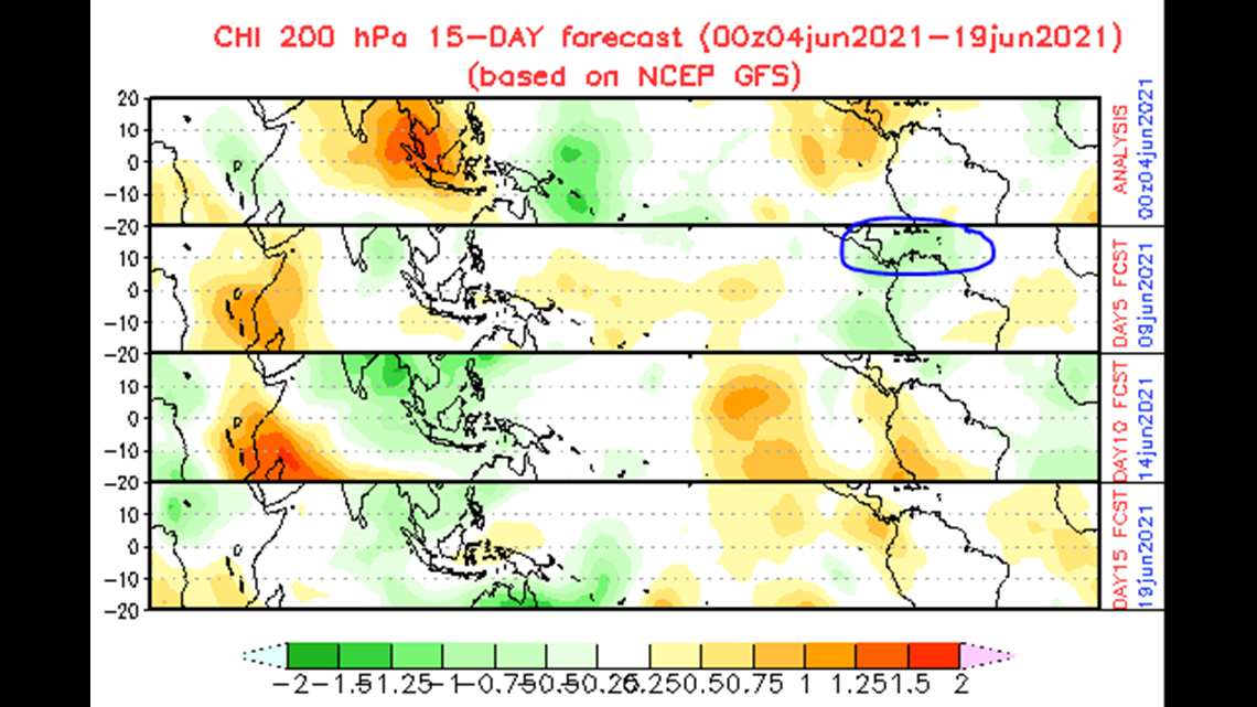
Whether that comes to fruition is still TBD, but there are some factors that support tropical development. SSTs (pictures above) are warm enough, for one. The Madden Julian Oscillation is expected to be in a 'convective' phase over this part of the world, during the middle of June. When that happens, showers and thunderstorms are more likely to develop. And when that happens during tropical season, you can sometimes get tropical development. On he image below, June 9, the green colors over the Caribbean represent the convective phase of the MJO.

This is still over a week away and as I typically say, it's something to watch; not worry about. Given the possible development, you may see images being shared of what may happen. Just know, nothing is there right now (June 4) and until something is, it's impossible to say what happens next, right now. We are aware and on top of it.
Holt out.


