
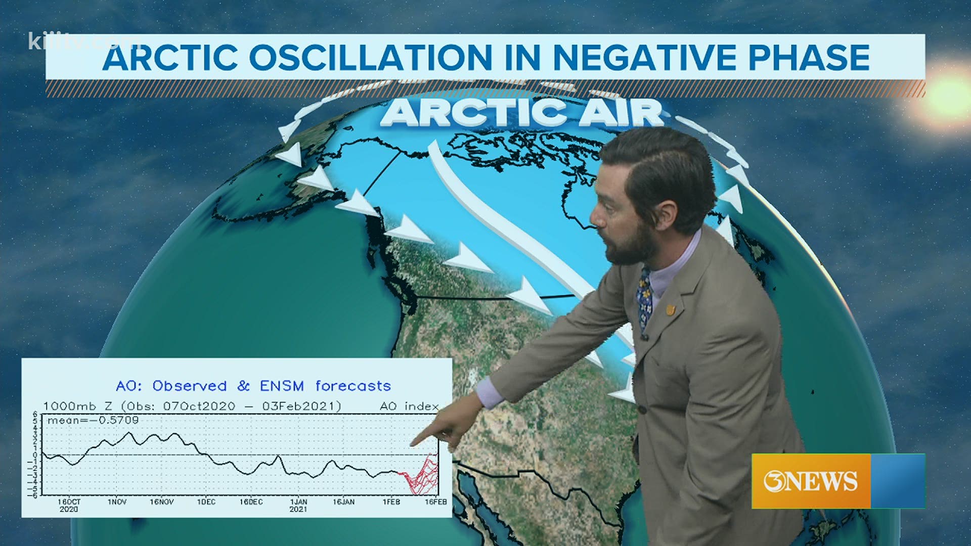
CORPUS CHRISTI, Texas — The coldest air of the season to date, and probably for all of winter in South Texas, is likely next week. Longer range forecast models are pointing at Arctic air getting into South Texas by the middle of next week and there are additional signals pointing to the same. We'll start with a teleconnection called the Arctic Oscillation (AO).
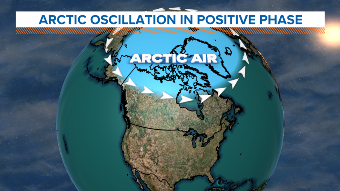
The AO is a teleconnection similar to the more familiar el nino/la nina (ENSO), in that it is weather in one part of the world influencing weather in another part of the world. The AO is a teleconnection focused on the North Pole, not the E Pacific like its ENSO counterpart. There are two phases of the AO, +/-. The + phase tends to keep cold air locked in over the north pole with a strong polar jet stream circulating and keeping Arctic air north.

When the AO turns negative, the polar jet stream is 'looser' and Arctic outbreaks are more likely to escape the pole and work south; whether that be into North America, Scandinavia, or Siberia. Cold outbreaks aren't exclusive to a specific region in the negative phase of the AO.

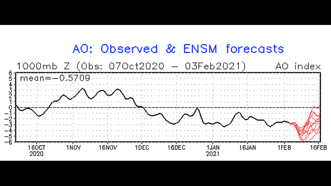

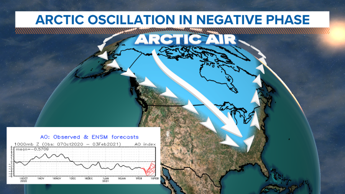
In next week's case, I pulled the AO forecast (above) and you can see....the lines in red dropping, showing the AO becoming more negative about a week from now. That tells me, ok there's reason to believe that if model guidance is showing cold air headed this way, it's plausible and shouldn't be discounted. That takes us to the two most reliable longer range models - the GFS and EURO.
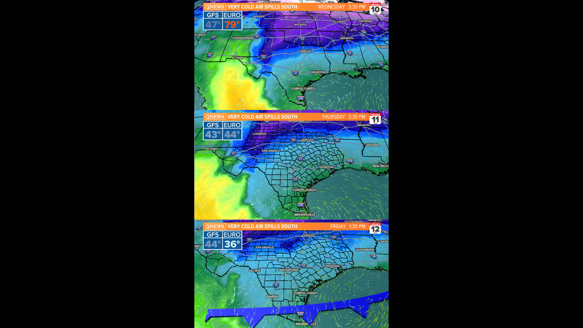
Both the GFS and EURO are showing an outbreak of Arctic air in South Texas next week. I don't think this is a question of if; rather, when. The GFS is a little faster with its push of frigid air (check out Wednesday in image below) with the GFS printing 40s and the EURO up near 80. Model disagreement! The two become more congruent by Thursday (Feb. 11) and keep 30s or 40s in place Thursday through the upcoming weekend! The fact that both show a prolonged snap of cold temperatures gives me more confidence this will happen (with the -AO providing addition confidence).

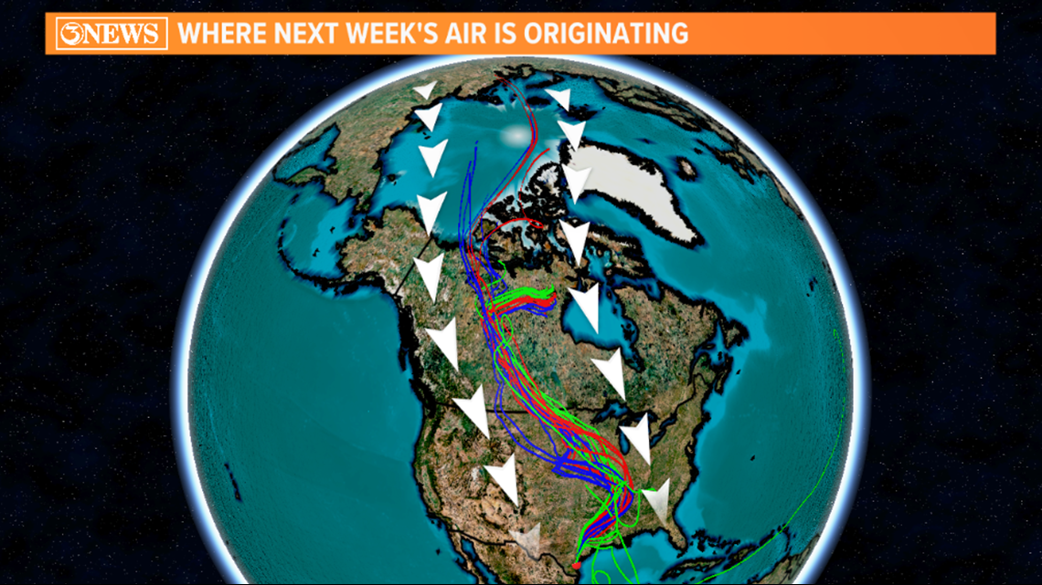
I pulled the GFS model data showing the origination of the air headed for South Texas. It's going be coming in from the North Pole/Siberia. brrrr

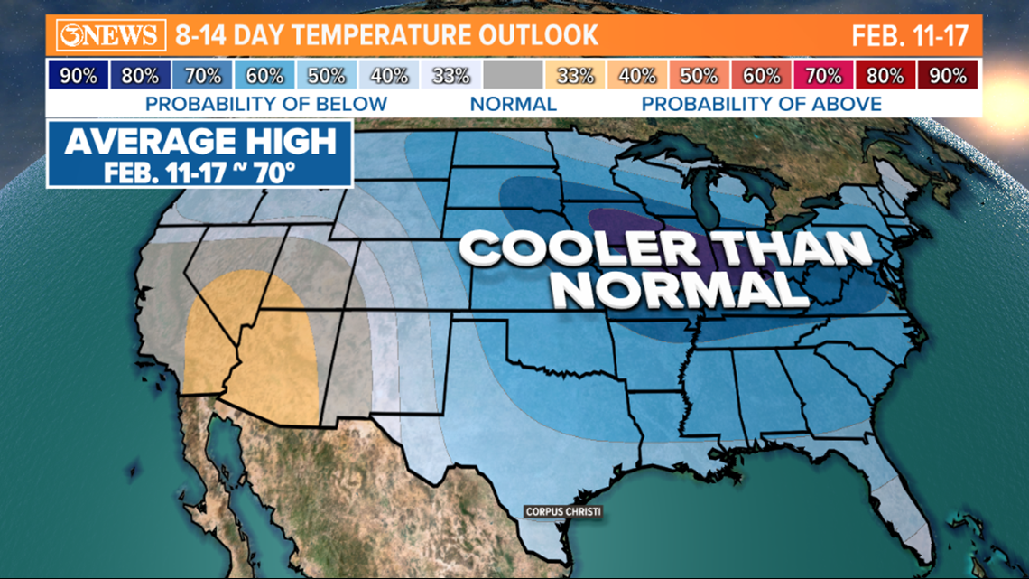
The Climate Prediction Center's 8-14 day temperature outlook (Feb. 11-17) also points at colder than normal temperatures for a lot of the country. More confidence. BTW, average high is 70 in Corpus Christi for the time-frame we are looking at.

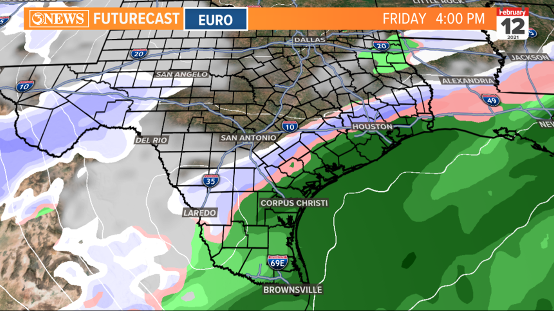
I know the question of winter weather will come up, so let's address that too. There's a reason I buried this at the end of this write-up, and that's because it's a far more difficult forecast to answer at this point (Thursday, Feb. 4), given it's a week or more away. Both the GFS and the Euro are suggesting wintry precip for parts of Texas late next week (Thursday/Friday).
- GFS with a wintry mix in East Texas Thursday

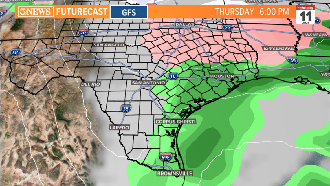
- Euro suggesting a stripe of snow/wintry mix From Laredo to Houston (south of San Antonio) next Friday.

The precip forecast will move around a lot through early next week so don't fall in love with a single run of a model. Trends between now and early next week will be more important. Given that a precip forecast (especially winter weather in South Texas) has so many more working parts than a temperature outlook, this will be something to keep an eye on, but not get too excited about yet.
As always, stay up to date (things will no doubt shift around) with the latest and lovers of cold weather can at least be excited about colder temperatures headed this way. Precip TBD.
Holt out