CORPUS CHRISTI, Texas — I've been getting this question a lot the last few days.
'Is it true that because Hanna just hit the South Texas Gulf Coast that we cannot get another tropical system for a month because the atmosphere needs to re-energize?' ....or something along those lines. Paraphrasing, of course.
My answer to this question: no, that's not true. Here's my reasoning:
History proves storms can pass through the same locations, bodies of water, and even the same point as a previous storm in just a week or a few week's time. Think about it....all of those Cape Verde storms pass over the same area for much of August and September. But, to drive the point home; let's look at some history closer to home in Texas and Florida.
I pulled three different decades to illustrate how it's possible for tropical systems to cross into and through the same areas in less than a month and as little as a week's time. First up...the Texas in 1942:

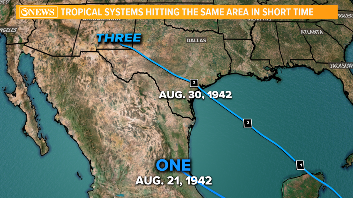
I admit, this isn't the best argument for the case I'm about to make, but it's a start. In August, 1942, two storms hit in Mexico and Texas in the Western Gulf of Mexico. This was before names were given to tropical storms and hurricanes, so you'll see 'one' and' three'. 'One' was a Tropical Storm into Mexico and 9 days later, 'Three' was a Category three hurricane hitting Matagorda. Not the best example, but it's a start. Next up, Texas, 1971:

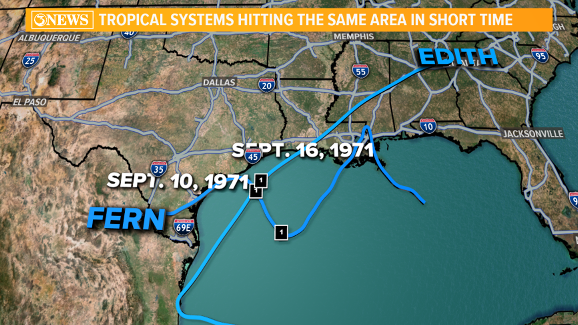
In this example, we have two storms crossing the exact same point off the TX Gulf Coast in less than one week's time. Fern, hitting Freeport, TX, as a tropical storm on September 10, 1971, and Edith, scraping by all of the Texas Gulf Coast before making landfall as a category 2 hurricane in Louisiana on September 16, less than one week later. Now on to the most glaring example. Florida, 2004.

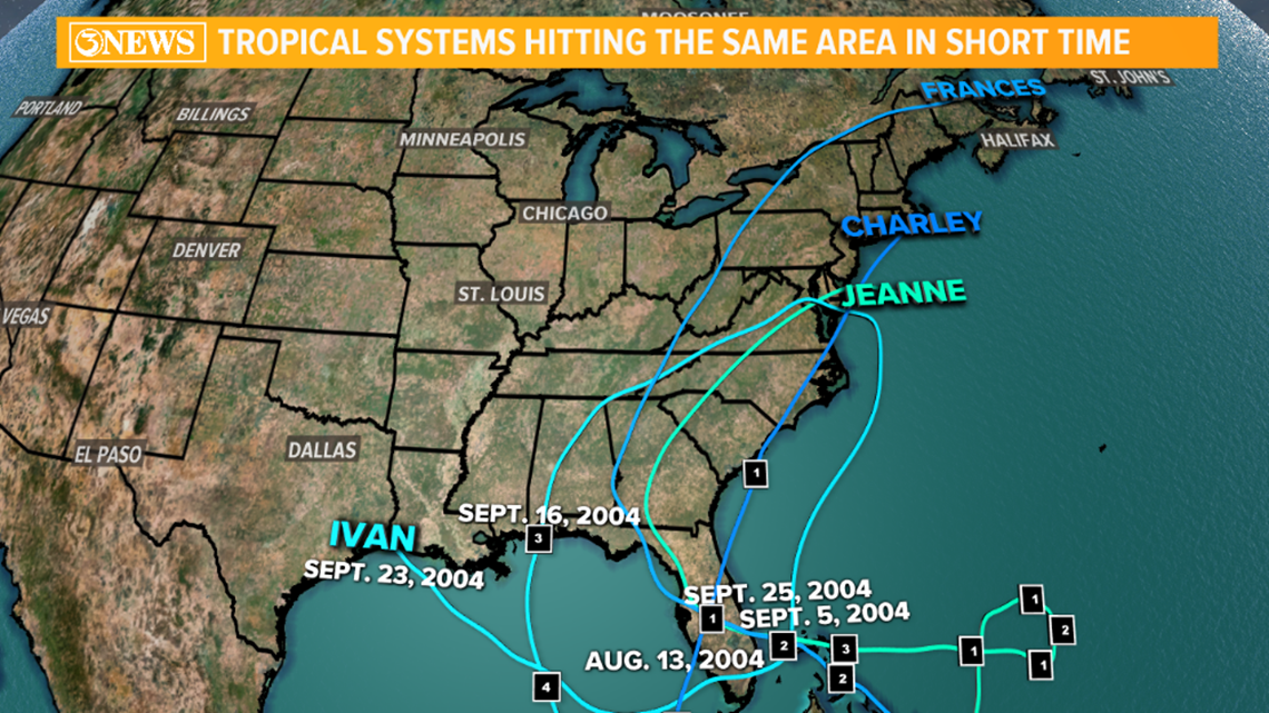
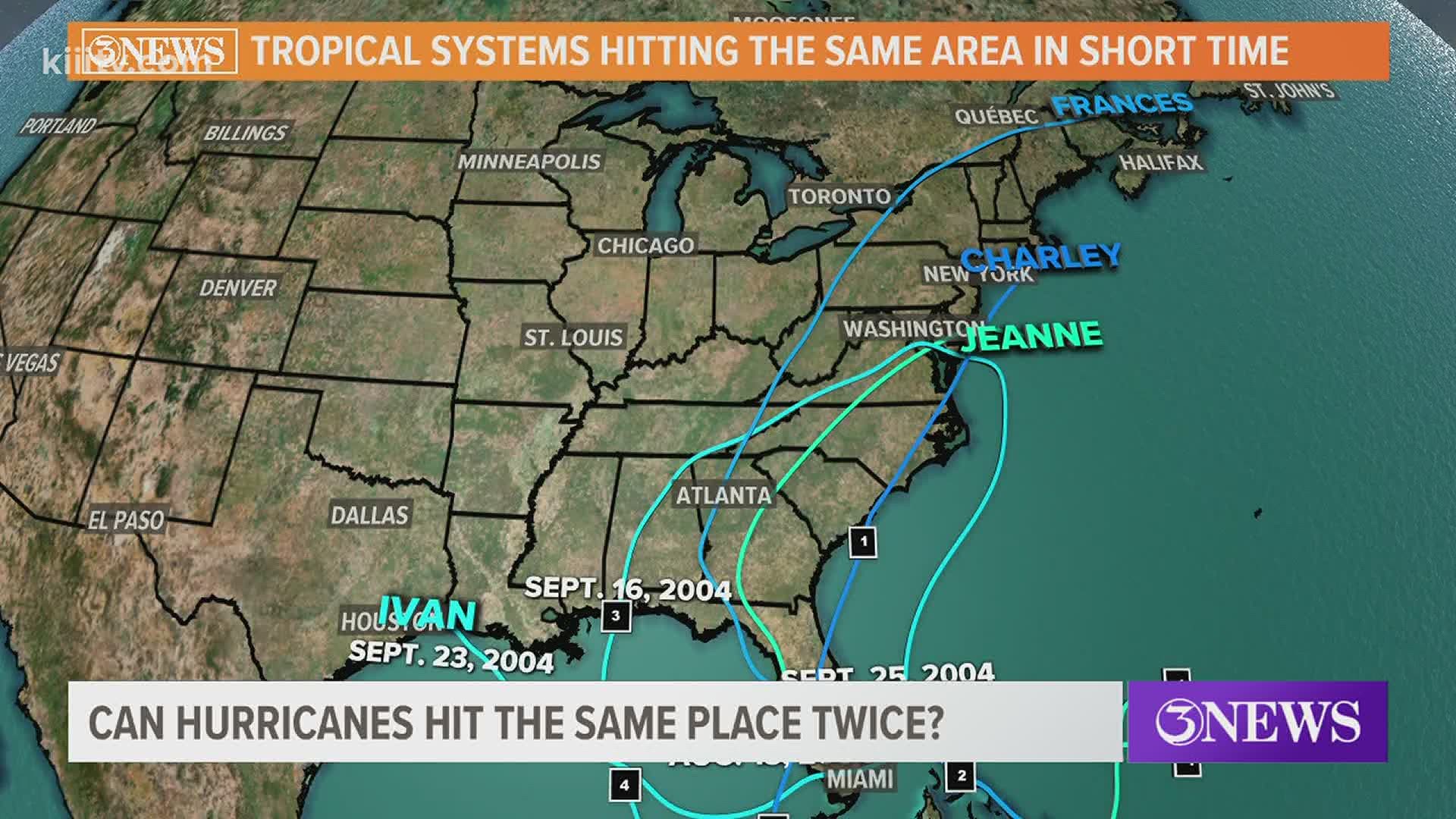
It looks like the worst spaghetti plot ever, right? That's 4 different storm tracks within the span of 7 weeks - August 13 - September 25.
A single storm crossing its own previous path - Ivan's first landfall was in Alabama as a Category 3 hurricane on September 16, 2004. Ivan then weakened and worked up to the Delmarva Peninsula and looped back into the Atlantic. The remnants of Ivan worked over Florida, then re-developed to a tropical depression, crossing over it's own previous track in the Gulf of Mexico, making landfall as a tropical depression near the TX/LA border, Sept. 23 - one week after its AL hit.
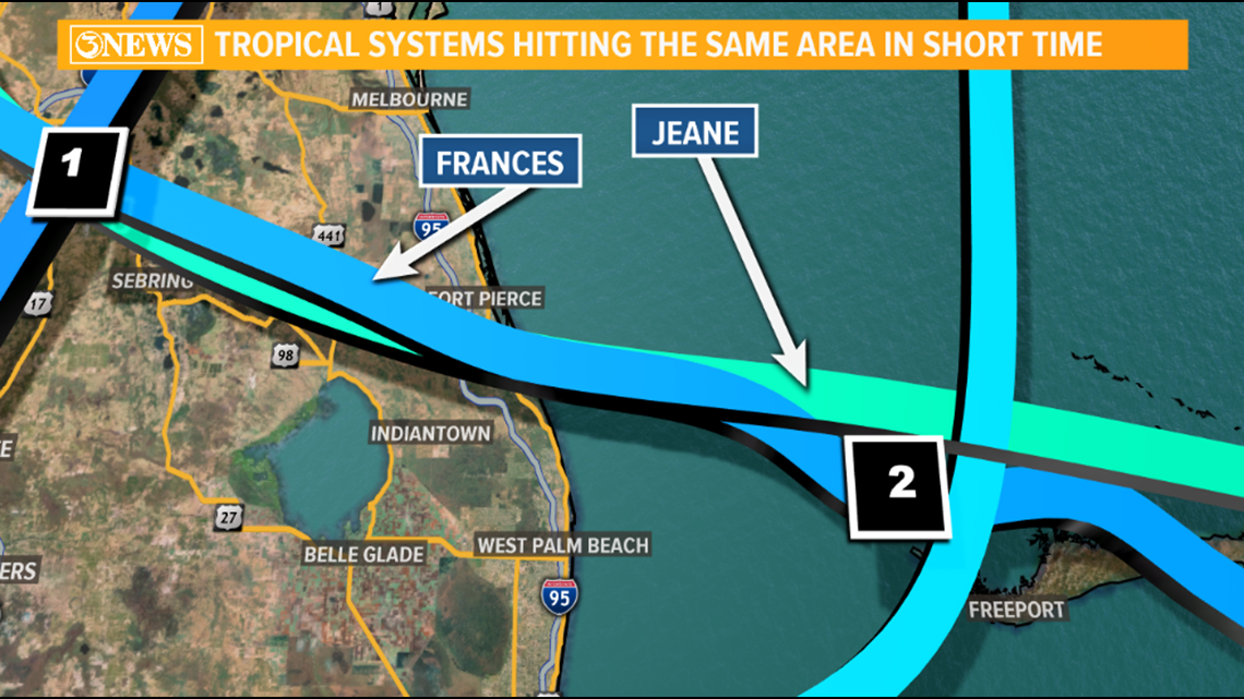
An example of two storms hitting the same location within a few weeks time. Also in Florida, 2004 - Hurricane Frances & Jeane in South Florida. Frances made Landfall near West Palm Beach as a Category 2 Hurricane on September 5, 2004. Twenty days later, on September 25, Cat 3 Hurricane Jeane made landfall just 3km (that's less than 2 miles!) from where Frances hit. So, there's that.

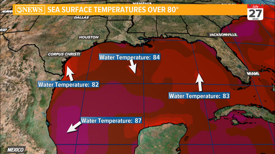
History shows us it is possible for tropical systems to move through the same areas they've previously been - and within a few week's time. Now, let's get to the argument that the atmosphere/water needs a month's (give or take) time to re-charge for another storm to move through. It is true that when storms move over water, they cool the waters under their location. But for dramatic cooling, a storm would have to sit over the same spot for multiple days - Dorian did this off the FL Coast last year. In our current situation, we just saw Hurricane Hanna make landfall along the South Texas Gulf Coast, right? Well, here we are - two days removed from landfall - and the gulf is still showing water temps in the 80s across ALL of the gulf. It cooled about 5 degrees, but still plenty warm enough to support tropical development. In the image below, any red hue represents water temperatures 80 or above. You can see the slightly cooler waters off the TX Coast.

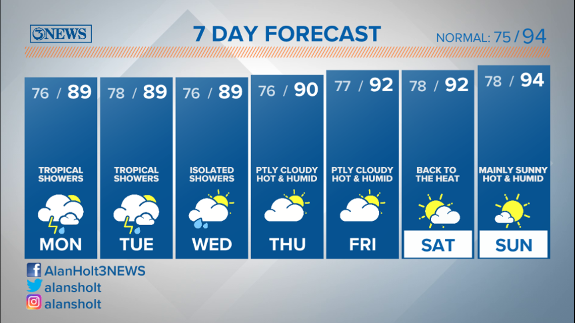
A quick check of the 7 day tells me we are still in summer - Hello, 90s with triple digit heat indices this weekend. Consider the atmosphere charged.

The answer to whether or not a storm returns within a short period of time really depends on if there is another system out there, and where things like dry air/moist air, upper level high and low pressure features, and wind shear are.
The reason a location usually doesn't get a storm within a few weeks of another one is more because of the general odds. They're low. And they're lower in Texas than in Florida. The two examples I show in this article for Texas aren't the best, either. There are many locations a storm can develop and track. So, you could, with some semblance of certainty, say that another storm won't come this way for a few weeks, or even a month. But the qualifier of it being because the atmosphere/water can't handle it is incorrect. History proves this to us. It's because the odds, with respect to how many different paths a storm can take, are very low. Storm frequency is also low. 20 storms for an entire season (6 months) is considered very active.
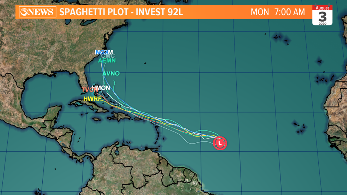
On that note: 2020 was forecast to be active and it certainly has been. Invest 92L in the Atlantic Basin will likely develop into ISAIAS over the next few days. Current spaghetti plot bends this system toward the Bahamas into early August. Too early to write anything off with this one. As always at this point - it's something to watch, not worry about.

Holt, out.

