CORPUS CHRISTI, Texas — It's early September, and just like we see in May/June with the tropics and forecast models blowing up huge storms 2 or 3 weeks down the road, models can tease us with cold fronts. I'm always weary to chase the cold front carrot this time of year, but the forecast into next week calls for at least a write-up.

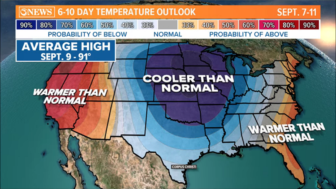
You've probably seen this image, or images like it over the last few days. It's the Climate Prediction Center's long range 6-10 day temperature outlook. This chart is valid from Sept. 7-11...we are focused on Sept. 9 for the front (possibly) in South Texas. The chart is a great tool but can be a little misleading when you see that large blue blob covering much of the Central US and into South Texas. This chart is telling us how temperature will compare to average in each location, but doesn't tell us much about what those temperature will be.
For example, in Milwaukee, WI, average highs on September 9 run in the middle 70s. So, temperatures in the upper 60s would classify 'below normal' there. In Corpus Christi, the average high on September 9 is 91. It's possible highs could be in the middle to upper 80s if the cold front makes it through, but that wouldn't be 'cold'...just, below normal. Which is what the chart indicates.
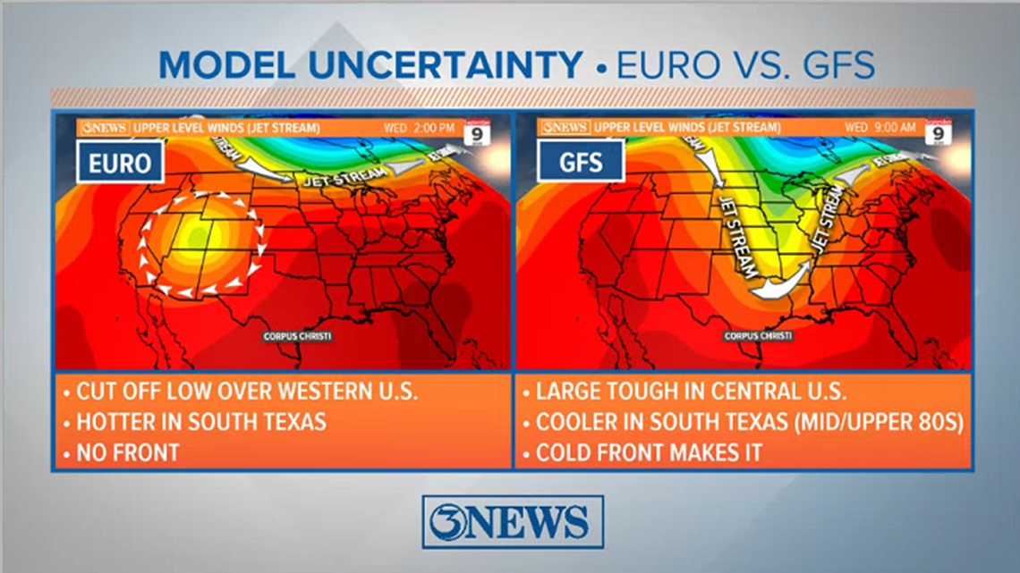
Now, for the front itself...will it make it? It depends on what forecast model camp you're in. The European model, which typically performs well, does develop a trough. But the trough becomes cut off from the main flow of the jet stream and stays over the western half of the US. That would keep South Texas cold front free and hot. The GFS brings a deep trough into the central/eastern part of the US. This would send a cold front through South Texas. One note about model performance...the GFS nailed Hurricane Laura's track, while the Euro missed on the track, taking it too far west. Take that for what it's worth.

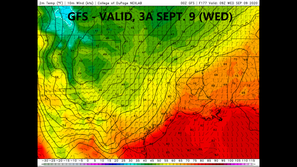
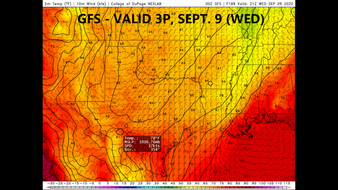
Let's humor the GFS, for optimism's sake, and say a cold front does make it into and through South Texas next Wednesday. The GFS is advertising a Wednesday morning arrival (forecast images below), with temperatures staying in the upper 70s in the afternoon. That would be nice; however, even if the GFS is right, I don't see temperatures staying in the 70s in the middle of September and I definitely didn't have that on my 2020 Weather Bingo Card. It may be that a cold front does work through, but highs stay in the middle to upper 80s.


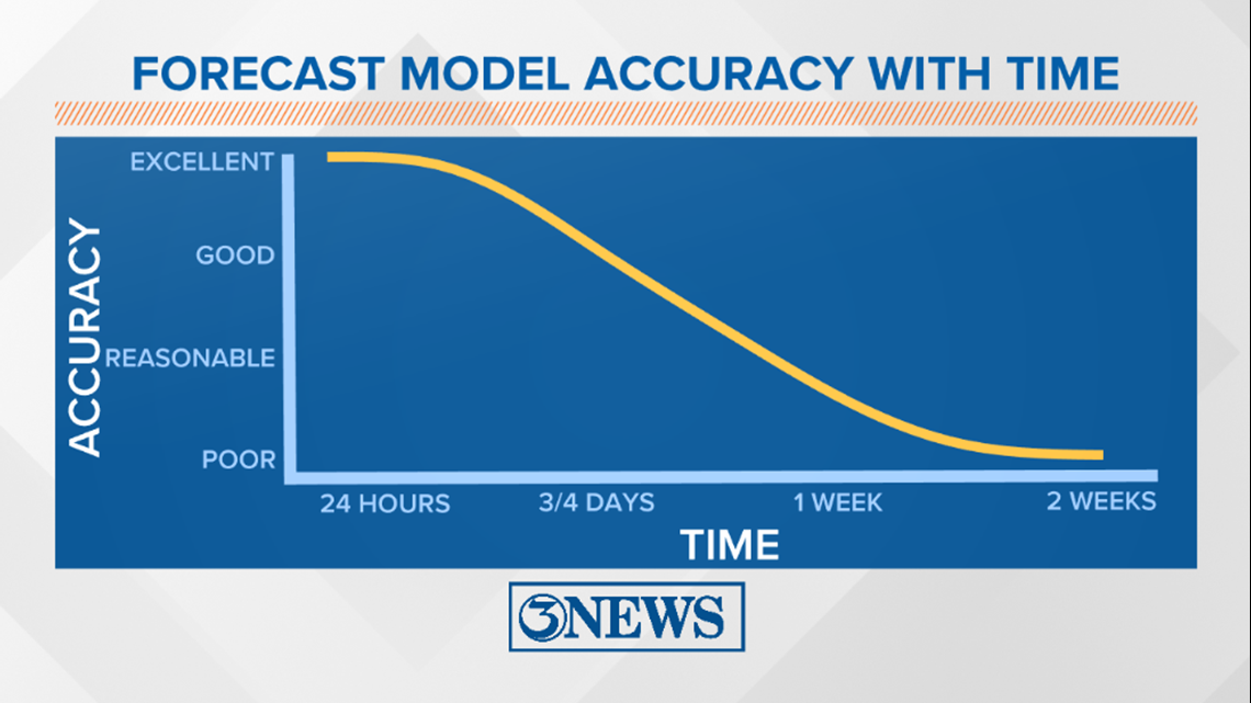
This is still a week away, but I'll certainly be paying attention to forecast trends over the next few days. Fingers crossed on the GFS. I like to include this model reliability graph when talking about things a week or more away. Illustrates that there is some degree of uncertainty, still.

-Holt, out