CORPUS CHRISTI, Texas —
GENERAL SET-UP
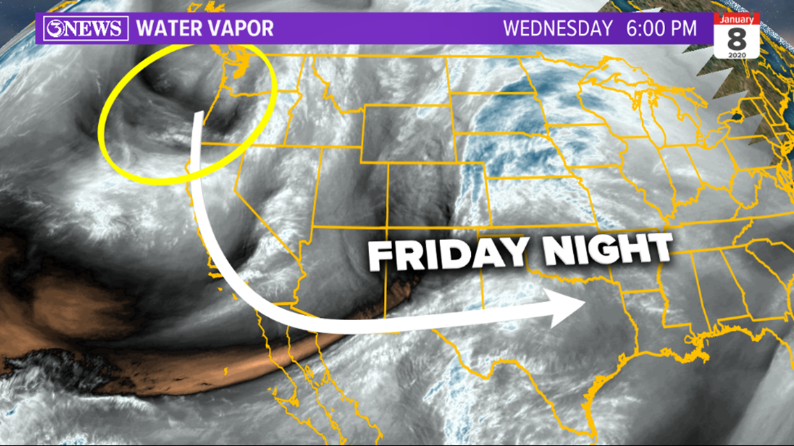
A disturbance entering the Pacific Northwest this evening will find itself moving in to Texas, Friday, bringing with it a cold front and chance for strong to severe thunderstorms - Mainly in eastern Texas.

For South Texas and the Coastal Bend, the chance for strong/severe storms is not a 100% slam dunk, but it's not zero, either. As the disturbance approaches from the west, supercell thunderstorms will likely develop in eastern Texas between Houston and Dallas. The best energy for violent storms will be there and that's where the Storm Prediction Center has given an 'enhanced' risk for severe weather. A squall-line (line of thunderstorms) is forecast to extend south of I-10. How far south and how strong, both iffy. And that's where we are in the overall set-up of this system.

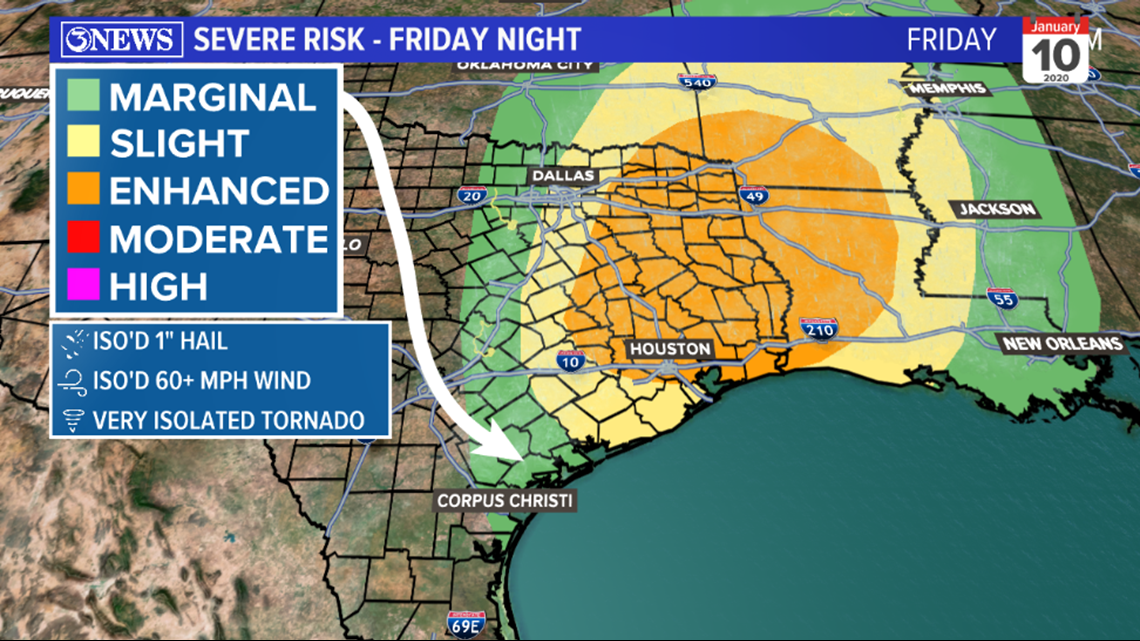
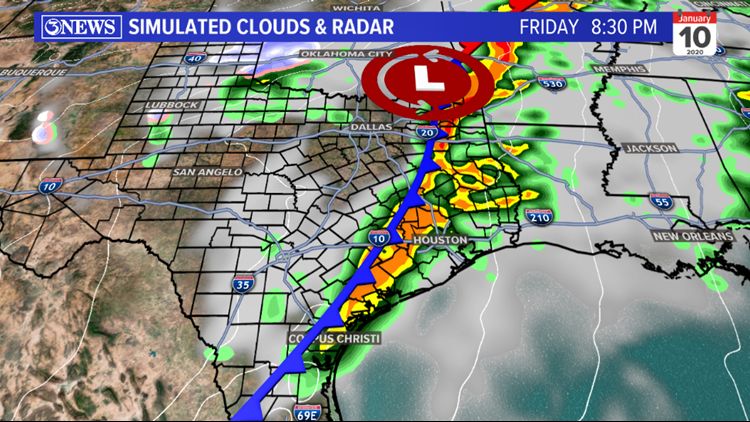
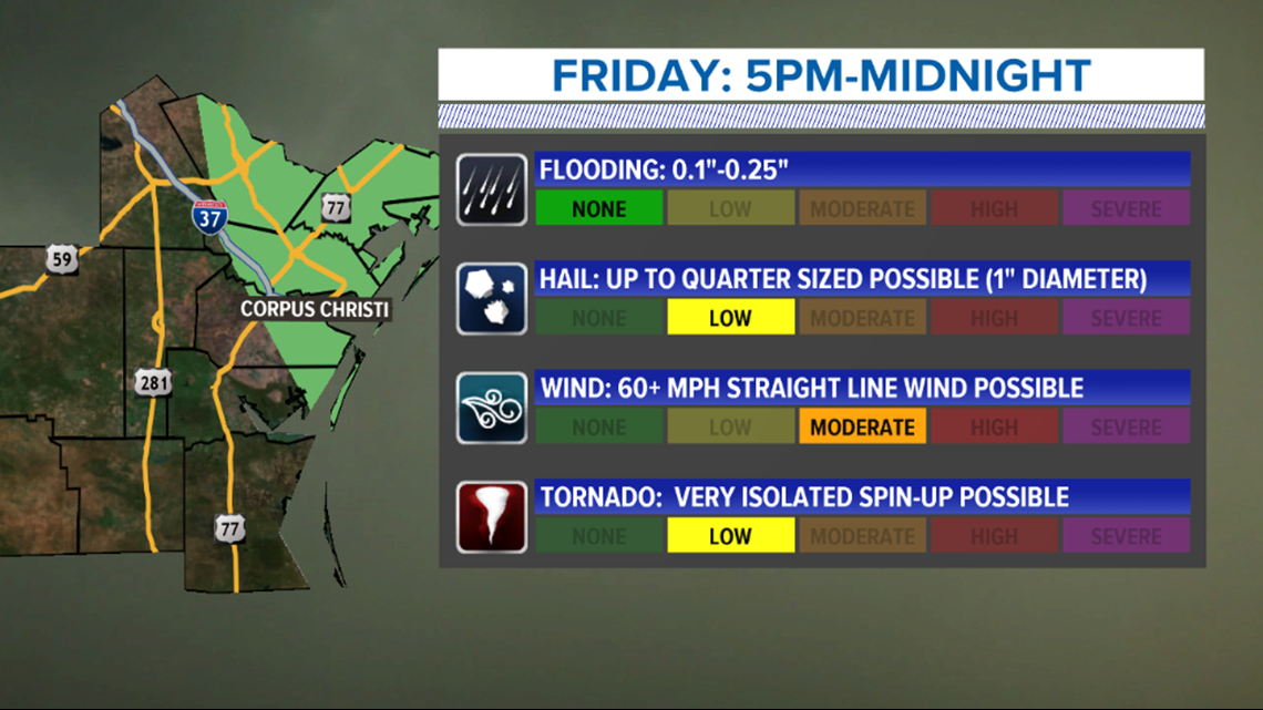
South Texas is in the lowest risk category, 'marginal'. In my opinion, the severe threat is fairly low for the Coastal Bend Friday night. It'll depend on how far south a line of thunderstorms can extend as a cold front approaches from the west. Within the squall line, damaging straight line winds in excess of 60 mph will be the primary threat. The better chance for the other modes of severe weather (hail and tornadoes) will be more likely north and east of the Coastal Bend. On simulated radar imagery, you can see how the shower/storm shape is more linear in South Texas. That's the possible squall line.


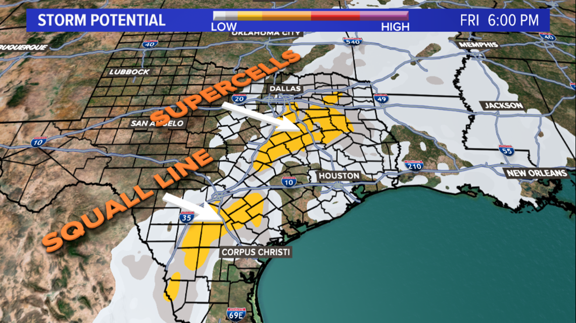
The Supercell Composite Parameter (SCP) can be a guide to where the best energy for destructive winds, large hail, and even tornadic activity are most likely to happen. It takes into account parameters like wind shear, energy, and rotation available in the environment for storms to tap in to. I pointed out the two areas where discrete supercells (East Texas) and a squall line (South Texas) are possible. Note: these values are not overly impressive, but point to where the most unstable air may be.
LOCAL TIMING & IMPACTS
If, IF a squall line can unzip far enough to the south to extend into the Coastal Bend (this still isn't a guarantee), the most likely mode of severe weather locally will be strong straight line winds, greater than 60mph. While the chance for an extremely isolated tornado and/or hail of 1" in diameter are possible, the chance for those here is low...much more probable in East Texas, where better energy will be. It's also possible that only a weak line of showers and isolated storms moves through....no big deal. Given the quick moving nature of squall lines, flooding will not be problematic.

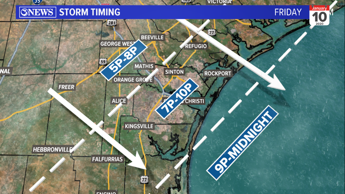
This will be a Friday evening/night event for the Coastal Bend. Activity will move from northwest and move southeast between 5p and midnight. Bee, Live Oak, Duval, and northern Jim Wells County will have the best chance between 5p and 8p. Activity will move toward the coast between 7p and 10p, moving off-shore between 9p and midnight.

THE PAYOFF
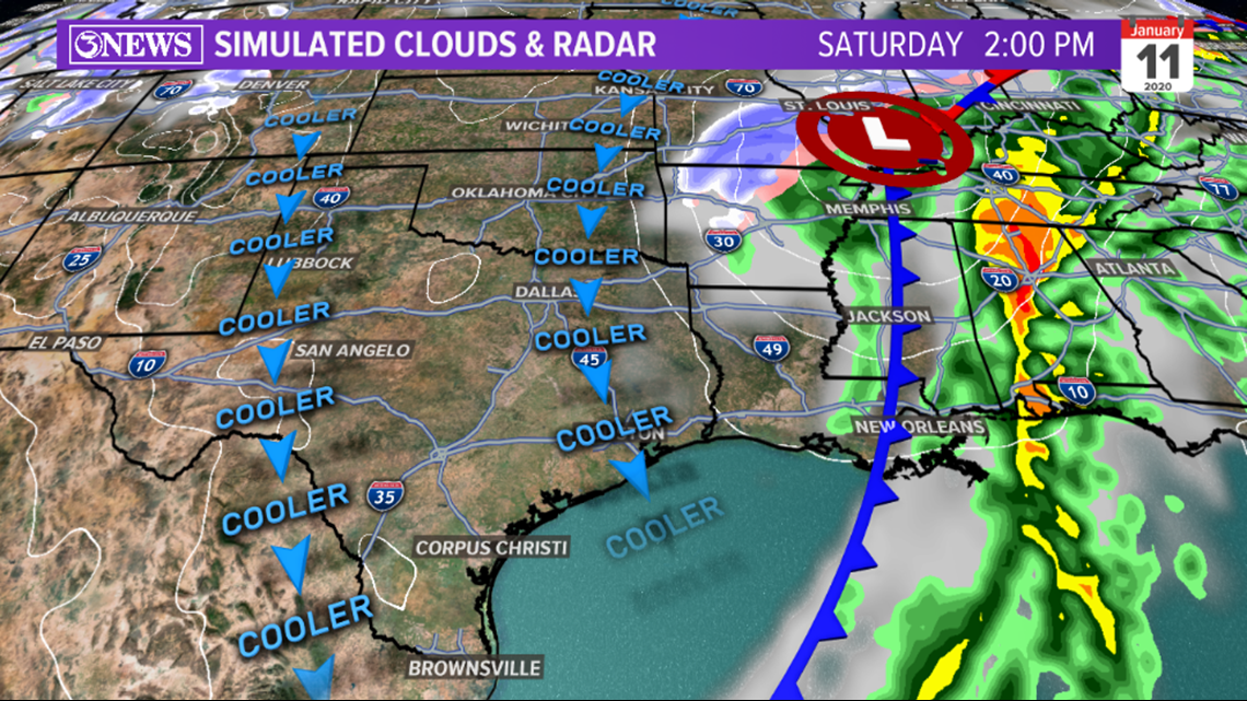
The associated cold front will move through Friday night, bringing drier/cooler air with it. Temperatures will stay in the middle 60s under sunshine and breezy NW winds, Saturday.

Per usual, details may shift/change between now and Friday night. We will update as needed with any and all changes through the event.
- Holt, out