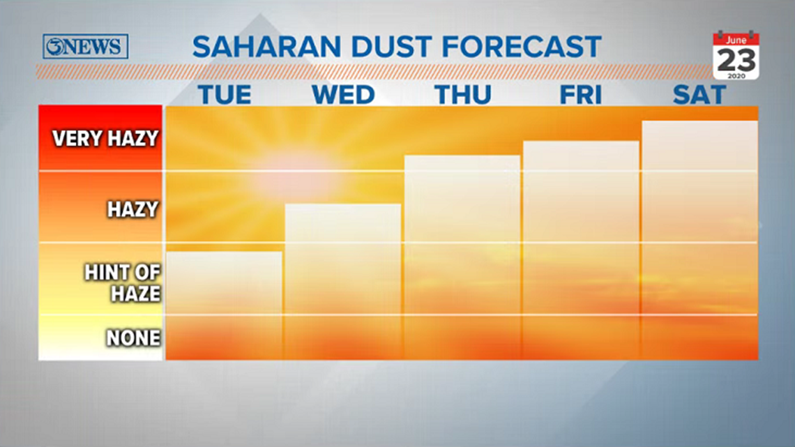
CORPUS CHRISTI, Texas — Like the title says, take this one with a grain of dust...yes, couldn't resist the pun. Saharan Dust has started to filter in to the Coastal Bend, as seen on our Lex Cam this morning -


We've got a forecast the likes of which I have not experienced in my time at KIII (8 years). A large plume of Saharan Dust arriving at the same time as a hearty slug of tropical moisture. Independently, these two are fairly straight forward to forecast for, but the two together take me down a forecasting road I have not yet traveled. I think the easiest way to break it down is to break it up into three camps...


Camp 1
The Saharan Dust filtering in acts as a catalyst for enhanced rain development. The dust in the air serves as condensation nuclei. All precipitation needs a condensation nucleus to begin the condensation/precipitation process. With a lot of dust in the air, the large surge of tropical moisture has a field day and lots of rain falls. More than forecast. Some guidance (European model) supports this scenario, printing around 20" of rain near San Antonio. Not gonna happen. While I can't totally be against this scenario, I think it is the most unlikely of the three.
Camp 2
Saharan Dust moves in and serves as a rain deterrent, blocking precipitation from developing, because that what dust does. That's why it suppresses tropical activity. It's a dry/stable layer of air. Yes, the dust is a cloud of condensation nuclei. But the large amount of dust effectively eats up the available moisture and the forecast is a total dud and we get zero rain out of it. In essence, would there be enough moisture to overcome the very highly concentrated plume of Saharan Dust. This is also plausible, but not the most likely in my opinion.
Camp 3:
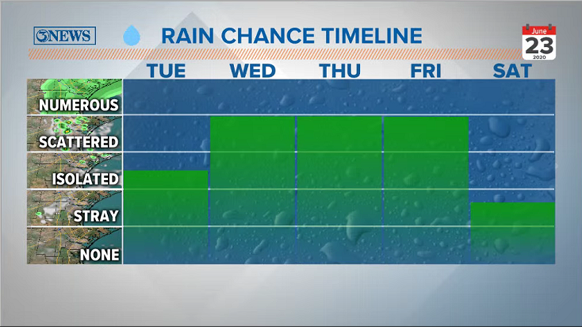
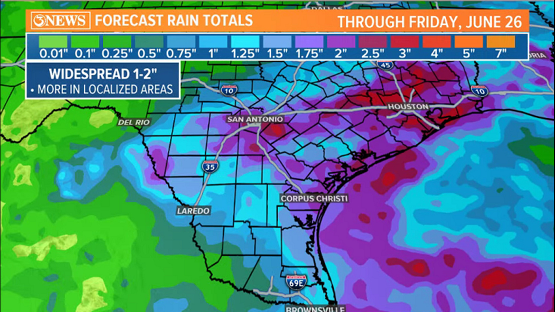
The Saharan Dust and tropical moisture move in simultaneously. There is a blend of dust eating up moisture and moisture using dust as condensation nuclei; a mix of the two camps described above. This, in my opinion is the most plausible resolution in this particular forecast. Based on this scenario, a reasonable rain forecast calls for 1-2" of rain between Tuesday and Friday. Localized higher totals would be likely. Any showers/storms that do take place would likely drop heavy rain. So getting just a few of these over the next few days would tally up totals quickly.

This is somewhat uncharted territory for me as a meteorologist....others I've asked, too. So, take this forecast for what it is: uncertain. The goal here is to explain reasoning as to WHY something may or may not happen and being able to effectively learn from this experience.
- Holt, out