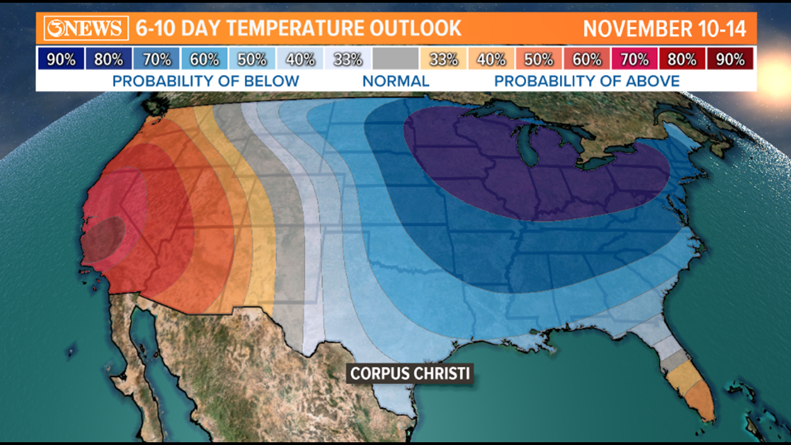
CORPUS CHRISTI, Texas — South Texas has two cold fronts in the forecast between now (Tuesday) and early next week - one Thursday and one Monday. These cold fronts will knock temperatures down to well below seasonal normal and bring a big chill to the eastern half of the United States. Here's the 6 to 10 day outlook for the U.S. You can see, Corpus Christi is forecast to observe below average temperatures through the middle of November. Average high for this time of year is in the mid to upper 70s.

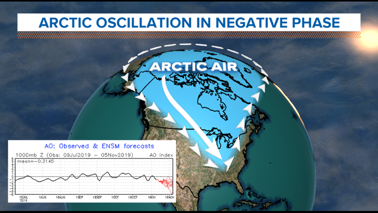
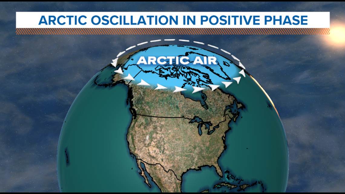
To set up a possible connection in how/why colder temperatures will spill in to much of the U.S. over the next 6-10 days, let's look north - the Arctic. Specifically, a teleconnection called the Arctic Oscillation. A teleconnection is how something happening in one part of the world affects another part of the world. You probably already know of one - El Nino. The Arctic Oscillation has to do with how strong or weak the polar jet stream is around the northern latitudes. When the AO is in a positive phase, upper level winds are strong in circulating around the Arctic, reducing the likelihood of cold air spilling south. When the AO is in a negative phase, like it is trending now, upper level winds are weaker around the northern latitudes. This increases the likelihood of cold air working southward. The two images below show the AO in positive vs. negative phase. I attached the graph of the AO trending down with the negative phase example.



Connecting the dots, with the Arctic Oscillation trending to a negative phase, we've got two strong cold fronts in the forecast between now (Nov. 5) and next Monday (Nov. 11). The first one will arrive on Thursday evening, dropping temperatures in the upper 50s and low 60s for highs on Friday. Keep in mind, average highs are in the upper 70s. A significant trough will set up in the eastern half of the U.S., allowing cold air to filter in.

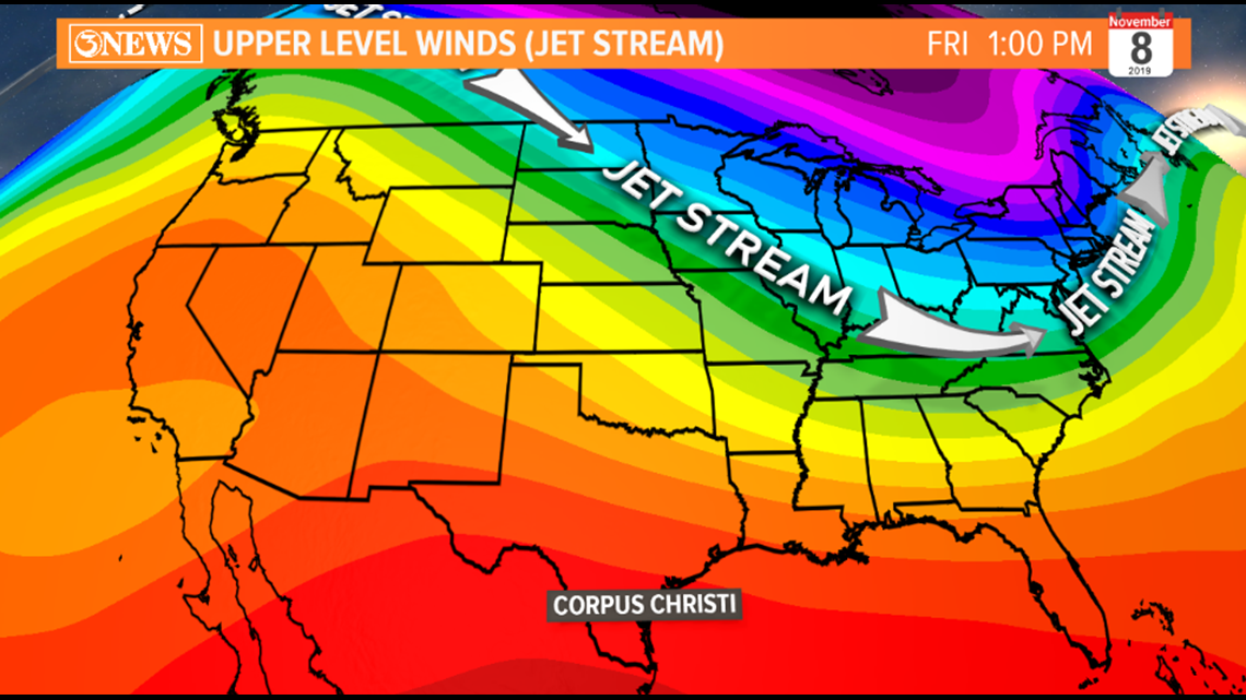

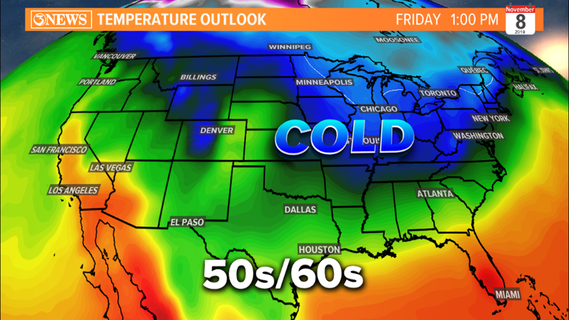
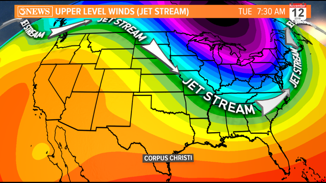
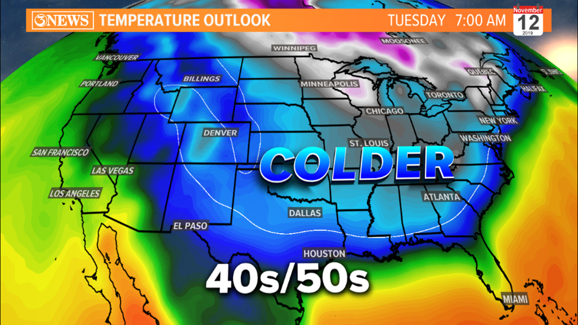
The cold front that is forecast to arrive next Monday, Nov. 11, is expected to be a little stronger. If you compare the two images of the upper atmosphere winds, you'll see a more pronounced, and more southerly dip in the jet stream early next week. This should translate to colder temperatures behind next Monday's cold front; highs in the 50s and 40s (maybe). With this cold front being 6 days away, forecast details will need to be adjusted as better data becomes available. The Arctic Oscillation trending to a negative phase gives credence to the forecast on next week's cold front being stronger.


- Alan Holt


