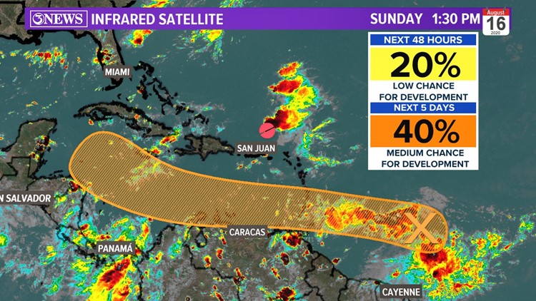
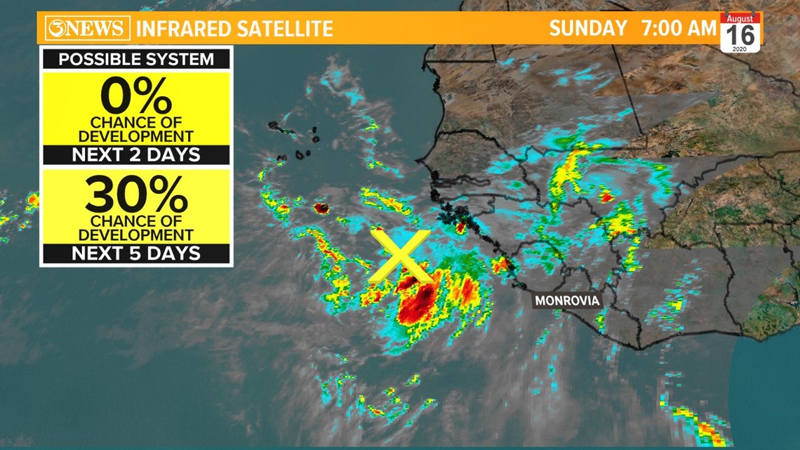
As of Sunday morning, we’re currently tracking two tropical waves over the Atlantic Ocean. The first wave is east of the Leeward Islands.The second wave is off the coast of Africa thousands of miles away. Both will need to be watched.


As the first tropical wave pushes into the Caribbean this upcoming week, it will enter a more conducive environment. With calm winds aloft, this tropical wave will have the ability to strengthen.
Also, when tropical waves start off low in latitude like this, they tend to drive west and end up near the Gulf of Mexico down the road.
The number one question: Where is it going? Also, will it strengthen?
With a favorable environment, it’s most likely. I would not be surprised if the National Hurricane Center increases the chance for both tropical waves next week. Waters are warm, dust is low, and wind shear is to the north.
Below is the European model. This is a reliable global model that tends to handle tropical systems “well” when far out over the open water. With that being said, take a look at next weekend. The timestamp is in the upper right-hand corner.

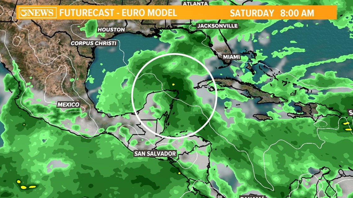
It looks more like a plume of tropical moisture in this particular model run. However, the fact that it’s near Central America and Mexico, is a cause for concern. Each day, models are updated as environmental conditions change, so it's something we’ll have to check back in frequently.
Here’s a look at the European ensemble. This is the European model but each line represents a different way in solving the problem or solving where the storm will potentially go.
Overall, it shows where these tropical waves are expected to move.

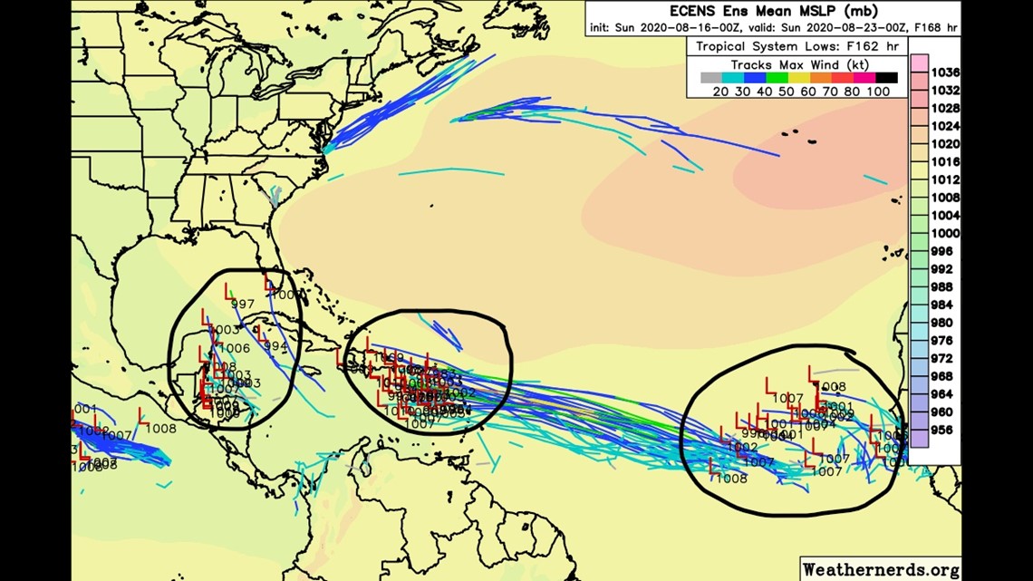
Right off the bat, you'll see the Euro is tracking not two but three tropical systems by next weekend.This is expected as we approach the peak of hurricane season in September. I circled three areas to watch.
Moreover, you’ll see by next Saturday (8-22), the first tropical wave is trending somewhere near Central America. Somewhere between Honduras and Mexico with its central pressure between 994 mb and 1008 mb. That range of pressure would be near Tropical Storm strength if not a weak Category 1 Hurricane.
A few members of the Euro ensemble have it curving right into the eastern Gulf of Mexico. Depending on what environmental conditions are present late next week, will dictate where this system will go and how it will strengthen. The Euro has low confidence where this system will track AFTER the western Caribbean.
The second tropical wave off the coast of Africa will continue to drive west-northwest. The Euro is confident in bringing it near the Leeward Islands next weekend.
To sum it up, both tropical waves are expected to track west into the Caribbean.
The first wave will end up somewhere near Central America while the second will be near the Leeward Islands by Saturday. We’ll have to watch both and how they interact with environmental conditions this upcoming week. Wind shear, steering currents and water temperatures will influence strength and direction.
As always, we’ll keep you updated.
Ryan Shoptaugh
KIII Meteorologist