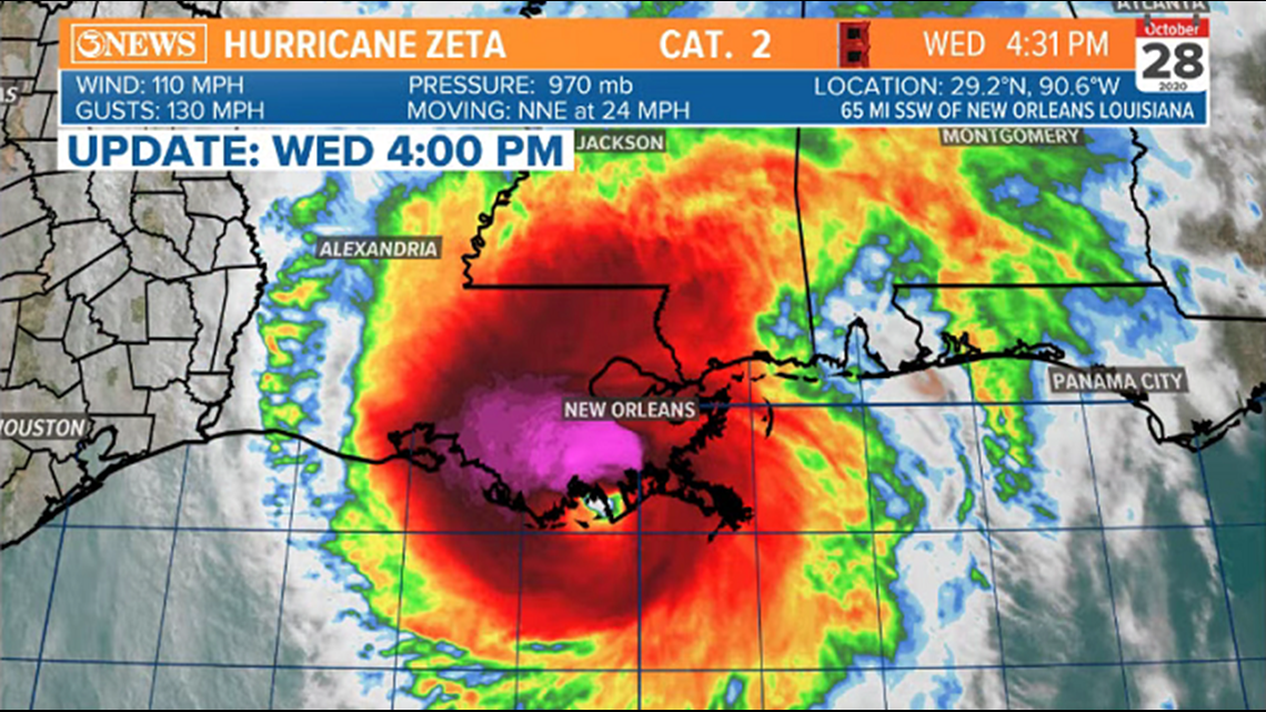
4:30 PM UPDATE:
Zeta is making landfall near Cocodrie, Louisiana, as a strong category 2 hurricane; 110 mph sustained winds - gusts up to 130 mph.

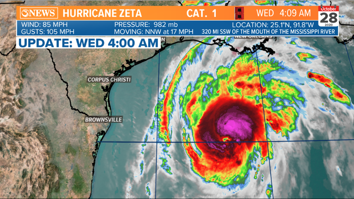
5AM UPDATE:
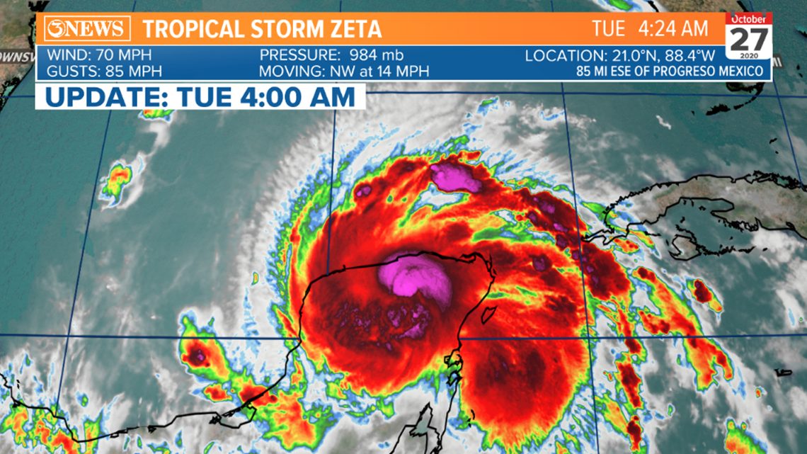
Hurricane Zeta is strengthening in the Gulf of Mexico this morning. As of 4am, a category 1 with 85 mph winds. It's moving NNW at 17 mph.

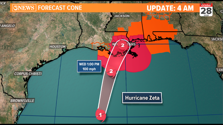
Zeta is forecast to strike Eastern Louisiana as a category 2 hurricane this afternoon/early evening. This will be the 5th time Louisiana has been hit by a tropical storm or hurricane this year alone.
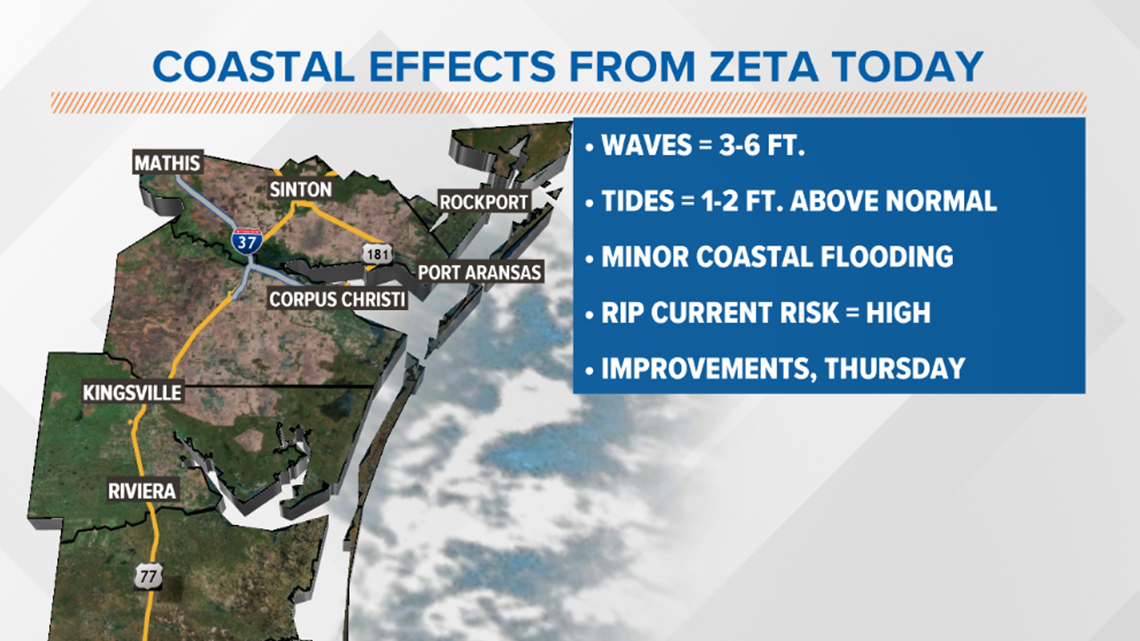
While Zeta poses no threat to Texas, some minor side-effects will be absorbed. Area beaches will get 3-6 ft. waves at a 10 second period. That'll lead to minor coastal flooding and a high risk for rip currents. Tides may run 1 or 2 ft. above normal.


4:45AM UPDATE:
After reaching hurricane status in the Western Caribbean, Monday, Zeta weakened overnight with land interaction over the Yucatan. Zeta is forecast to re-gain hurricane status in the Gulf of Mexico as it works north.

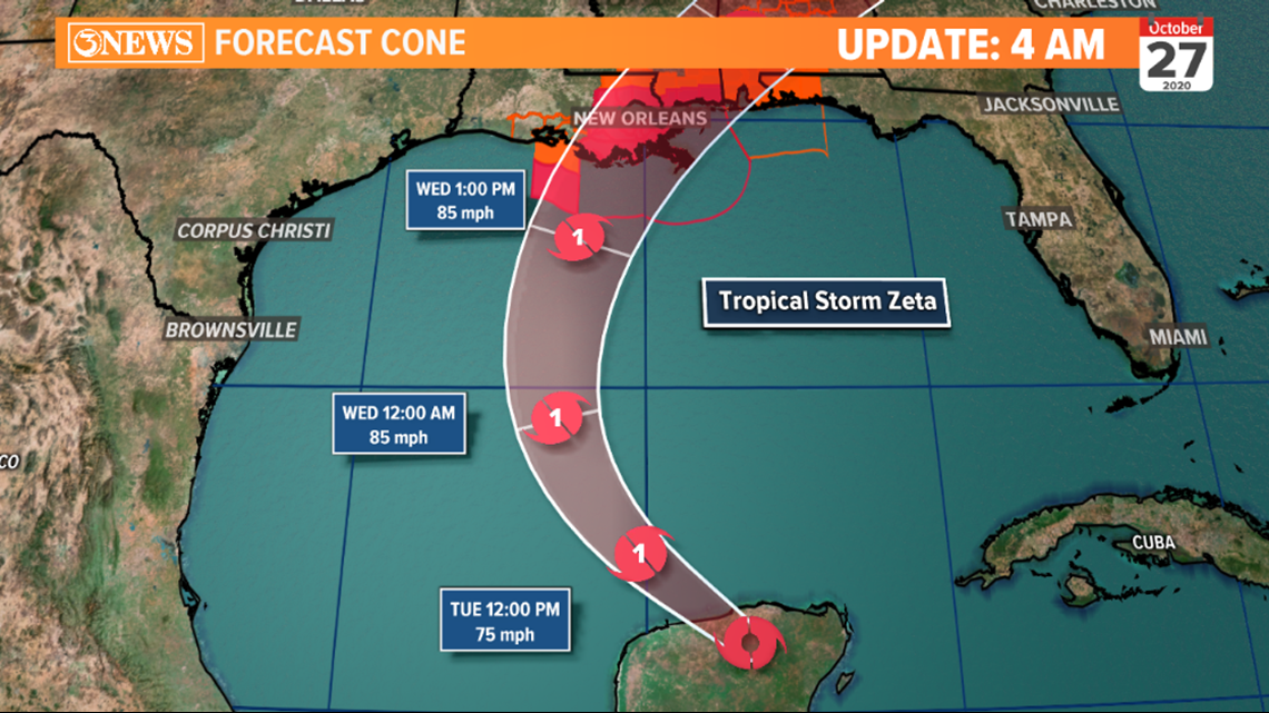
A cold front will deflect Zeta away from Texas, toward the northern gulf states, where Zeta is projected to make landfall Wednesday evening as a category 1 hurricane.

- Holt
10AM UPDATE:
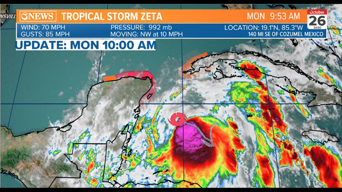
Tropical Storm Zeta is close to hurricane status, with 70mph winds this morning. It's moving NW at 10 mph.

Like many other storms this season, Zeta will move into the Gulf as a hurricane. A cold front moving through South Texas tonight will deflect Zeta to the east. A northern gulf landfall as a category 1 hurricane is expected Wednesday evening. High wind shear in the gulf should keep this storm from fast intensification. If it strikes Louisiana, it would be the 5th named storm to do so this year. Yikes.

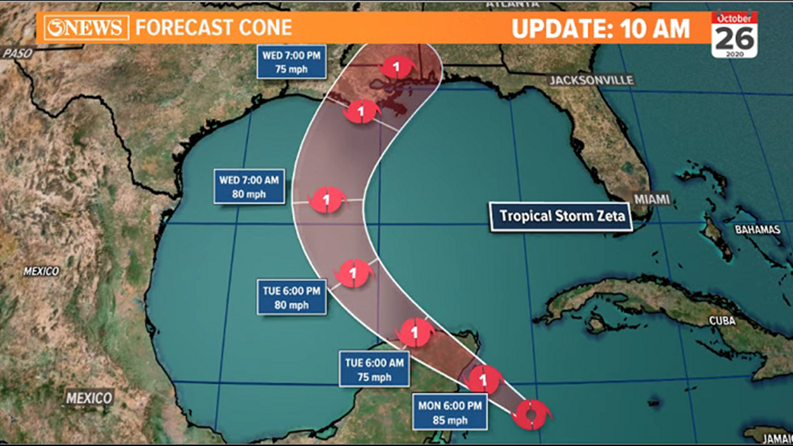
Aside from longer period swells, higher than normal waves/tides, rip currents, and minor coastal flooding...this storm is not a threat to the Coastal Bend.

- Alan
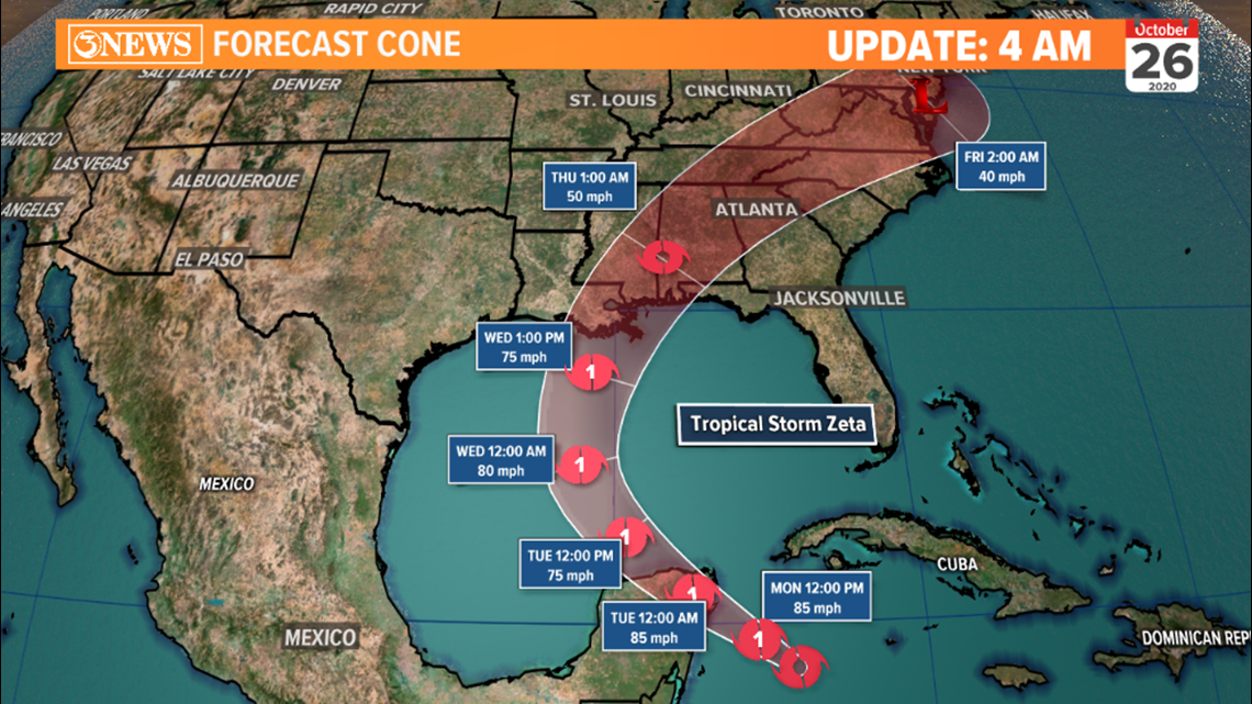
4:30AM Update:
Tropical Storm Zeta is forecast to strengthen to a hurricane in the Gulf of Mexico, prior to making landfall in the northern gulf, Wednesday. A cold front moving through the Coastal Bend tonight will deflect Zeta east, buffering the area. High wind shear in the gulf will mitigate strengthening on approach to landfall.

-Alan
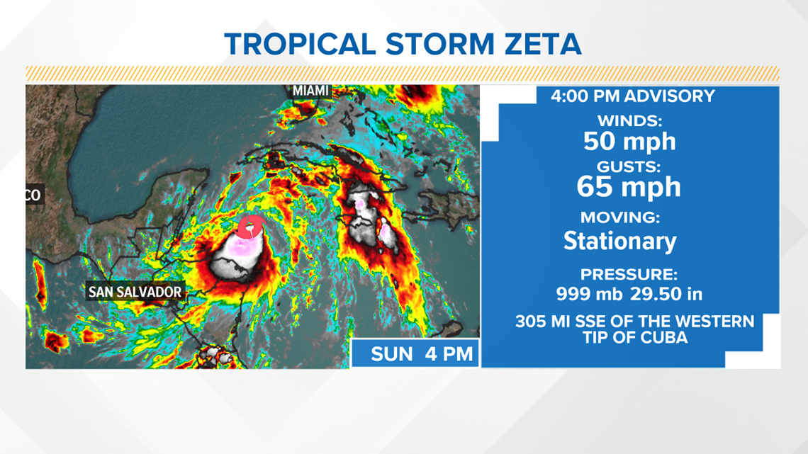
10 PM SUNDAY UPDATE
Tropical Storm Zeta has increased in strength with respect to wind speed, drop in pressure along with a small jump in forward speed.
Max sustained wind speed at 60 MPH.
Central Pressure down to 997 mb.
Movement: NNW at 2 MPH.
7 PM SUNDAY UPDATE
Max sustained winds have increased to 50 MPH and central pressure has dropped to 999 mb. Movement is stationary in the western Caribbean.
Zeta is expected to strengthen into a hurricane before it nears the Yucatan this week.

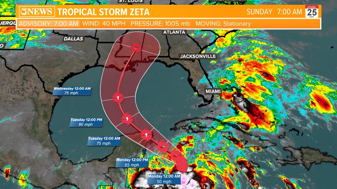
7 AM SUNDAY UPDATE
Tropical Storm Zeta remains weak and stationary this morning in the western Caribbean Sea. Max winds at 40 MPH. Forward speed is stationary.
Forecast track has it strengthening to near hurricane status through Wednesday where it will weaken as it pushes closer to Louisiana.

The National Hurricane Center has found a better organized tropical system this evening. Tropical Depression 28 will soon strengthen into Tropical Storm Zeta. This is big news.

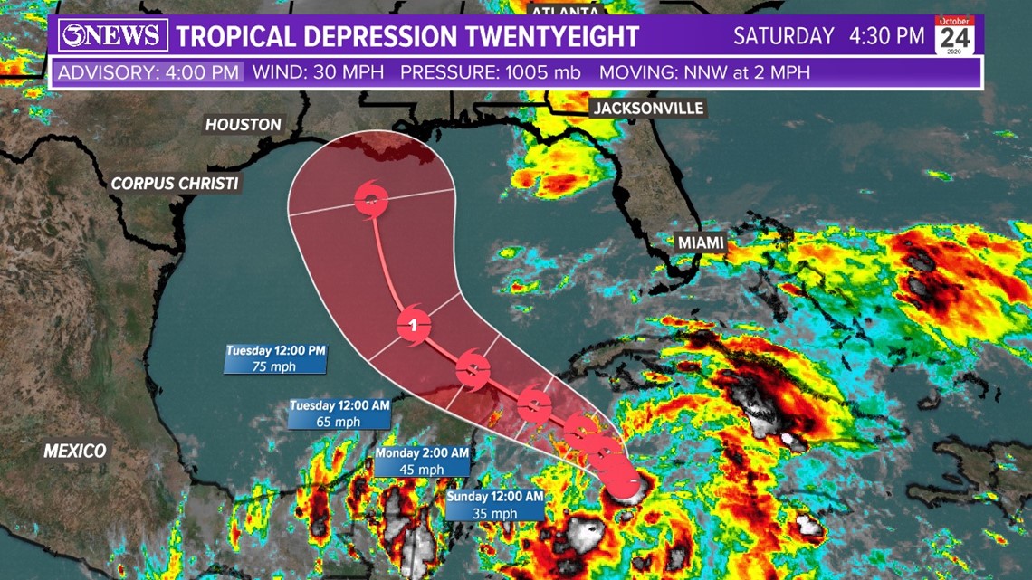
This will mark the 27th named storm of the 2020 season and that makes history. Only the second time this has ever happened.


In 2005, the season climbed to a grand total of 27 named storms along with one “unnamed” subtropical storm. Moreover, the 2005 hurricane season was the most active in recorded history. With soon to be Tropical Storm Zeta in the Gulf of Mexico next week, this will tie the all-time record.

For South Texas, this is not a threat. Due to a strong cold front forecast to move in Monday night, this will direct the tropical system closer to the northern gulf states. Further impacting the coasts of Louisiana, Mississippi, Alabama and Florida. Wind shear and cooler air from the north should keep it fairly weak as it pushes over land late Wednesday into Thursday. Aside from elevated surf conditions along our coast, we will not see any direct effects.
Hurricane Season goes through November 30th. If we see an additional tropical storm form by then, this would surpass the all time record.