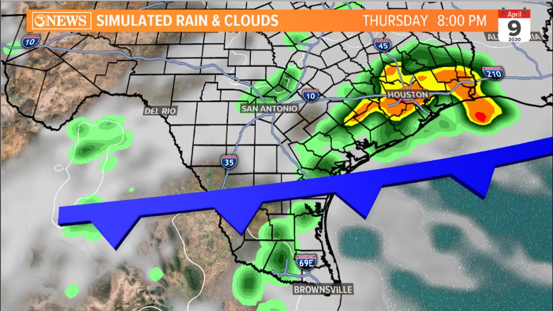
CORPUS CHRISTI, Texas — Each year, springtime offers South Texas periodic chances for severe weather. Warmer temperatures, higher humidity, and disturbances moving in from the north or west can lead to the production of strong to severe storms. On Thursday, it'll be an approaching cold front colliding with warmth and humidity, plus some wind shear that will translate to a shot at strong to severe storm activity.
A severe storm is one that satisfies one or any combination of these three things:
- Winds of 58 mph or greater
- Hail of 1" in diameter or greater
- A tornado


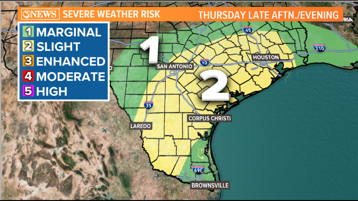
Much of the Coastal Bend, as of Wednesday morning, is placed under a 'slight risk' for severe weather. This map is produced by the Storm Prediction Center, a branch of the weather service that specializes in severe weather. Often, when I show this map and the risk is marginal or slight, people *expect* severe weather to happen. That's where understanding what the risk categories mean is helpful.
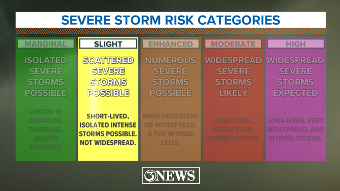
When a slight risk is in place, it means that scattered severe thunderstorms are possible. Storms will tend to be short lived and isolated cells could become more intense. Important to note that this is NOT widespread severe activity. It's certainly possible that many folks get showers and weak thunderstorms, but not everyone will get severe levels storms. This is number 2 on a 1-5 scale with 5 being the highest risk. You can see what the other categories represent in the graphic below.


The primary threats with any stronger storms Thursday afternoon/night will be damaging straight-line winds of 60mph, or greater and hail of 1" in diameter or greater. You can see, most of the area is placed under the slight risk category, this may change a little with Thursday morning's update. Flooding shouldn't be problematic with rainfall totals generally staying under 1". While the tornado threat is low, it is not zero. When strong/severe storms are in play, you cannot rule this out; however, this setup does not look favorable for tornadic activity.


Hope this helps with your understanding of severe risk categories and what they mean! We will be closely monitoring how the weather unfolds Thursday.
-Holt, out


