This winter has been warm. You're not the only one thinking that.
For South Texas, since the start of the new season, temperatures have generally been above average. This warmth is due to a teleconnection known as La Nina over the Pacific Ocean.
However, a separate teleconnection known as the Arctic Oscillation will bring colder air this month. This is also referred to as the Polar Vortex.
This vortex is always present and is nothing new. We hear a lot about it during the winter because it's responsible for arctic air traveling farther south. Sometimes down into Texas.
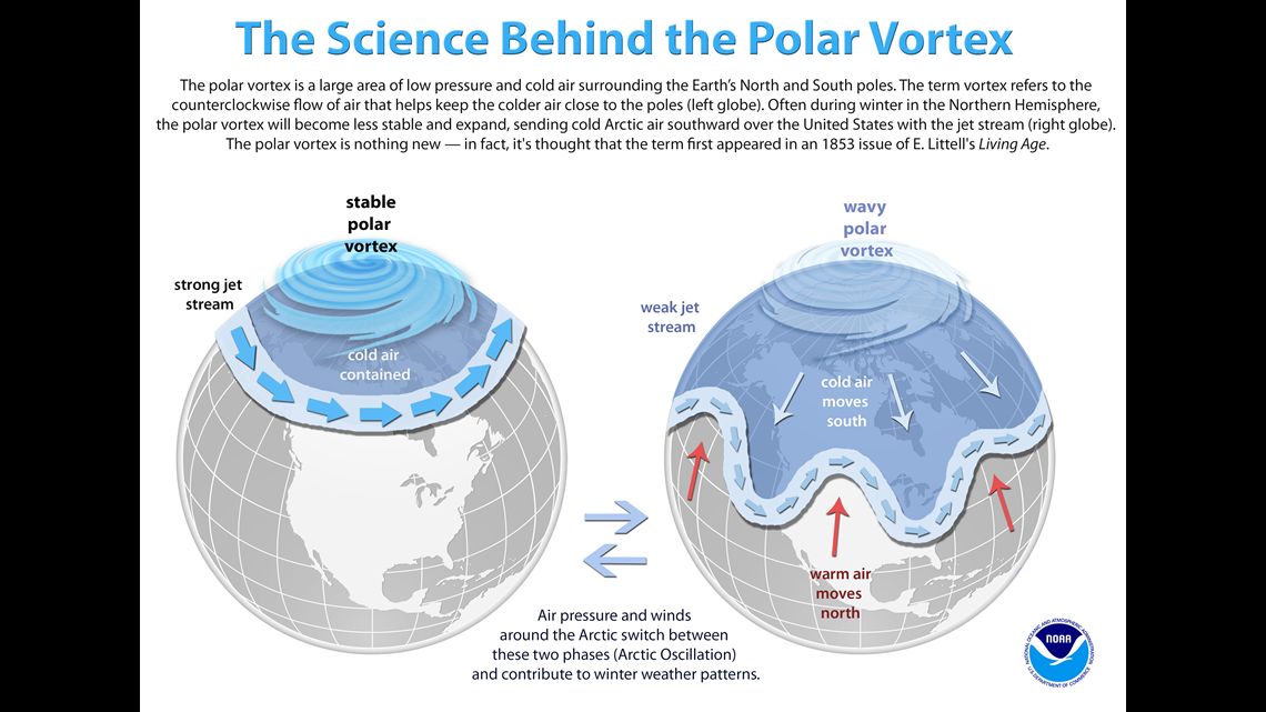
The Arctic Oscillation has two phases:
Positive - Arctic air stays north and is locked in over the northern latitudes
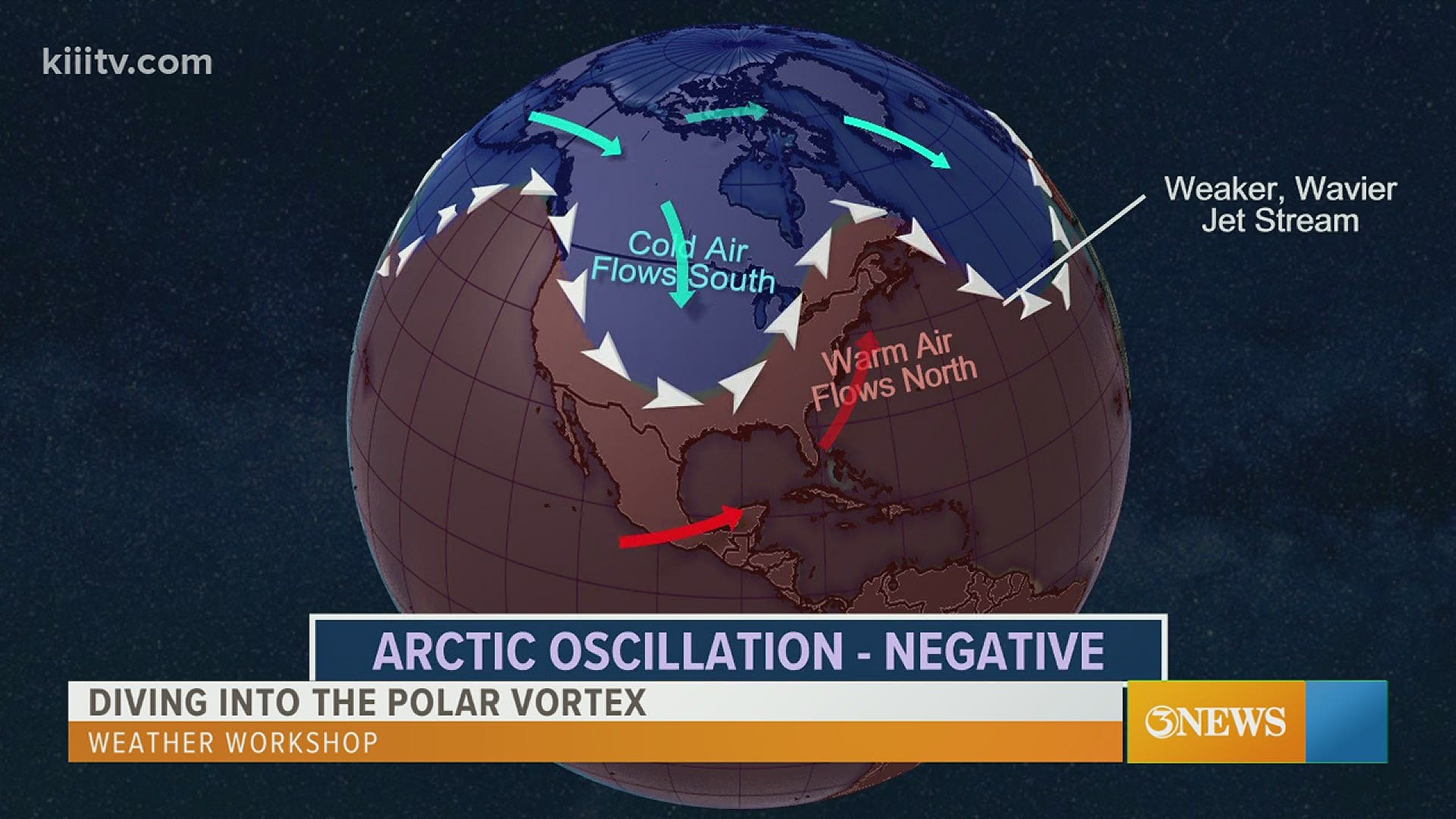
Negative - Jet stream fluctuates helping to transport arctic air southward
A piece of the polar vortex will branch off over the northern U.S this month.
This will provide the coldest air of the season.


Notice during a positive phase (left), the cold air is contained and bottled up over northern Canada. The vortex is stable.
A stronger variation in temperature from north to south helps with a "wavy" polar vortex and jet stream. The upper level winds help transport air from the north down into the middle and southern latitudes during the winter.
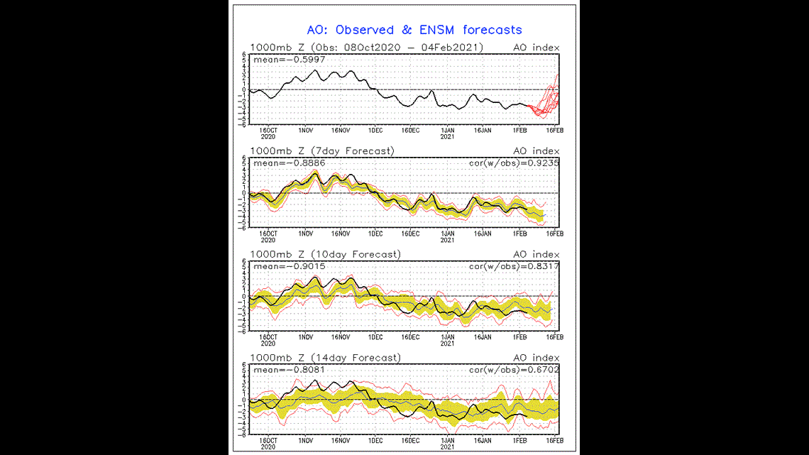
The observed AO (Arctic Oscillation) has remained negative since early December. Arctic air has been displaced over areas across the world.


Weather forecast models are suggesting a strong push of arctic air over the U.S. next week. The timing is not set in stone. However, the presence of much colder air is imminent for much of the region. Prepare yourselves, winter is coming.
Keep up with the forecast here on 3 News!
We will continue to update the extended forecast as we receive more data.

