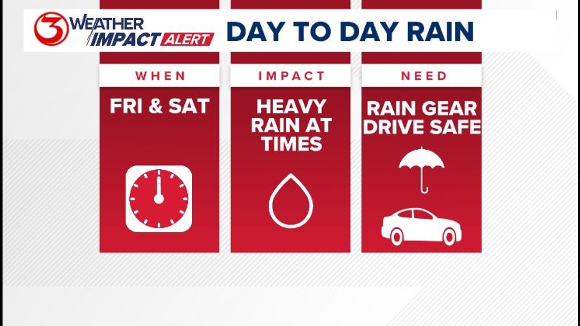
CORPUS CHRISTI, Texas — Weather Impact Alert Days continue through Saturday. We are calling attention to these days because we are expecting the coverage of rain in the area each day to be at or above 60%. This amount of rain can disrupt normal, day-to-day activities; especially as it relates to outdoor activities or driving conditions.

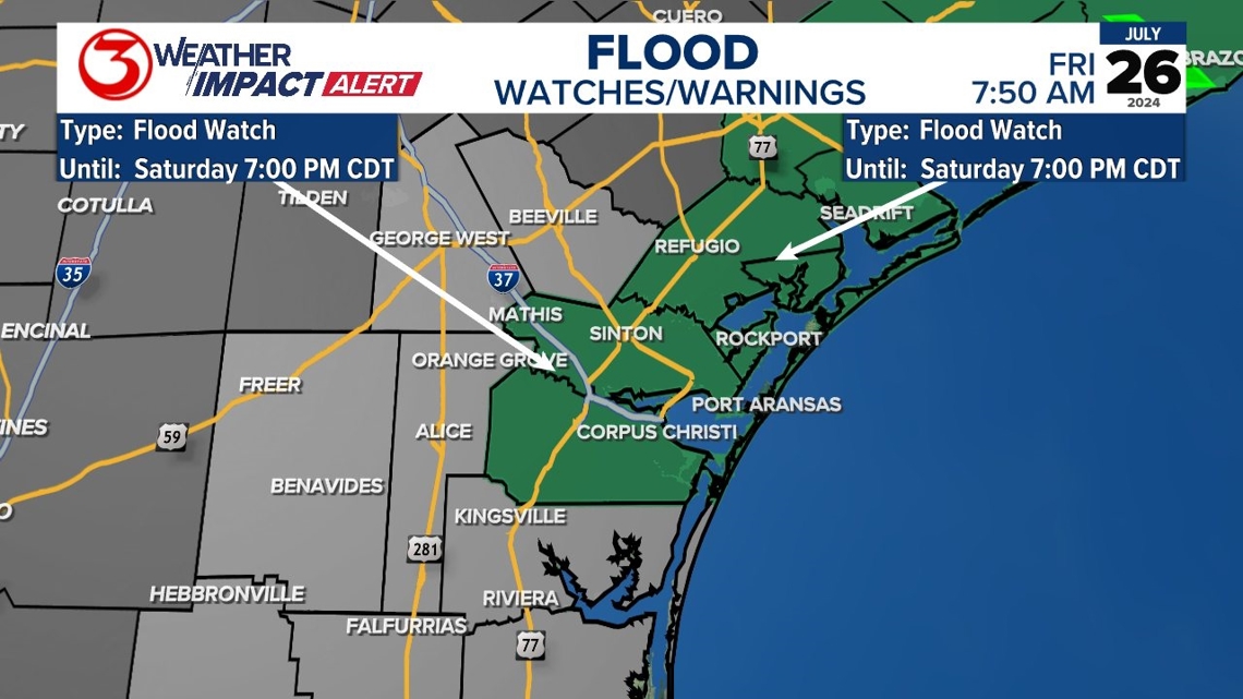
Flooding will happen much easier now that our soil is very saturated. A flood watch is in effect for Nueces, San Patricio, Refugio, and Aransas County through Saturday evening.

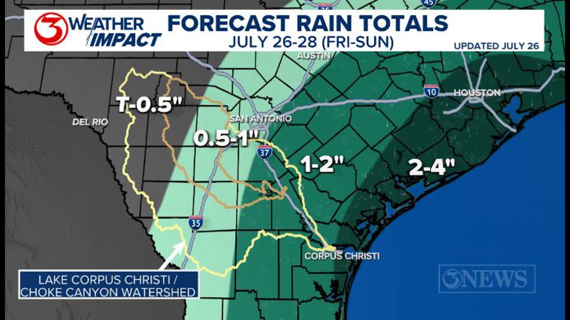
This area is likely to see up to four inches of additional rainfall. It will not rain all day, every day in every location. Some spots will get missed and may only get a little rain. There will be a random distribution through the weekend, with the trend for the most frequent rain near the coast.

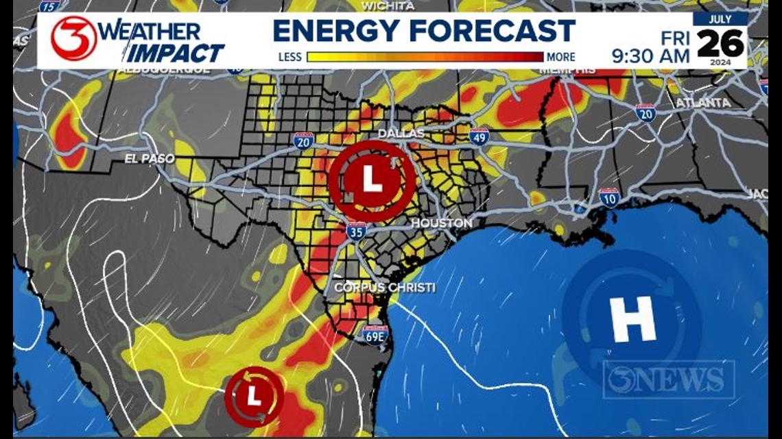
We remain in an unstable weather pattern through Sunday. Moisture is being brought out of the Pacific Ocean with an upper level low in Mexico, and the Gulf of Mexico thanks to high pressure over the water and the trough parked over the plains this week. The rain will periodically be heavy thanks to high levels of tropical moisture and shortwave pieces of energy moving around these low-pressure systems.

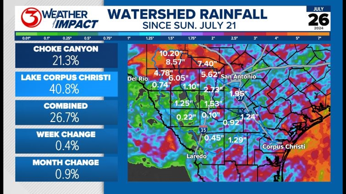
Lake levels have been steady or risen a small amount since we saw rain from Alberto in June. This rain event did bring high rainfall totals to the northern watershed. A lot of this rain will be soaked up by the drought-ridden soil. Some of the rain will make it downstream so we will likely continue to see a small rise into next week. Both the Nueces and the Frio River saw a rise upstream from Uvalde. Past Uvalde there has not been a rise yet. Most of the rain fell on Tuesday, so It has taken about 2-3 days to get to this point.

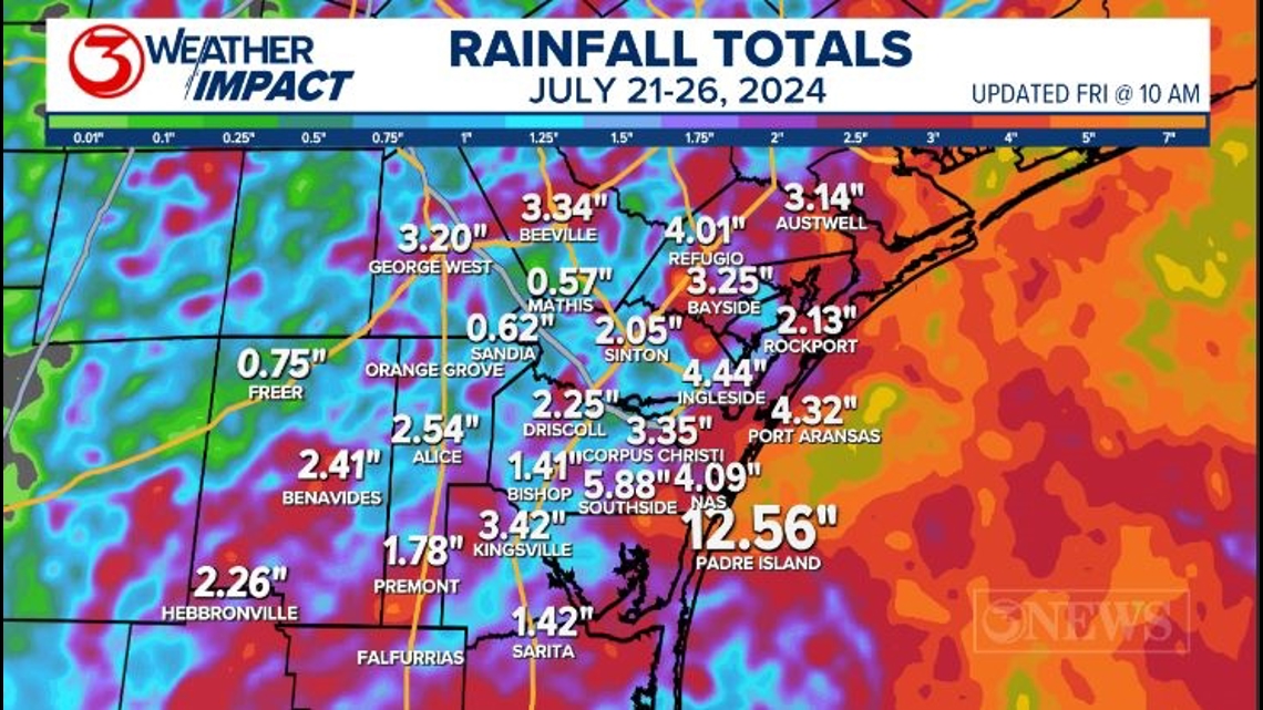
Locally Padre Island picked up the most rain with over a foot of rainfall this week. Most of that fell Thursday morning.

If you are curious what constitutes a Weather Impact Alert day, check our criteria here: What is a 3NEWS Weather Impact Alert?


