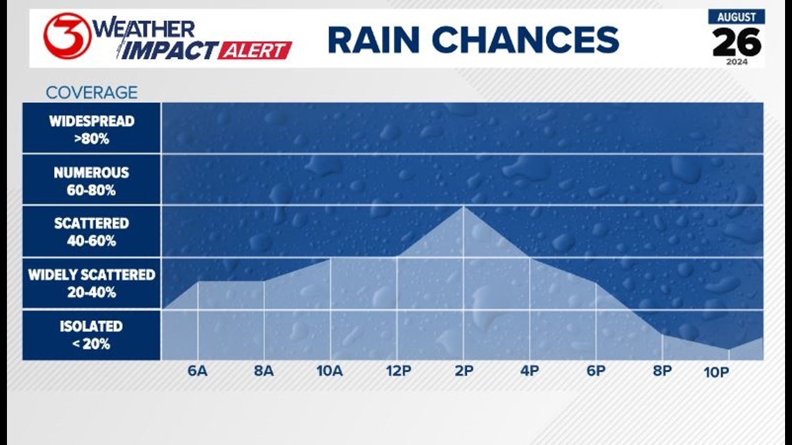
Today's 60% scattered rain chances meets our requirement to issue a Weather Impact Alert Day. This looks like the highest rain chances of the week, but we'll see rain chances other days as well.
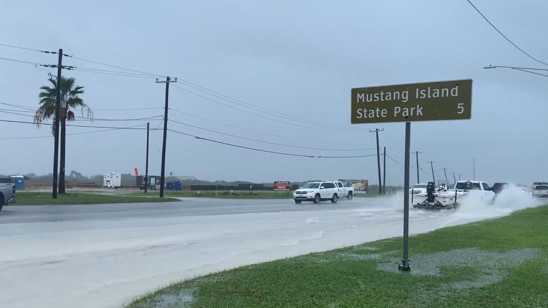
Make sure you're grabbing an umbrella on your way out the door, staying weather alert, and driving safe on wet roadways.

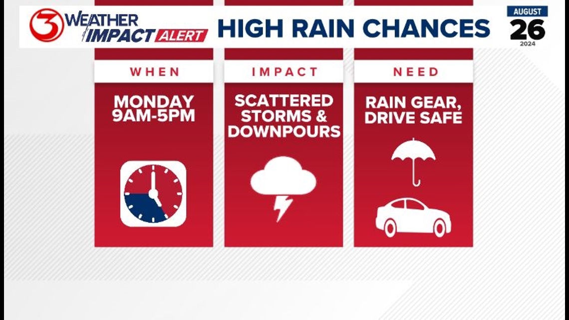
Scattered showers and storms pick up closer to lunchtime and persist through the early evening hours around 5pm. The off and on showers moving the region, will play a major role in dropping afternoon high temperatures into the low 90s and heat index values into the upper 90s and below 105. No heat advisories are expected this week as rain chances are possible everyday this week.

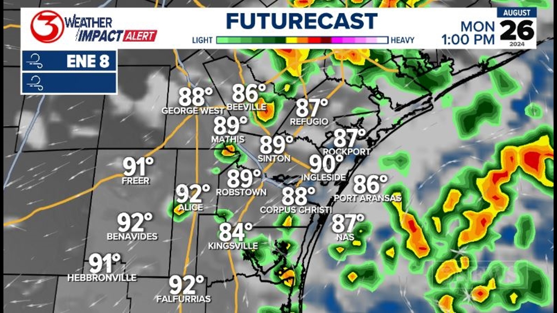
The main reason for the scattered rain chances is an upper-level disturbance combining with tons of moisture in the atmosphere. The energy will help to "squeeze out" the moisture, giving us the rain chances.


The highest rain chances will be midmorning through midafternoon as showers and storms move inland from the coast. The afternoon sea breeze will provide a boost in the rain chances, as well. Heading into the evening hours, rain will fizzle out until the chance for showers pick back up Tuesday morning.