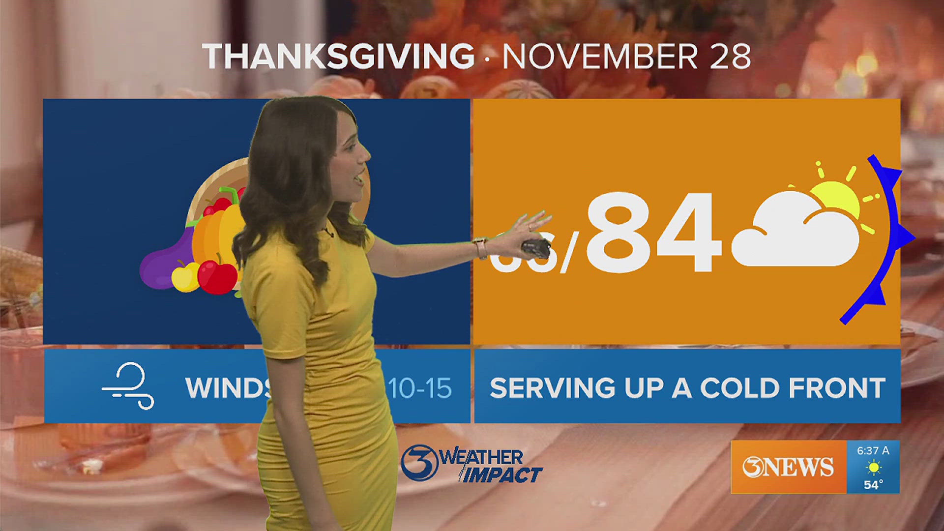
CORPUS CHRISTI, Texas — As we head into the cooler part of the year in South Texas, we know that the brunt of winter does not regularly show up in these parts terribly often and we typically have very few bouts of wintry weather, if any at all in a given year. However, the last few winters have seen some pretty chilly air spill southward; most notably the February freeze in 2021.
Since 2020, we've been in a la niña. La niña is part of the El Niño Southern Oscillation index and can give clues on trends in both the hot and cool times of year. We know that in the summer, la niña can encourage tropical development during hurricane season. La niña's trend in winter is to deliver warmer & drier weather compared to average to this part of the world. So, how/why have the last few winters been so cold at times?
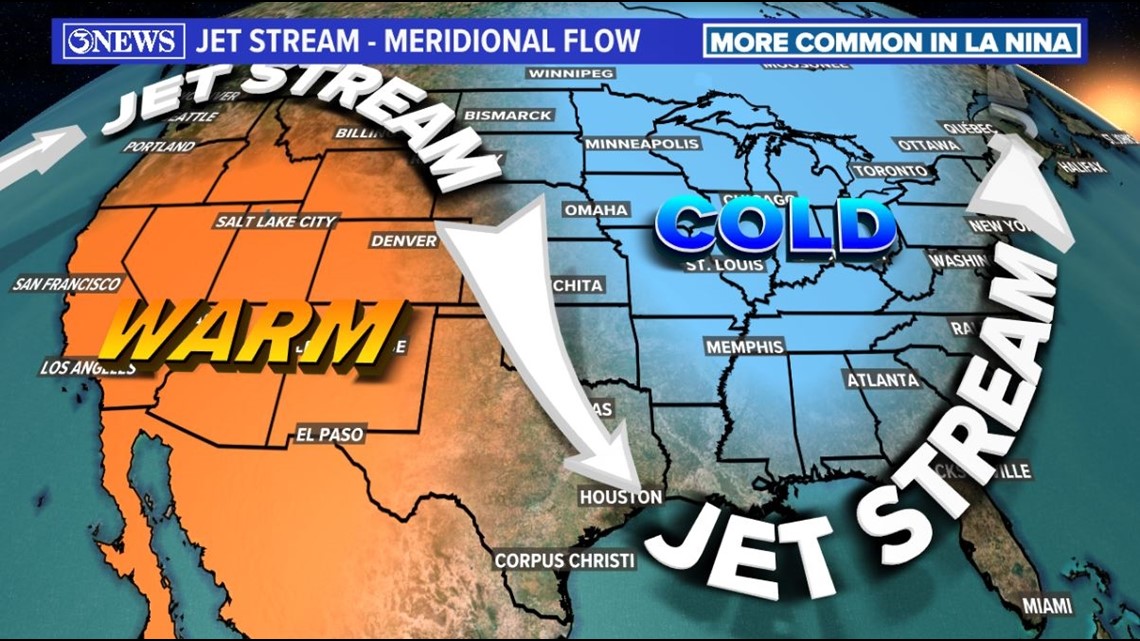
Well, la niña tends to yield a more active upper level wind pattern (jet stream). During la niña, the jet stream is often more wavy with more ups and downs embedded within the flow. This is referred to as meridional flow in the weather community. When we find ourselves under one of those downs (a trough), it can get cold in South Texas. Conversely, under a ridge it can get quite warm. The example below is an example of meridional flow.

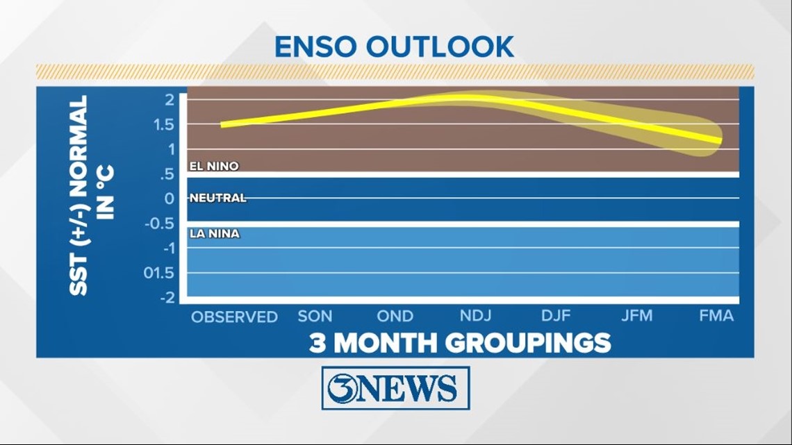
This year, we will be in an el niño for the first time since 2019. For much of the southern US, el niño's trend in the fall and winter is to bring cooler and wetter than average weather. It is my opinion that this can be mis-leading for two reasons.

- 'Than average' is often misinterpreted. In Corpus Christi, a cooler than average day could mean a high temperature of 65° in early January; the statistical coldest time of year (on average). When folks read 'cooler than average'...I feel that sometimes it is perceived as a 'bad winter' or extreme cold. Perspective is key here. 'Cooler than average' is with respect to that location's average. Corpus Christi's lowest average high and low temperature comes in early January at 67°/48°. Anything below that means colder than average. Would you think a high of 60° and a low of 40° is brutally cold?
- It does not imply winter weather is coming to South Texas, but above average precipitation should be expected for the fall and winter months. Precipitation in South Texas almost always comes in the form of rain. Of course, there are a few exceptions - the 2004 Christmas Eve snow and the snow in December of 2017.

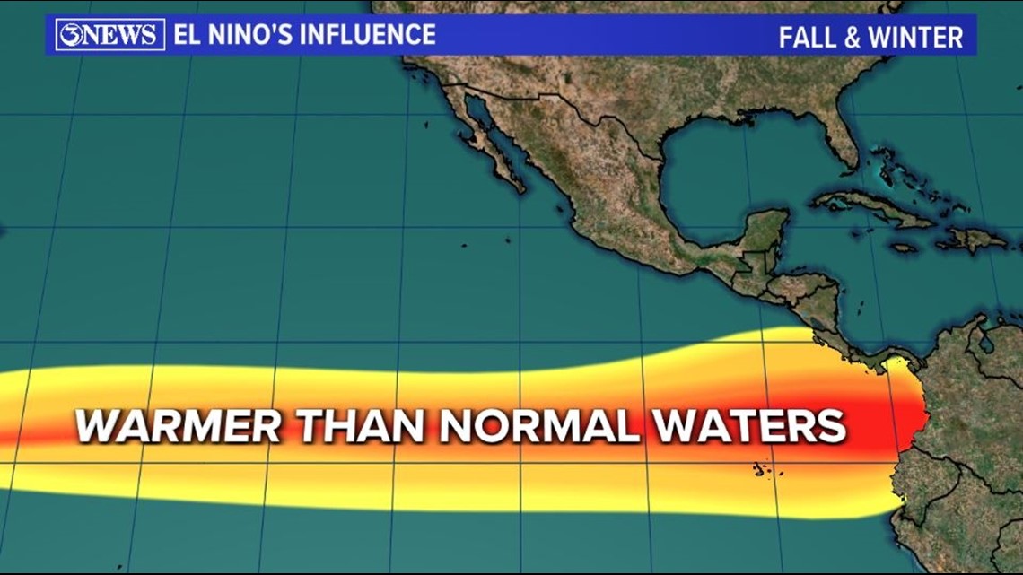
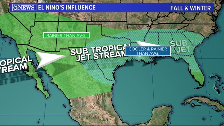
What makes it 'wetter than average' during an el niño in South Texas? The answer is above us. The sub-tropical jet stream is more active over the Southern US during an el niño. Equatorial Eastern Pacific waters are warmer than normal and the sub-tropical jet is more enhanced. This flow often streams in right over the top of Texas and within that flow is a lot of moisture.


With the sub-tropical jet stream overhead, a bi-product of it is cloud coverage. When clouds are overhead, you tend to get less sun, which means a cooler day. Makes sense, right? What falls from clouds? Rain! There are more opportunities for rain in South Texas with a tap of moisture streaming in from the Pacific more regularly. So, cooler & wetter....than average...

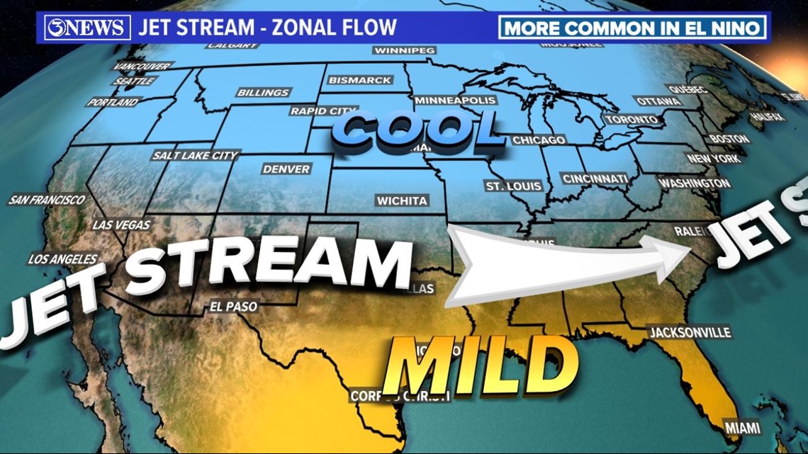
I find myself believing it is more difficult to get wintry precip this far south during an el niño. This thinking is because jet stream winds during an el niño tend to be more flat (zonal flow...example above) than the la niña counterpart. With a more west to east flow (rather than north to south), it can be harder to tap into that EXTREME cold to our north that we have felt the last few winters. Of course, there are exceptions...we are talking trends here.
In summary, while it is likely that we have a cooler and wetter winter ahead, thanks to el niño, it does not mean or guarantee arctic air or wintry weather in South Texas. It's the increased cloud coverage with Pacific flow streaming in over head that leads to the cooler temperatures, on average. From those clouds, more opportunity for rain also comes, leading to wetter than normal conditions, on average.
Holt out

