CORPUS CHRISTI, Texas — Editor's note: This tropical update blog has been retired and will no longer be updated. Click here for the active tropical update blog.
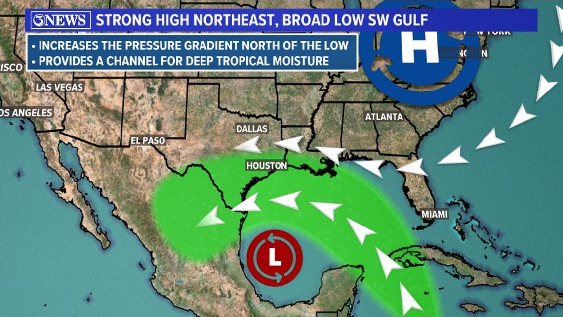
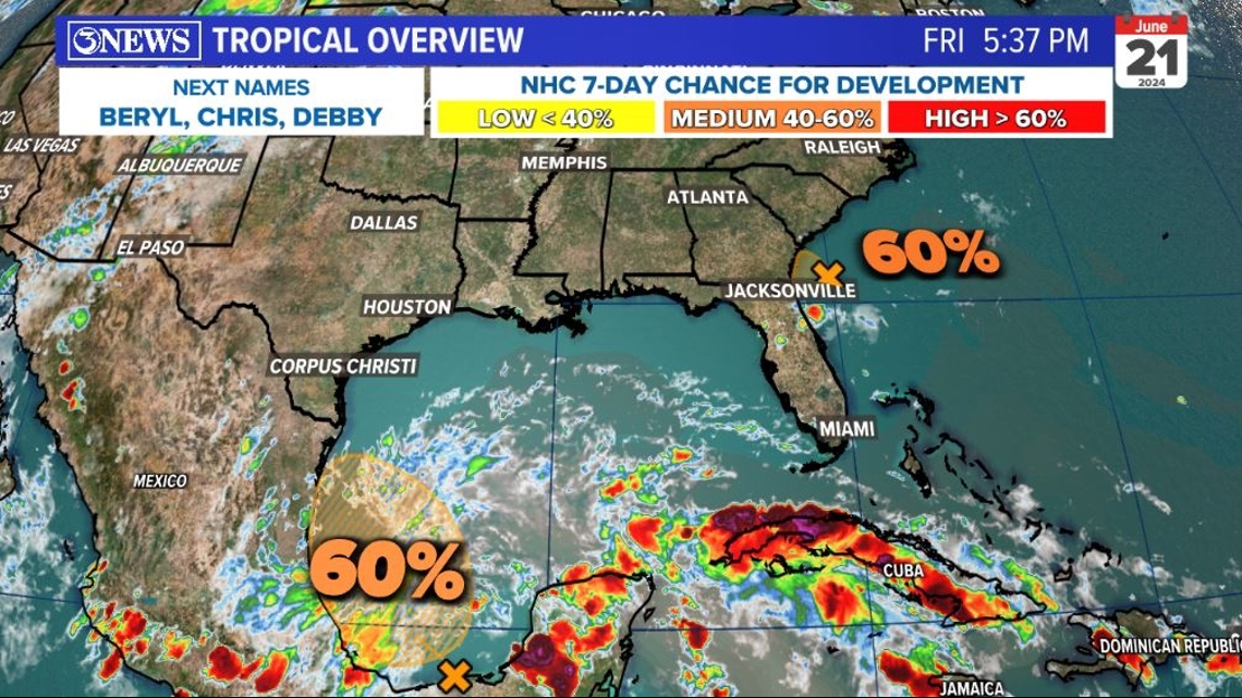
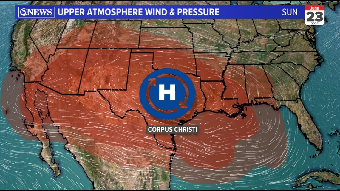
The National Hurricane Center is marking two different areas for a 60% chance for development over the weekend. The feature of the SE US Coast is a non-issue for Texas. The tropical disturbance in the SW Gulf will have no where near the impact Alberto did earlier in the week. It will primarily offer the region a chance for a ew showers.

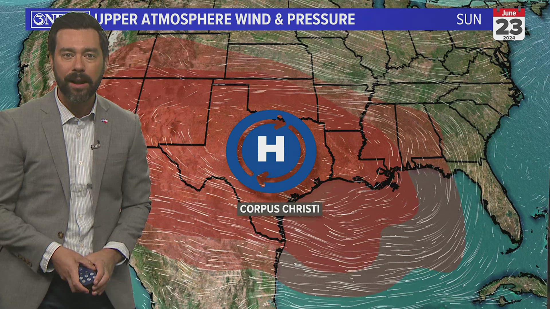
High pressure will build in over Texas over the weekend. It'll buffer Texas from any wind, surge, or flooding from this development, no matter what it's eventually called. The valley could pick up a few inches of rain, but I do not see that much spreading this far north.

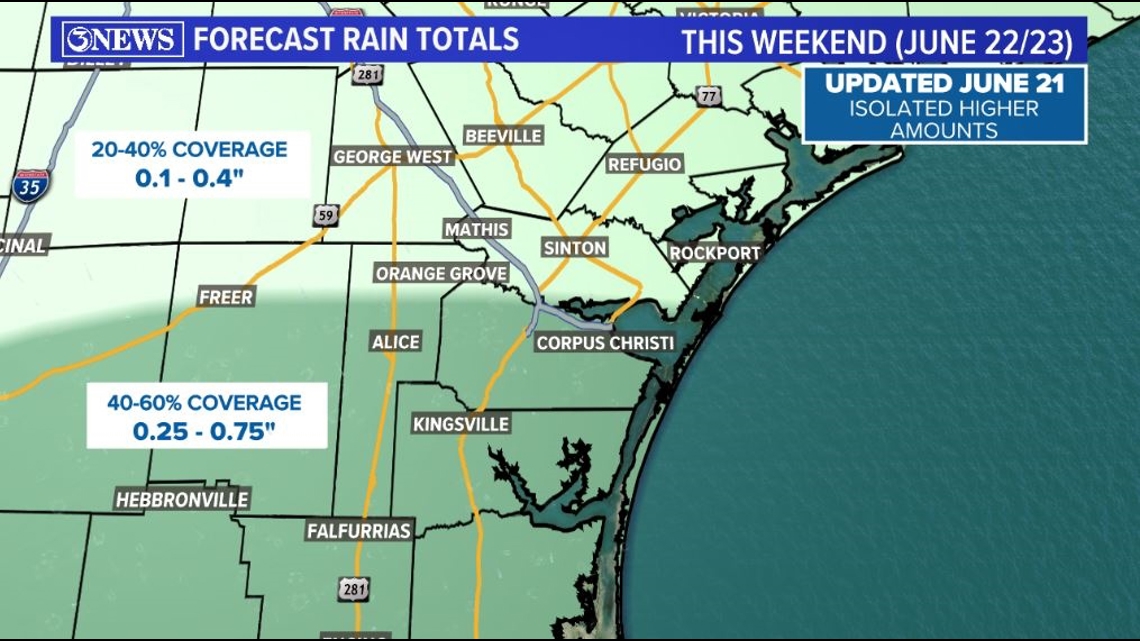
In the Coastal Bend, scattered showers with a quarter to three quarters of an inch will be possible south of the HWY 44 Corridor. North of that, lower coverage and forecast totals.

At the beach, there will still be some minor coastal flooding in the morning with high tide Saturday and Sunday. However, the flooding will not be because of the disturbance to our south. It will be because of the increased gravitational effect from the full moon happening Friday.

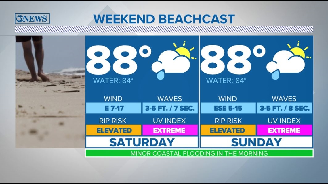
Waves will be between 3 and 5 feet with a 7 to 8 second period on gulf facing beaches this weekend. There will still be an elevated rip current risk with those longer period swells coming in. Water temperatures dropped a handful of degrees post-Alberto; now in the middle 80s.
Holt out
We talk about the risk of high surf and dangerous rip currents even when a storm is hundreds of miles away in the 2024 KIII Hurricane Special, you can watch it (or re-watch) it here! The special includes topics like evacuations, hurricane kits, and rip currents - on top of information like the tropical outlook and new data on hurricane-related fatalities. You don't want to miss it!
For more on our local weather, head on over to our forecast post.
_______________________________________________________________
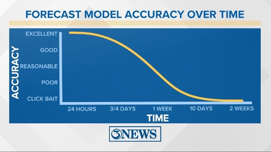
Remember to not "anchor" to the first forecast you see - forecasts change. Also, rely on a credible source for your tropical information and forecasts.

-------------------------------------------------------------
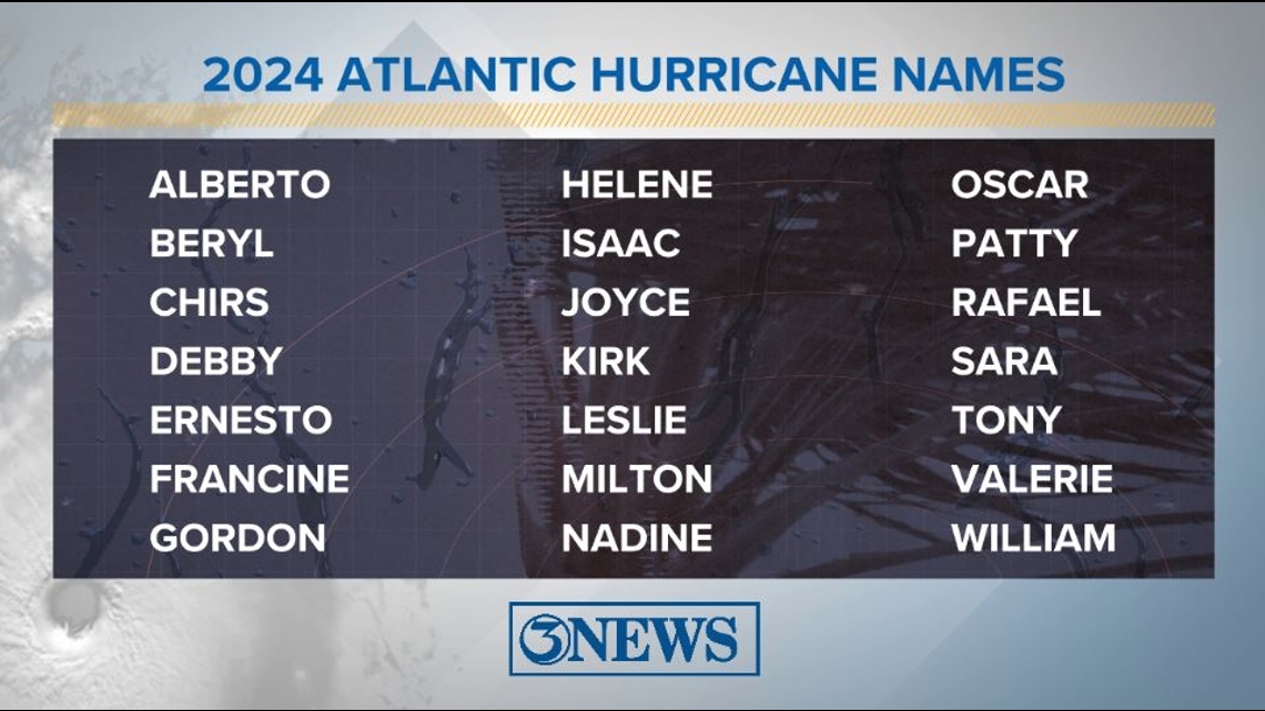
2024 Atlantic Tropical Cyclone Names

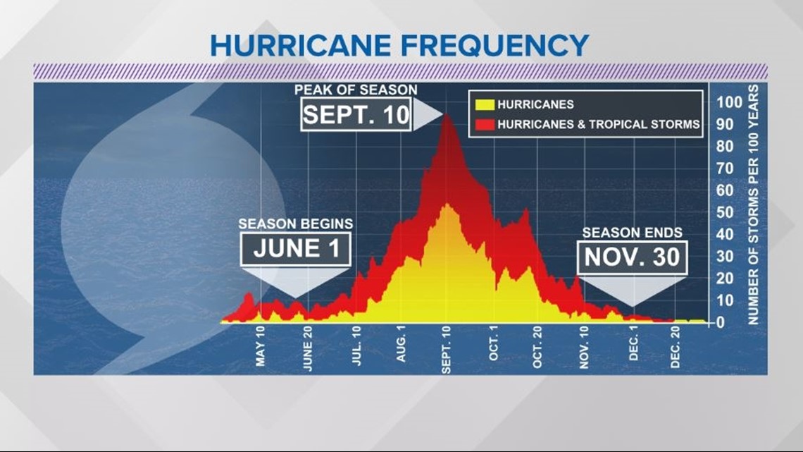
The Atlantic Hurricane Season runs from June 1 to November 30, with the peak of the climatological peak of the season happening on September 10.

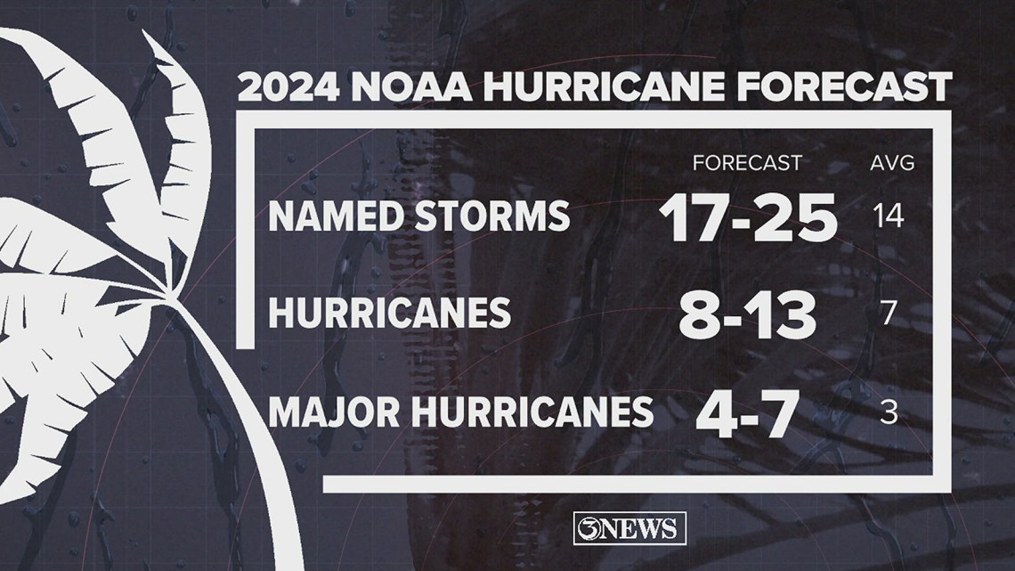
On May 23, NOAA released their forecast for the 2024 Atlantic Hurricane Season. They're predicting an above-average year, with 17-25 named storms. This is the highest pre-season forecast they've ever issued.
The high number of storms forecast is due to near-record sea surface temperatures and the return of La Nina, both of which favor tropical cyclone development. We talk more about those in our Hurricane Special, which you can watch here!