CORPUS CHRISTI, Texas — Editor's note: This tropical update has been retired, click here for the latest version.
The National Hurricane Center is now flagging an area of possible development in the SW Atlantic or Northern Caribbean Sea for a 20% chance to develop over the next 7 days.

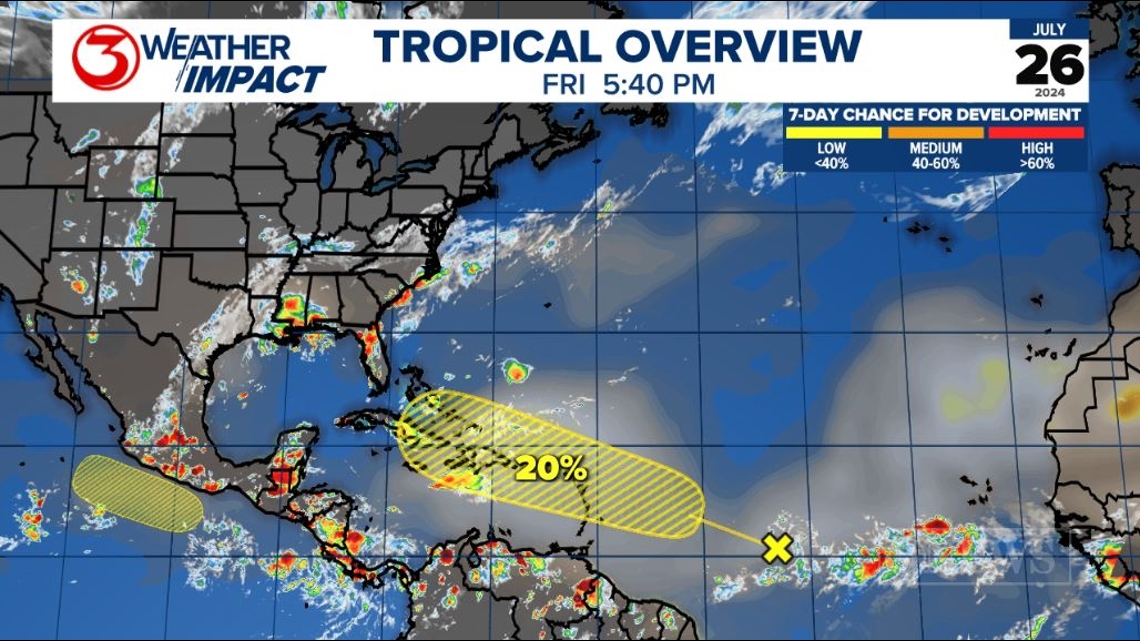
The feature in question has a lot of Saharan Dust ahead of it, meaning the environment does not look the most pristine for development - lots of dry air.
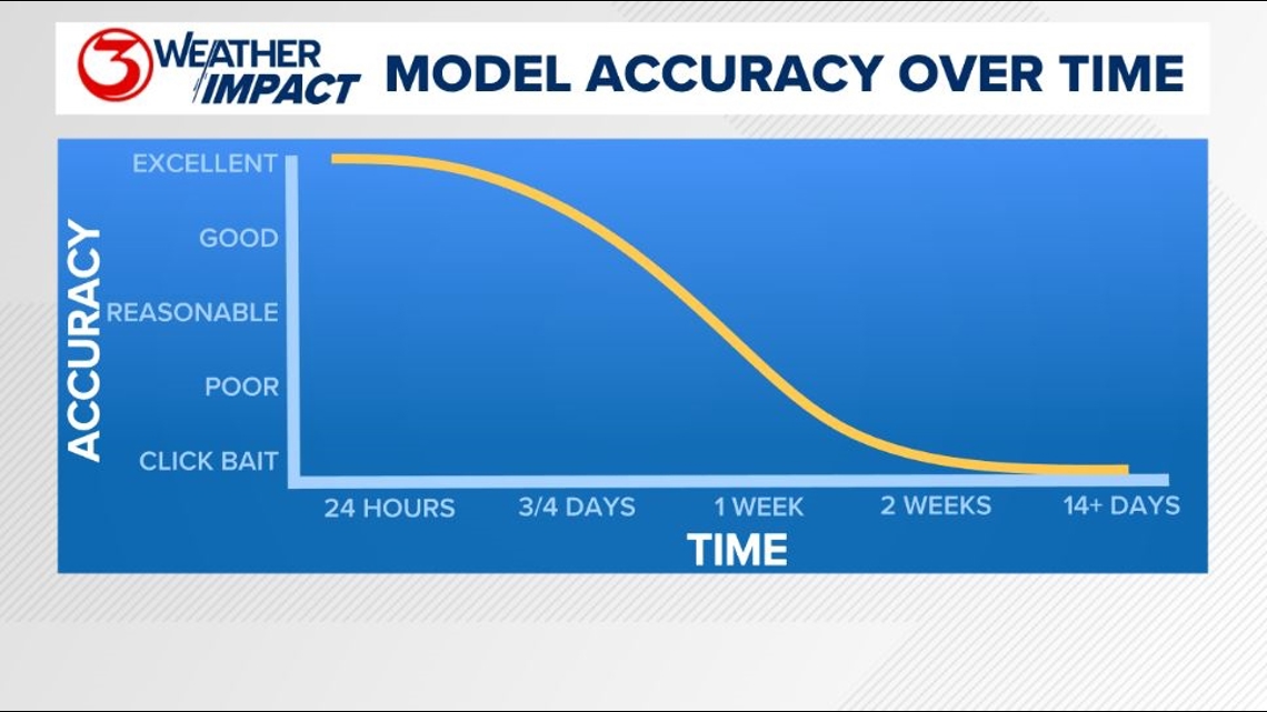
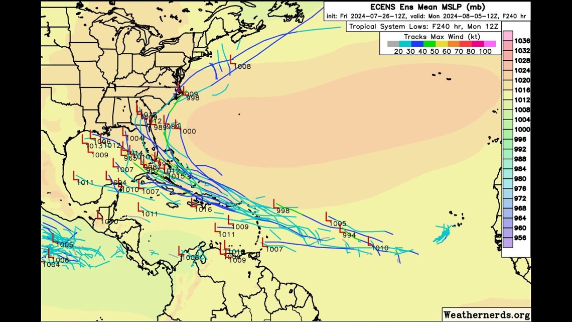
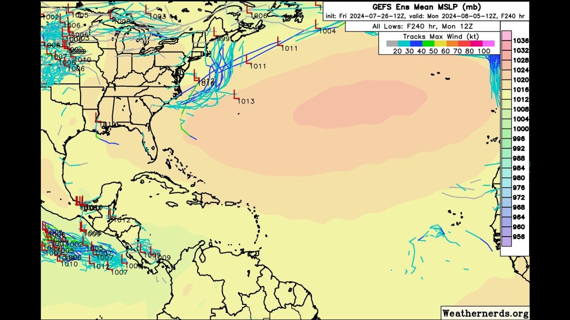
Longer range forecast modeling is split on the eventual outcome of this feature. The European is more insistent on something developing and moving toward the Gulf or up the SW Atlantic. The GFS shows nothing at all. Not a ton of confidence either way at this point. For Texas, this is something to watch, not worry about at this time.
If it were to track toward the gulf, rather than north into the Atlantic, it wouldn't be until August 3, 4, or 5 time frame.


Holt out
For more on the Coastal Bend weather, head on over to our forecast post.
This season is expected to be an active hurricane season. Check out the 2024 KIII Hurricane Special - you can watch it (or re-watch) it here! The special includes topics like evacuations, hurricane kits, and rip currents - on top of information like the tropical outlook and new data on hurricane-related fatalities. You don't want to miss it!
-------------------------------------------------------------
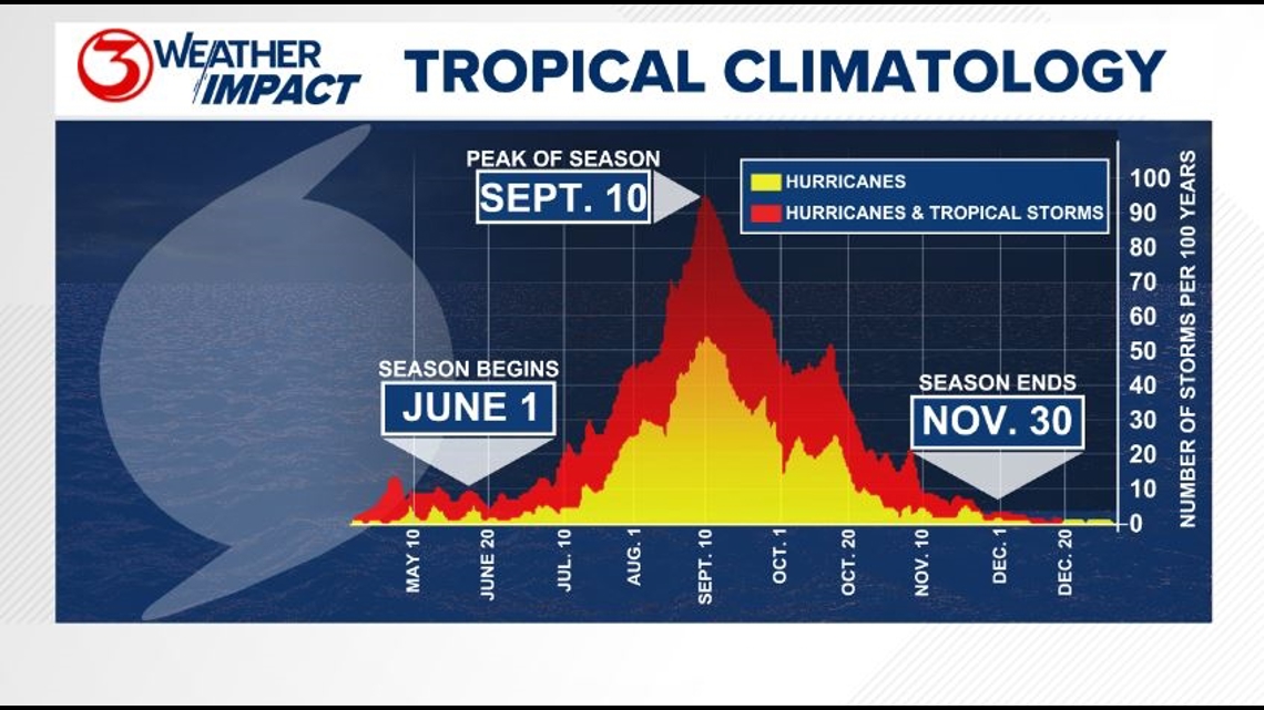
The Atlantic Hurricane Season runs from June 1 to November 30, with the peak of the climatological peak of the season happening on September 10.

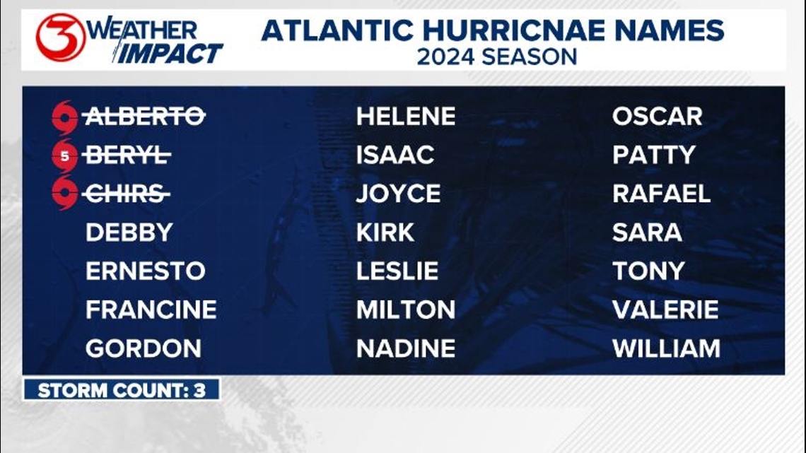
Here are the names for the 2024 Atlantic Hurricane Season. Names are given to tropical cyclones (tropical storms and hurricanes).

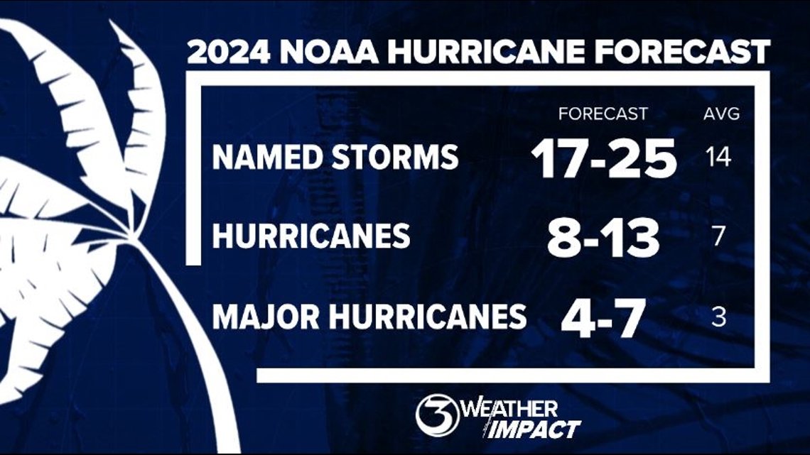
On May 23, NOAA released their forecast for the 2024 Atlantic Hurricane Season. They're predicting an above-average year, with 17-25 named storms. This is the highest pre-season forecast they've ever issued.
The high number of storms forecast is due to near-record sea surface temperatures and the return of La Nina, both of which favor tropical cyclone development. We talk more about those in our Hurricane Special, which you can watch here!

Remember to not "anchor" to the first forecast you see - forecasts change. Also, rely on a credible source for your tropical information and forecasts.

