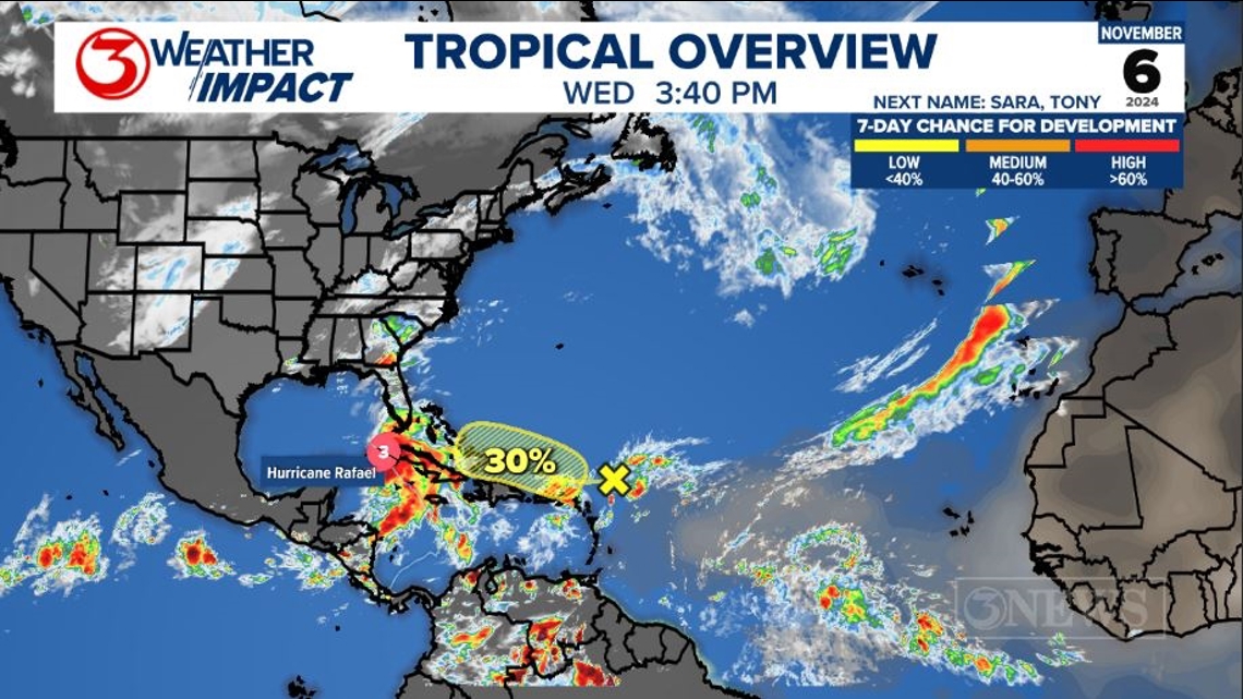
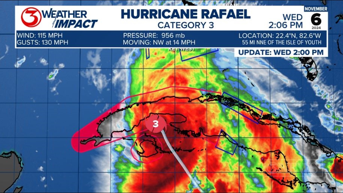
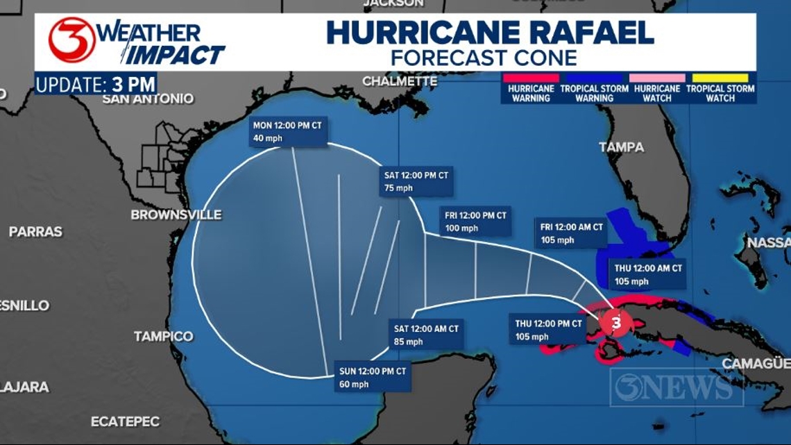
CORPUS CHRISTI, Texas — Hurricane Rafael is the primary feature on the board, making landfall in Cuba this afternoon as a category 3 hurricane. The National Hurricane Center is also flagging an area of interest in the Southwest Atlantic, but we will be focusing on Rafael.
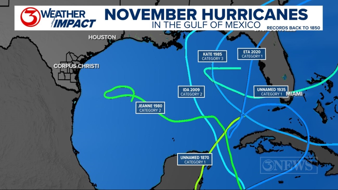
Rafael will enter the Southeastern Gulf of Mexico as a hurricane Wednesday night and into Thursday. This will make Rafael the 7th hurricane to be in the Gulf of Mexico during the month of November. Records date back to 1850.
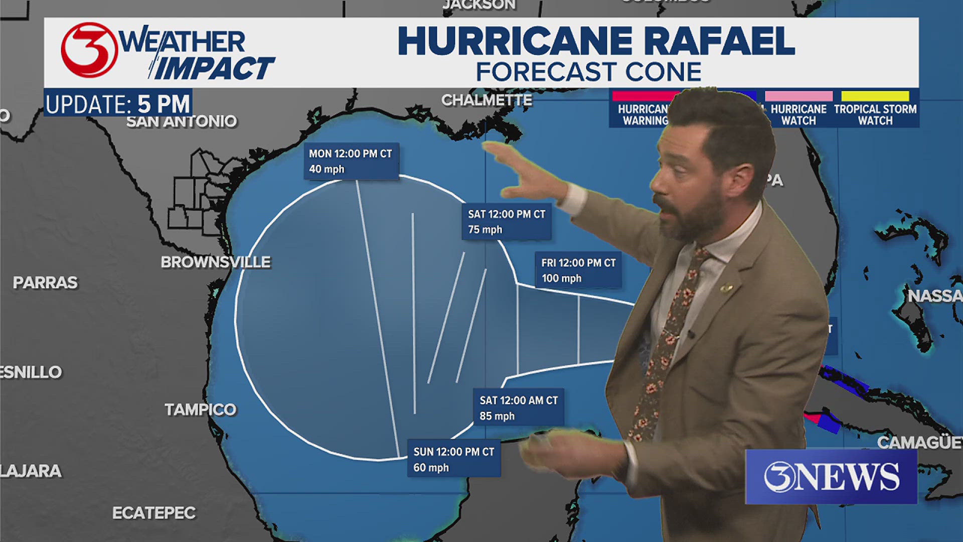
As Rafael moves westward, the storm will weaken as it enters an increasingly less favorable environment in the Gulf of Mexico. The current forecast cone weakens Rafael to a low-end tropical storm with 40 mph winds by Monday afternoon, somewhere in the Western Gulf of Mexico.



Note how circular the forecast cone is by Monday. That represents low confidence in the outlook at that time. Let's unpack...

First, the weakening part of the forecast. While water temperatures are still in the lower 80s in most of the Gulf of Mexico, wind shear will be present; especially in the NW Gulf this weekend. Wind shear is a variable that lowers a tropical system's ability to organize or stay strong when a tropical system moves into an area of high wind shear.

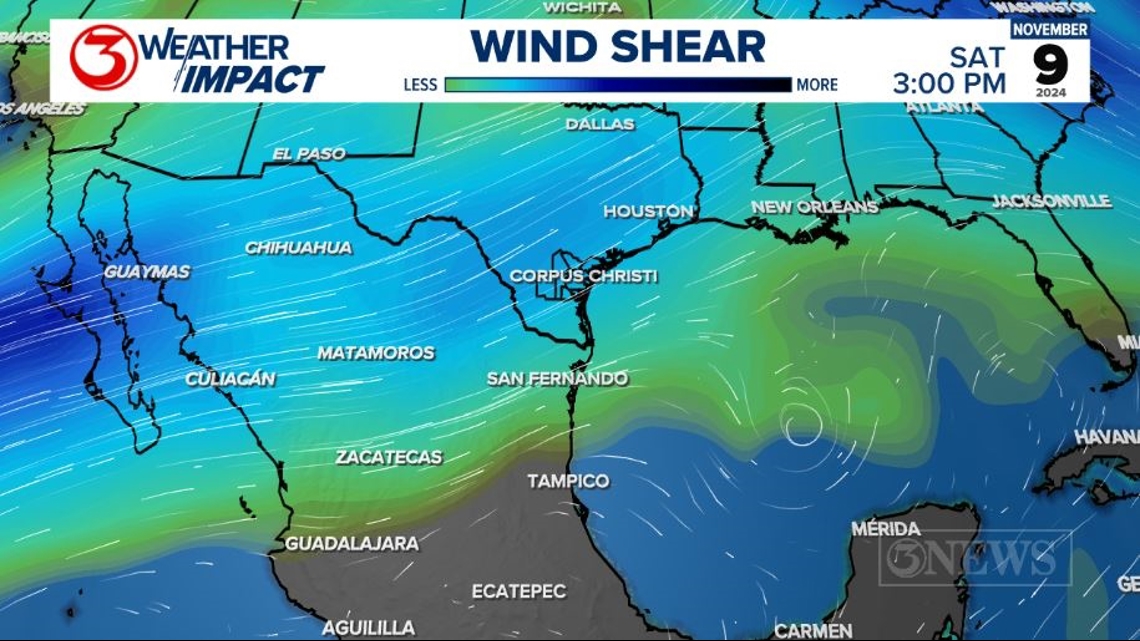
The elevated wind shear will be thanks to a weak cold front/dip in the jet stream. That cold front will move through South Texas on Saturday morning, helping to buffer the area from this system.

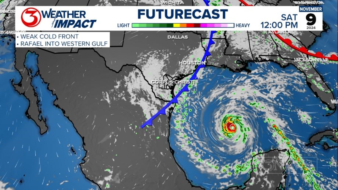
With respect to track, Rafael will likely start to run into this weak front in the Western Gulf late weekend/early next week. Forecast models had been split on whether or not Rafael would turn north, toward the Northern Gulf Coast, or continue west/south, toward Mexico.
I am starting to lean toward the west/south solution over the weekend and early next week. The reasoning has to do with high pressure in Northern Mexico sliding over South Texas early next week. That placement will guide Rafael south/west, toward Mexico early next week.

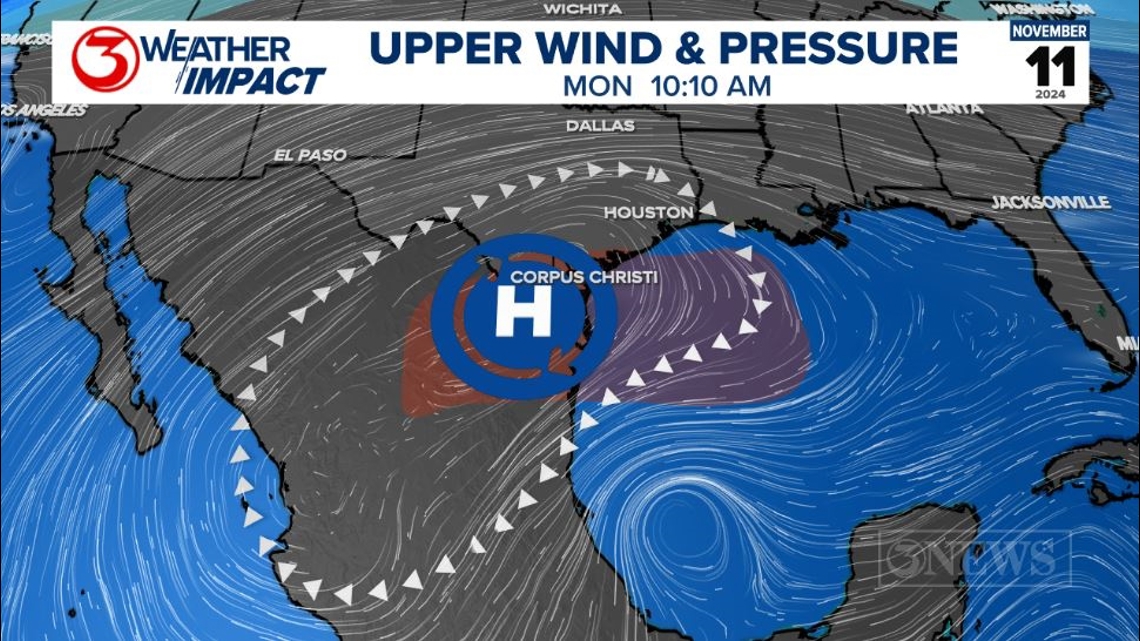
The scenario laid out above is still 5+ days away, so there is still plenty of time for adjustments and we will make them as needed with respect to the forecast. Even if Rafael comes directly toward the Coastal Bend, the storm would have to contend with abundant shear and the stalled frontal boundary.
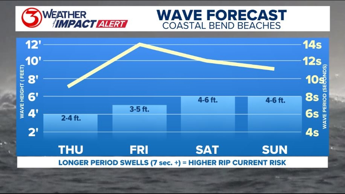
There will be elevated surf coming to Coastal Bend beaches, regardless of what Rafael does. That is of high confidence. Waves will pick up to between 4 and 6 ft. over the weekend with wave periods nearing 15 seconds by Friday. Those longer period swells will elevated the rip current risk on Coastal Bend beaches through the weekend. Swimmers beware.

Holt out

