
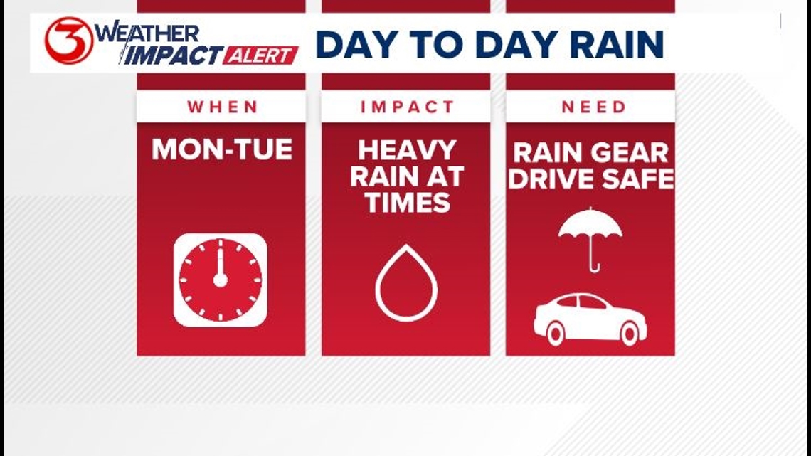
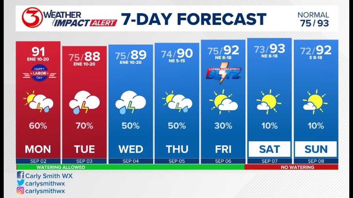
Hit-and-miss showers and thunderstorms continue in the Coastal Bend this week. I went ahead and added the Weather Impact Alert for Monday and Tuesday. We may extend the alert for Wednesday and Thursday. Most of the rain will be near the coast,.The alert may underproduce today, but since it's a holiday, and many people may have fishing or a beach day in their plans it will be very important to keep an eye on the sky and the radar today. Remember when thunder roars head indoors. Periods of heavy rainfall may lead to temporary street flooding where slower-moving storms set up.

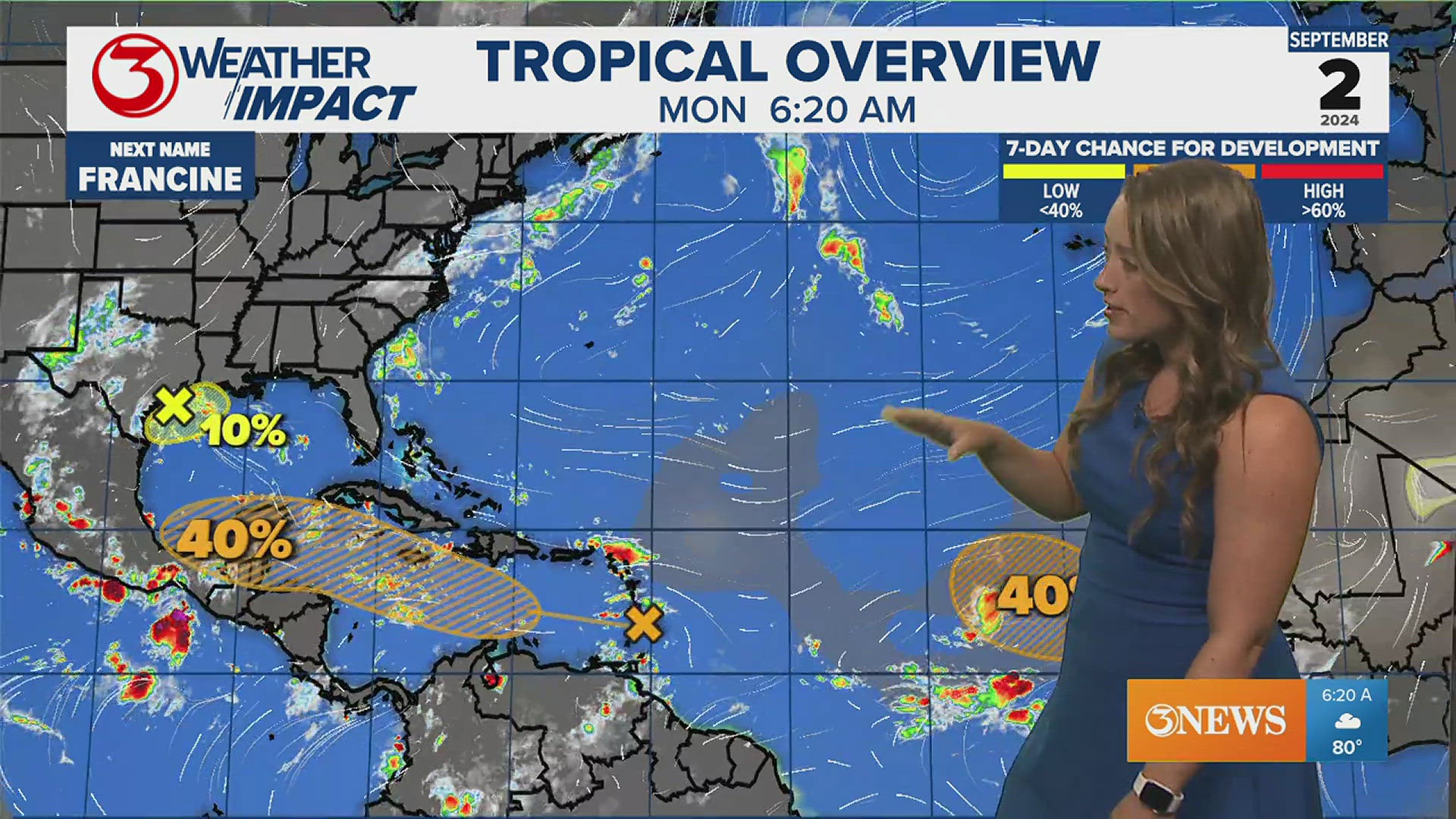
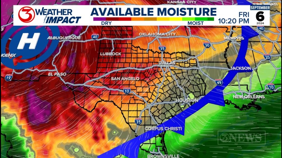
This soggy pattern is thanks in part to a weak low-pressure trough off the coast in the Gulf of Mexico. There is a low chance of tropical development possible with this feature. It may strengthen a little bit, but a named storm is not expected. Click here for our latest tropical forecast update.
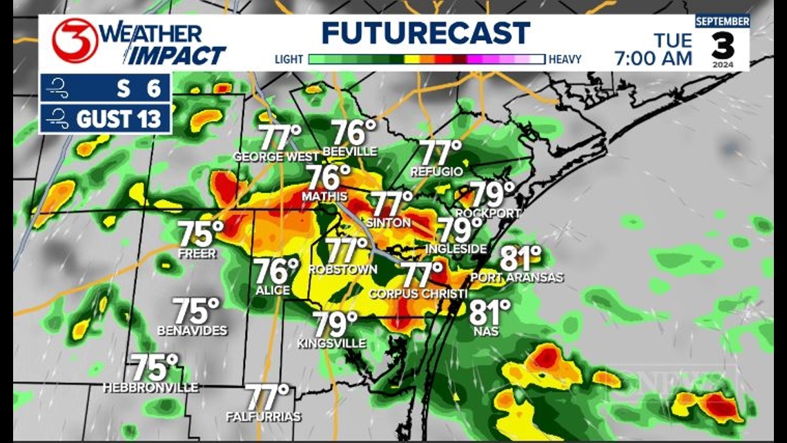
On Tuesday this trough will meander offshore, but the forecast has it drifting a bit to the south of the Coastal Bend Tuesday and then it drifts into the Valley by Wednesday. Once it's to our south that should lead to more rainfall for us especially on Tuesday.

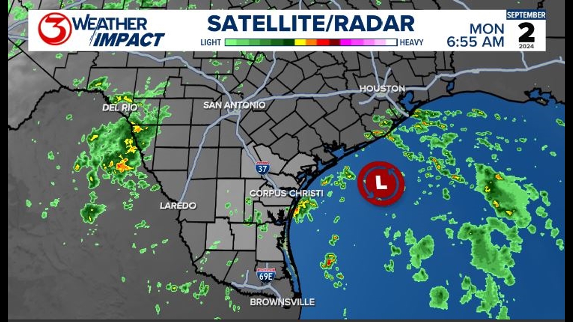
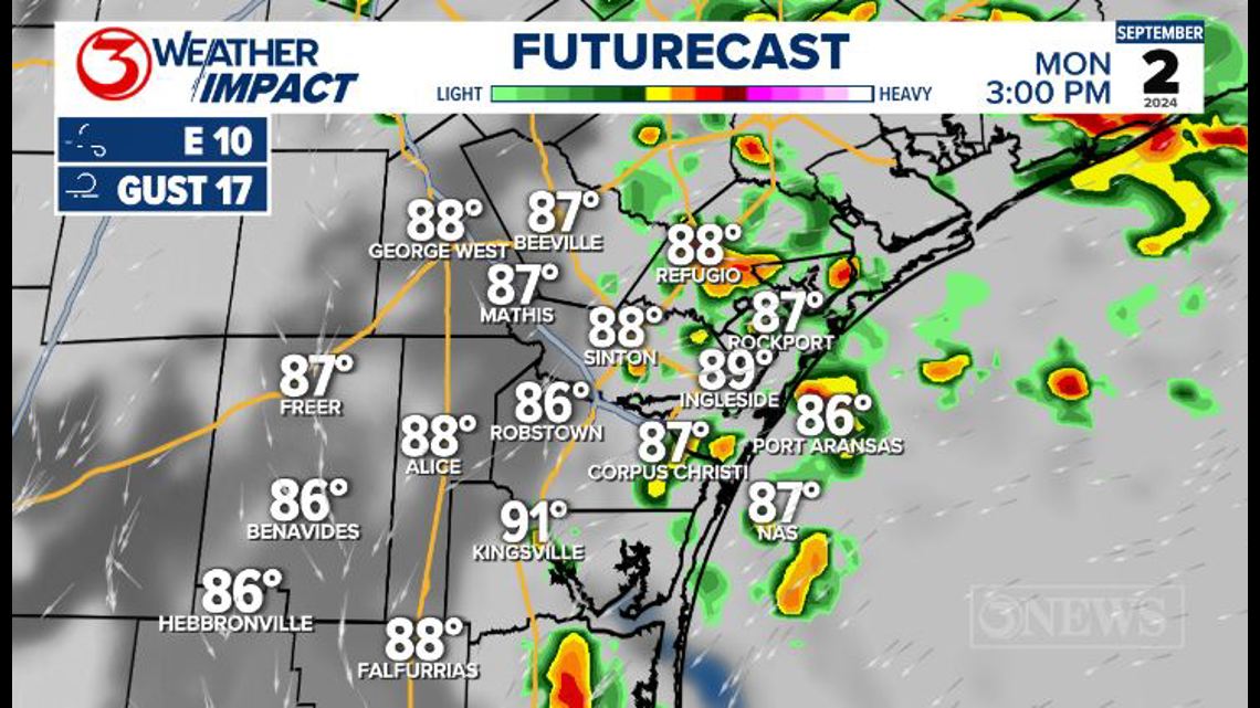
A large thunderstorm cluster drifted south, southwest around the low and onto Padre Island National Seashore this morning. There is a new moon, so the tide may be a little higher than anticipated, but I am not expecting coastal flooding. Showers and thunderstorms will make the beach wet throughout the day. Wind will be northeast and shift east northeast 10-20 mph with gusts up to 25 mph.

Convection will continue off and on today. Rainfall isn't overall impressive today, but areas from Port Aransas to Kingsville have the best chance to see over half an inch of rain today. Expect storms mostly for the island and offshore much of the morning, coastal locations around noon and into the early afternoon, and then more activity for the Brush Country late afternoon and into the early evening.

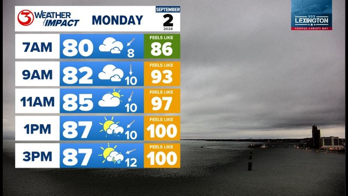
Coverage is still only around 50% this afternoon, but may be active when people are traveling, or running errands to prepare for the week ahead. The most impactful rain looks to come Tuesday morning.

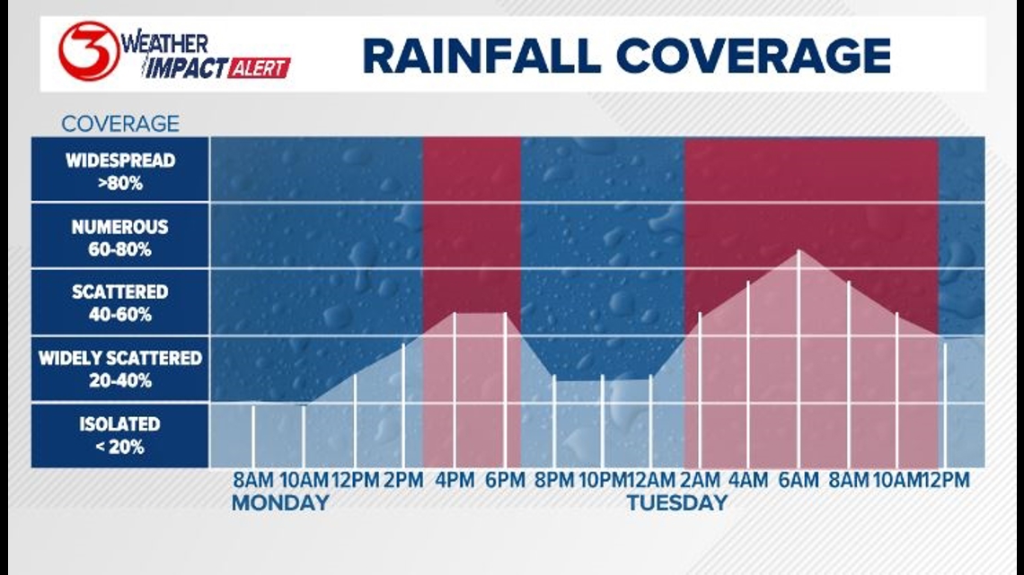
Rain is looking likely for the morning commute on Tuesday. Consider having the rain gear handy. Have a plan for kids waiting outside for the bus, or walking to school. If there is thunder it is best to limit time outside.

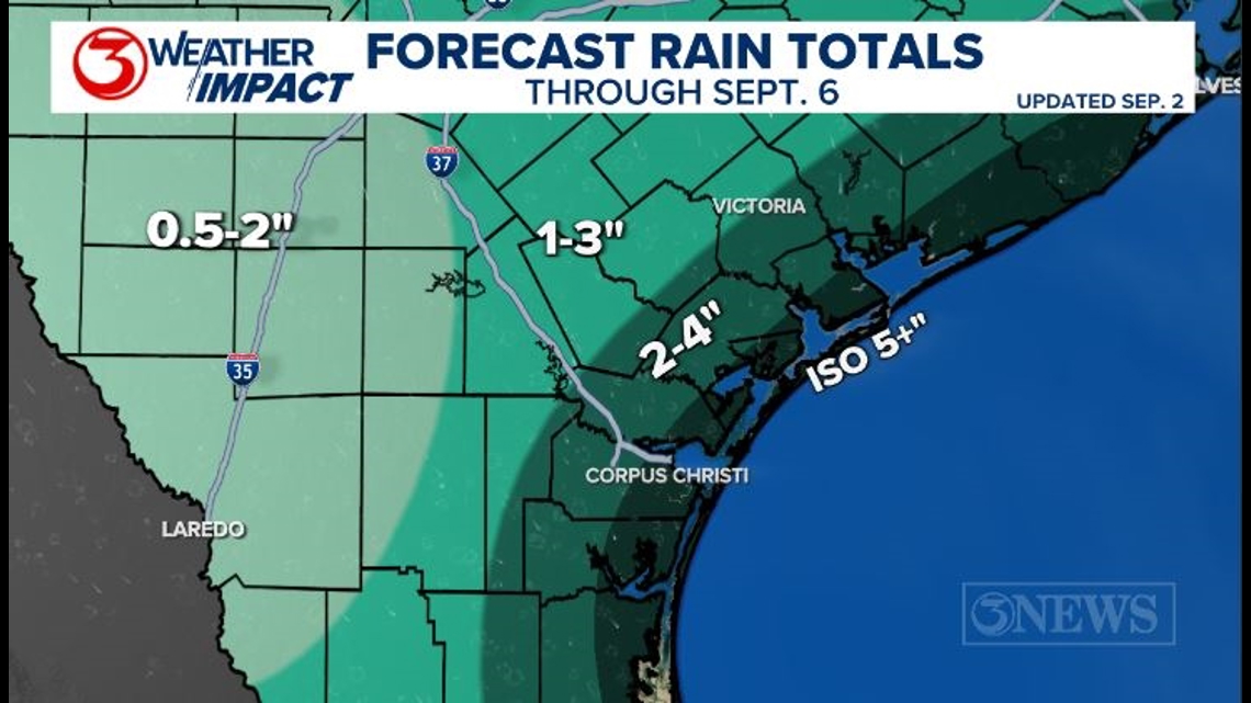
The Impact Weather Alert may continue through Thursday as we stay in an unsettled pattern. The low will continue to meander off our coast. Rainfall totals will likely be highest near the coast with some locations topping out over five inches before the week is all said and done.

The rain will come to an end as a weak cold front sweeps through the area. Yes, there is a cold front. The exact timing of the cold front may change a bit, but overall it looks like it will be responsible for drying us out and bring sunshine back to the coastal bend.

Since this front will do more to the dew point than the air temperature, you will notice a little bit less humidity, less rain, and cooler overnight lows. Afternoon high temperatures may actually be a few degrees warmer thanks to more sunshine.

TROPICAL UPDATE: Click here for our latest tropical forecast update.
Also, if you missed our 2024 KIII Hurricane Special, watch it (or re-watch it!) here. The special includes topics like evacuations, hurricane kits, and rip currents - on top of information like the tropical outlook and new data on hurricane-related fatalities.