CORPUS CHRISTI, Texas — Low-lying areas and streets are flooded across much of eastern San Patricio and Aransas County this morning. Heavy rainfall overnight produced over 8 inches of rain for Aransas Pass and Ingleside.

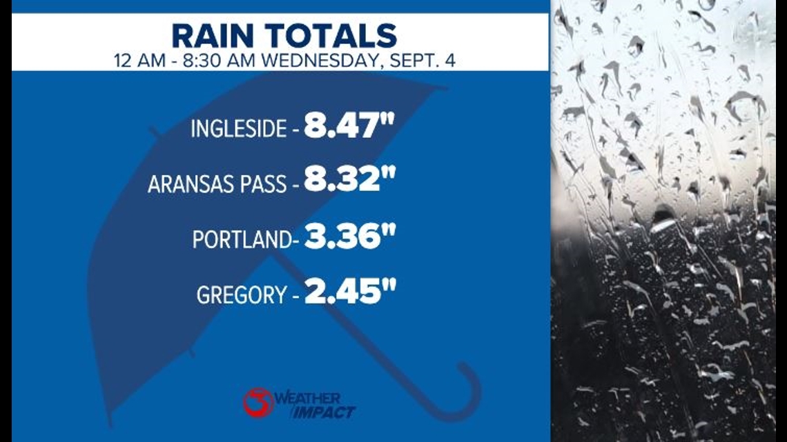
Flooded streets have made it difficult to drive in Aransas Pass. Over eight inches of rain will be hard on any drainage system.
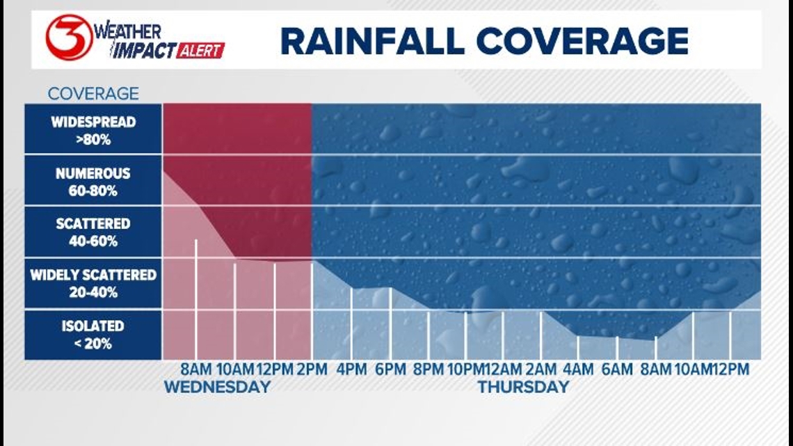
The main timeline for the Weather Impact Alert was for this morning when we saw the most rainfall. For the rest of the day showers will remain widely scattered across the region with a higher concentration still possible near the coast.

The uncertainty in the forecast and exact rainfall totals for the rest of the day has to do with the fact that the low pressure off the coast is still wobbling. There is not a clear steering current. A lot of guidance suggests it will move back east before being pushed south by the cold front. The farther east the low moves the less rain we will see the rest of the week. This morning the low was just onshore near Port Mansfield. That position is what delivered us the most rainfall.

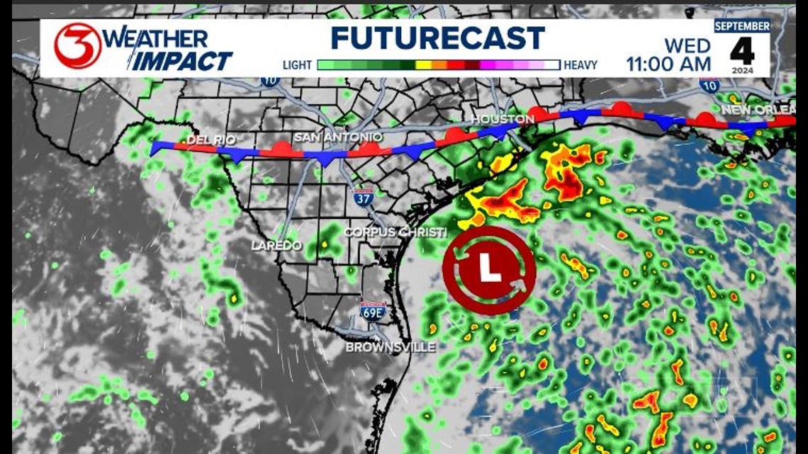
Flooding will remain a concern. Continue to watch for ponding on the roads with any rain that fall through Friday. Heavy downpours will still limit visibility at times. The coverage across the coastal bend is trending down, but any storm that does develop can still have a high impact. An additional inch of rain is possible with two inches possible near the coast.


This is because the soil is already saturated from the rainfall we have seen. Corpus Christi saw the highest amount of rain for the week so far with more than two inches falling since midnight.

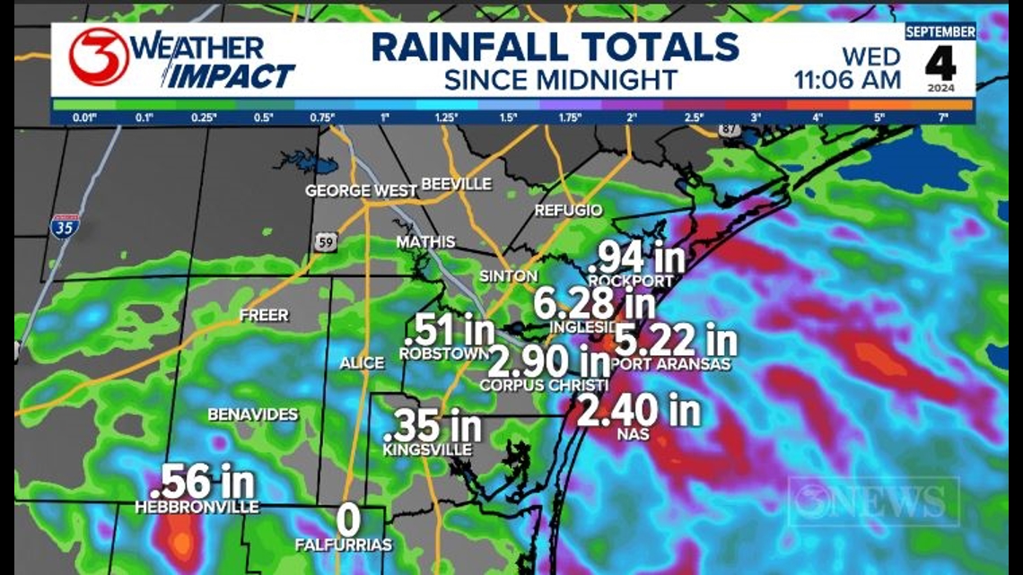
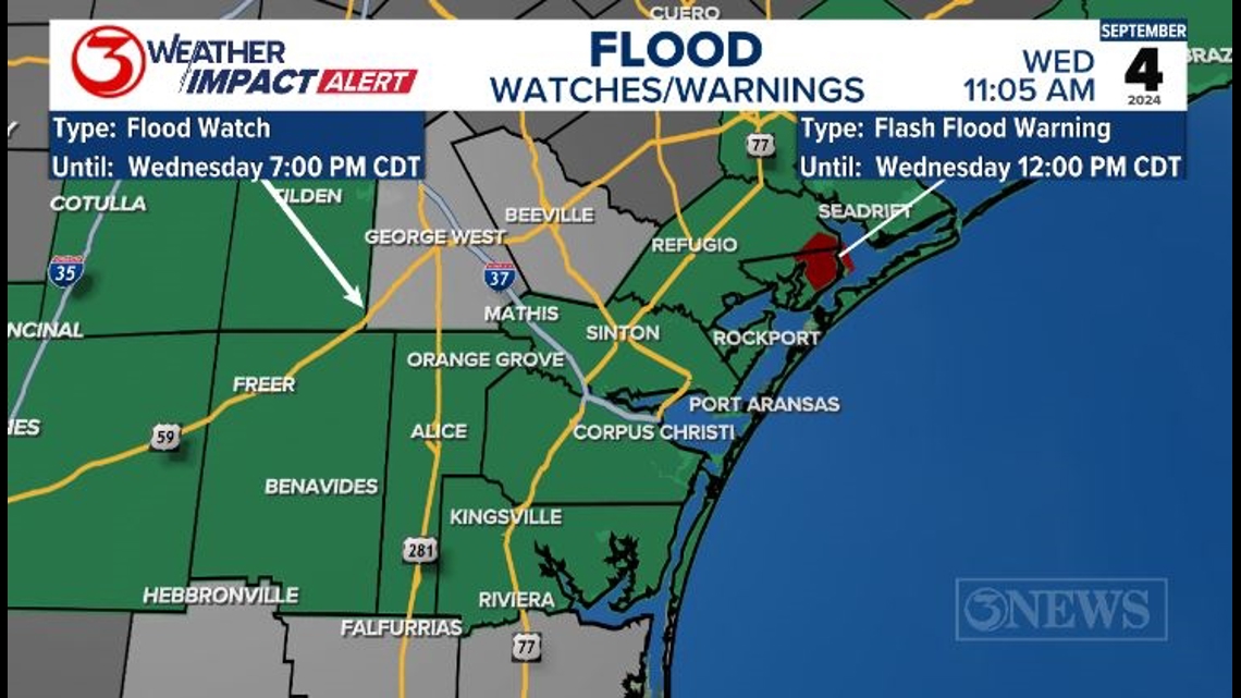
Thanks to our saturated soils, a Flood Watch is still in place until 7 PM tonight. The Flash Flood Warning in northern Aransas County should expire at noon.

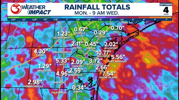
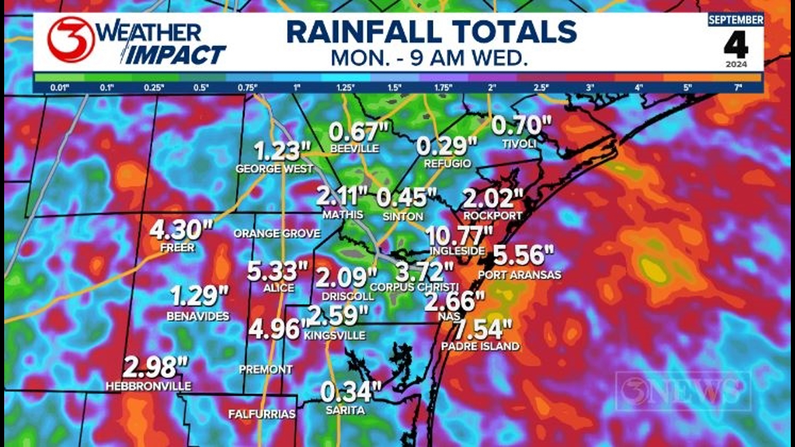
We've seen several inches of rain over the last few days and that will make it easier for runoff to collect in lower-lying areas. Here is a look at the rainfall totals since Monday.

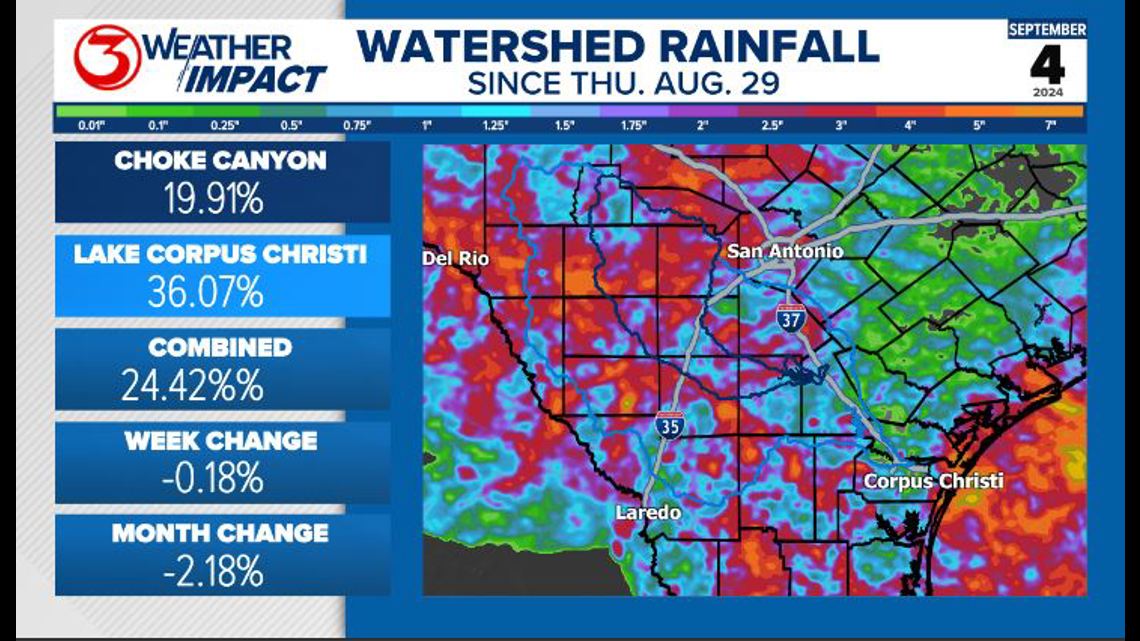
The watershed has also been collecting a decent amount of rain over the least week. Lake levels are beginning to even out and may rise a small amount into next week as the water from the northern watershed moves downstream.

Less coverage and a little warmer Thursday and Friday. We are also tracking a weak cold front that move into the region over the weekend. More info on that, here: Showers and storms expected into Wednesday morning. Localized flooding possible. Weak cold front this weekend!

